
Network GIS system and data transmitting method thereof

A data transmission method and GIS server technology, applied in the field of network GIS system and its data transmission, can solve the problems of network GIS application development limitation, storage I/O bottleneck of spatial data storage system, difficulty in satisfying multi-user concurrent access, etc., and achieve The effect of solving storage I/O bandwidth bottlenecks, solving network service bandwidth bottlenecks, and solving heterogeneous environment problems

Inactive Publication Date: 2007-08-08
WUHAN UNIV
View PDF0 Cites 12 Cited by
  • Summary
  • Abstract
  • Description
  • Claims
  • Application Information

AI Technical Summary

Problems solved by technology

However, as the amount of spatial data increases, there are two data transmission bottlenecks in this structure: the network service bandwidth bottleneck of the server providing services and the storage I / O bandwidth bottleneck of the spatial data storage system
Specifically, when the number of GIS users increases, the GIS application server with a single server structure is limited by the network bandwidth, and it is difficult to meet the requirements of concurrent access by multiple users. Stress causes storage I / O bottlenecks in spatial data storage systems
Because the application of network GIS is very different from conventional transaction processing, especially in the huge amount of data, complex processing methods, and spatial distribution, so the existing network GIS technology field has not yet appeared technical means to solve these two bottlenecks. The development of GIS applications is limited

Method used


Image

  • Network GIS system and data transmitting method thereof
  • Network GIS system and data transmitting method thereof

Examples


Embodiment Construction

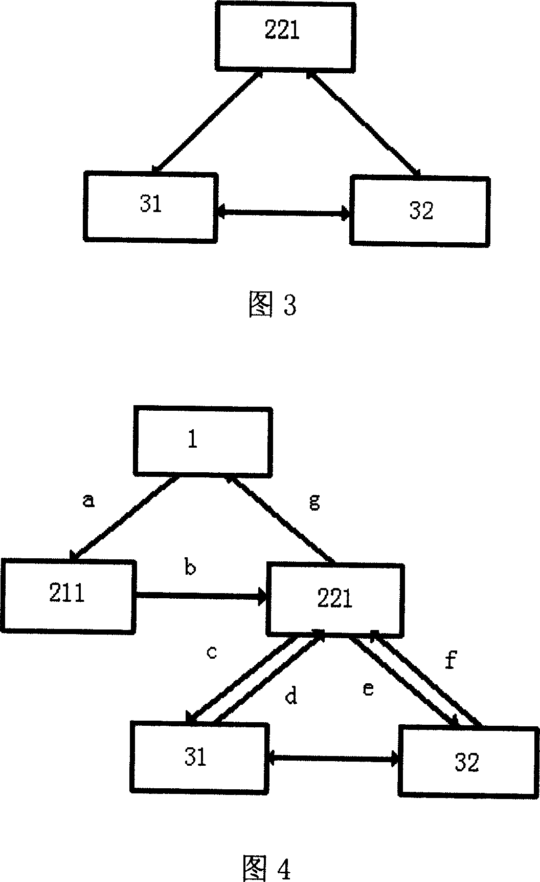
[0027] Referring to accompanying drawing 1, the network GIS system provided by the present invention comprises the following components,

[0028] (1) GIS client 1, used to provide clients with GIS service request operations;

[0029] The GIS client part is mainly composed of client computers equipped with GIS client software; the GIS client is connected to the application server cluster through the network (usually using the Internet). The GIS client part belongs to the existing part of the prior art. In a network GIS system, the number of GIS clients is often huge and uncertain. Users only need to install GIS client software on their personal computers, which means creating an accessible client. Therefore, unless the geographic information system with high security requirements (such as military use), the GIS client 1 and other parts adopt the internal LAN connection, and the Internet connection is the most convenient and practical way in other cases.

[0030] (2) Applicati...


PUM


Abstract

The invention provides one network GIS system and its data transmission method, wherein, the system comprises the following parts: GIS customer end to provide GIS service require operation and to get service result; application servo group to respond GIS service require and services; subject based memory group to store subject space data and to provide common pool to application servo. The transmission method comprises the following steps: space data stores space memory subject based on group and the application servo group and the memory group are combined.

Description

technical field [0001] The invention belongs to the technical field of geographic information, and in particular relates to a network GIS system and a data transmission method thereof. Background technique [0002] The Internet provides an information highway for information exchange and information query between users around the world. Geographic Information System (GIS) has rich functions of spatial query, spatial analysis and attribute management, and is becoming an important part of the Internet or Intranet. a main content. With the continuous development of Internet technology and people's demand for GIS system, the GIS system and network technology are integrated, and the Internet is used to provide users with the functions of spatial data browsing, query and analysis, forming a networked geospatial integration platform, becoming The inevitable trend of GIS system development. With the increasing application of network GIS, the continuous improvement of spatial data ...

Claims


Application Information

Patent Timeline
Patent Type & Authority Applications(China)
IPC IPC(8): H04L29/06H04L12/44
Inventor 喻占武李忠民郑胜李锐潘少明胡滨
Owner WUHAN UNIV
Learn More