Garbage collecting and transportation method based on geological information

A geographic information and geographic information system technology, applied in data processing applications, instruments, resources, etc., can solve problems such as overflow, waste of manpower and material resources, and empty travel of transport vehicles

Inactive Publication Date: 2008-04-30
SHANGHAI JIAO TONG UNIV
View PDF1 Cites 38 Cited by
  • Summary
  • Abstract
  • Description
  • Claims
  • Application Information

AI Technical Summary

Problems solved by technology

But in fact, due to the uncertainty of the amount of garbage at each collection point, the transport vehicle will travel empty, wasting manpower and material resources
Moreov

Method used


Image

  • Garbage collecting and transportation method based on geological information

Examples


Embodiment

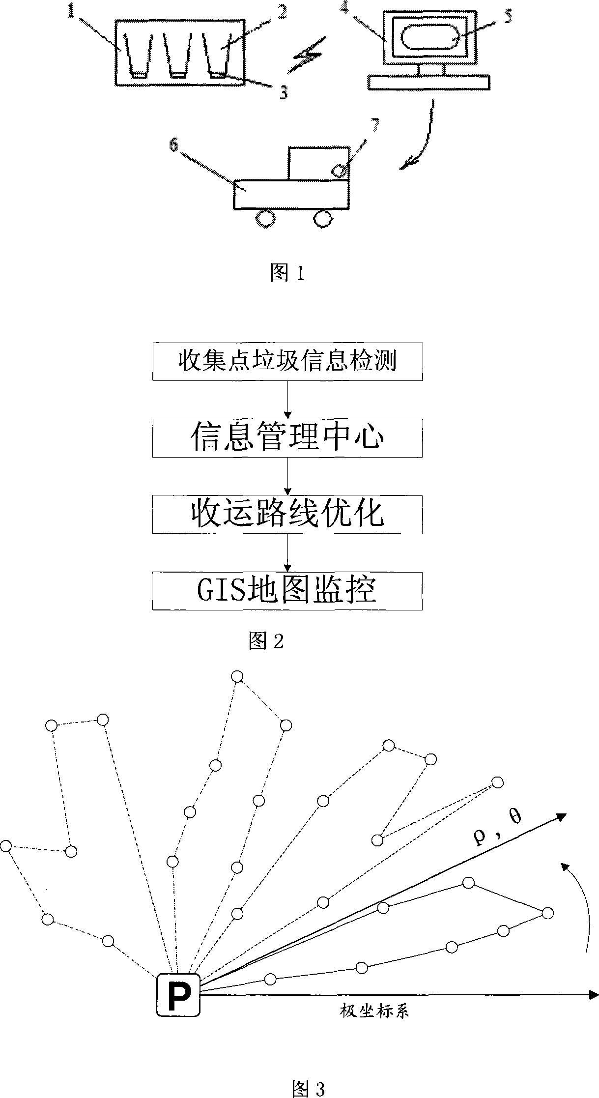
[0027] 1. Detection of garbage volume information at collection points

[0028] The volume information can be detected in the garbage bin of the garbage collection point, and the wireless module sends the information to the information management center. The sending data format is:

[0029] Table 2 Send data format

[0030] collection point number

time

Garbage Volume (100%)

[0031] 1

11 / 16 / 2007 3:02:49

80

2

11 / 16 / 2007 3:02:49

70

3

11 / 16 / 2007 3:02:49

90

4

11 / 16 / 2007 3:02:49

25

5

11 / 16 / 2007 3:02:49

10

6

11 / 16 / 2007 3:02:49

92

[0032] 2. GIS monitoring of information management center

[0033] The information management center judges the status of the current collection point according to the volume information of the garbage, and displays it on the GIS map with different color levels. Under the constructed coordinate...


PUM


Abstract

A rubbish collecting and delivery method based on geographic information in environment protection technical field includes the following steps: the first step, a collection site acquires rubbish volume information via a sensor and sends the information to an information management center via a wireless sending module; the second step, the information management center receives rubbish information from each collection site and displays rubbish condition and urgency to be collected of each collection site on a geographic information system map; the third step, the information management center dispatches vehicles for collecting and delivering rubbish and defines collecting and delivering path based on scanning grouping arithmetic by combining the shortest path calculated with the geographic information system; and the fourth step, a rubbish vehicle arrives collection sites in sequence along the optimized path to deliver rubbish to a treatment plant, and returns to parking square after finishing the task. The invention can perform rubbish collection and delivery reasonably and effectively to realize optimized rubbish collection and delivery and provide a good living environment.

Description

technical field [0001] The invention relates to a method in the technical field of environmental protection, in particular to a method for collecting and transporting garbage based on geographic information. Background technique [0002] Geographic Information System (GIS for short) is a computer system that collects, stores, manages, describes, analyzes and displays and applies geographic information. GIS describes information about spatial locations and spatial relationships on the Earth's surface. Using GIS technology can store, process, display and analyze the data collected in real time, so as to realize the purpose of providing auxiliary means for environmental decision-making. [0003] At present, general urban waste collection and transportation is carried out by waste transport vehicles visiting the waste collection points sequentially according to a certain route. After the vehicle is fully loaded, it will be transported to the transfer station or directly to the ...

Claims


Application Information

Patent Timeline
IPC IPC(8): G06Q10/00G06Q50/00G06Q10/06
Inventor 范秀敏罗威塔何其昌朱明华费德里科·比森特尼刘炳凯亚历山德罗·朱斯蒂
Owner SHANGHAI JIAO TONG UNIV
Why Eureka
Try Eureka