Road indication method, device and navigator supporting image

A display method and display device technology, applied in the field of navigation, can solve the problems of staggered three-dimensional levels and numerous entrances and exits, and achieve the effect of reducing reaction time

Active Publication Date: 2008-08-20
CARELAND TECH SHENZHEN
View PDF0 Cites 31 Cited by
  • Summary
  • Abstract
  • Description
  • Claims
  • Application Information

AI Technical Summary

Problems solved by technology

[0021] The purpose of the embodiments of the present invention is to provide a road display method supporting pictures, aiming to solve the problem that the existing GPS navigation system cannot quickly, clearly and accurately guide the driver through the complex environment, especially when there are many entrances and exits, or there are many roads. The problem of forked intersections with scattered three-dimensional levels

Method used


Image

  • Road indication method, device and navigator supporting image
  • Road indication method, device and navigator supporting image
  • Road indication method, device and navigator supporting image

Examples


Embodiment Construction

[0055] In order to make the object, technical solution and advantages of the present invention clearer, the present invention will be further described in detail below in conjunction with the accompanying drawings and embodiments. It should be understood that the specific embodiments described here are only used to explain the present invention, not to limit the present invention.

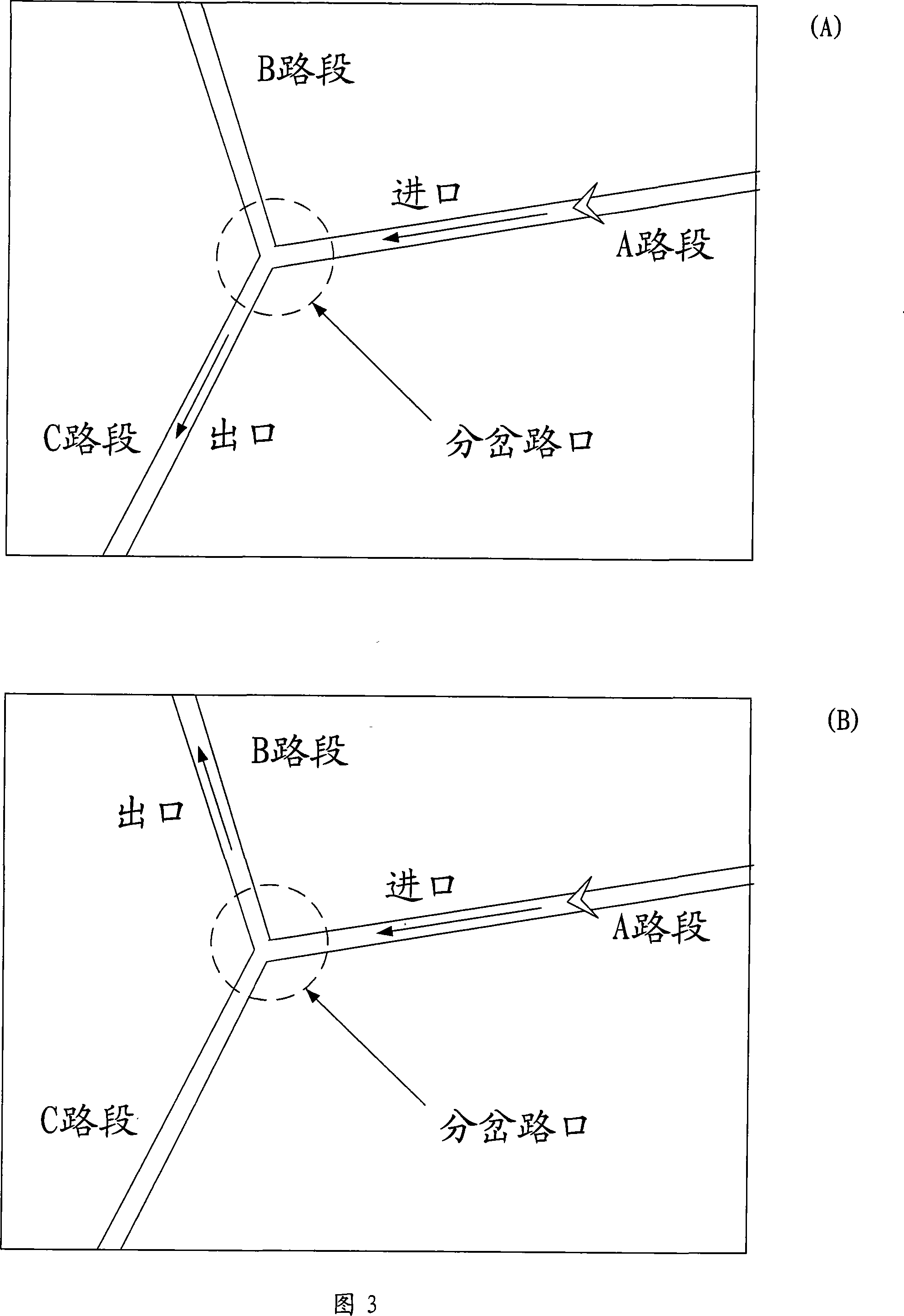
[0056] The embodiment of the present invention judges whether it is necessary to enter the navigation state of the bifurcation intersection; when it is necessary to enter the navigation state of the bifurcation intersection, obtain the picture guidance data of the combination of the entrance and exit sections of the bifurcation intersection, and display the read picture guidance data.

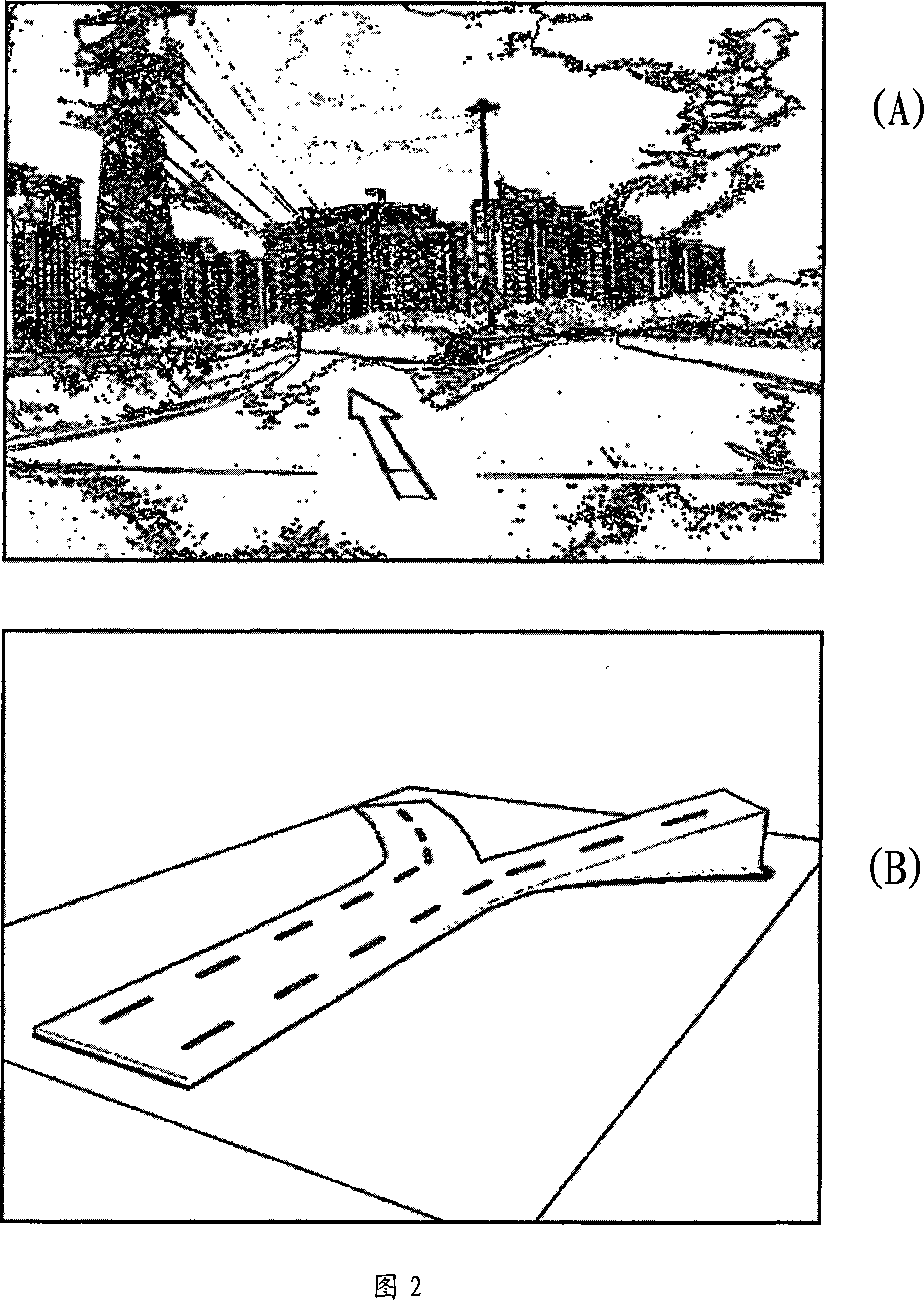
[0057] Fig. 2 is a picture of a branch road provided by the present invention. As shown in accompanying drawing 2 (A), it is a photographed bifurcation picture, and as shown in accompanying drawing 2 (B), it is a th...


PUM


Abstract

The invention is applicable for the technical field of navigation and provides a road display method, a road display device and a road navigation device which support pictures. The road display method comprises the following steps: whether needing to enter into a fork road navigation state is determined; when needing to enter into the fork road navigation state, picture guidance data of the fork road is read; the picture guidance data read out is displayed. The road display method leads a driver to accept and identify a guidance picture at the first time, reduces reaction time, and can quickly, clearly and accurately guide the driver to smoothly pass the fork roads with complex environment, particularly with various exits and entrances or three-dimensional strew hierarchy.

Description

technical field [0001] The invention belongs to the technical field of navigation, and in particular relates to a road display method and device supporting pictures and a navigation device. Background technique [0002] At present, the global positioning system (Global Positioning System, GPS) for vehicles is one of the important application directions of GPS navigation. The GPS antenna of the car GPS navigation system receives the data information transmitted by at least 3 of the 24 GPS satellites around the earth, combined with the electronic map stored in the car navigation terminal, the position coordinates determined by the GPS satellite signal and this match to determine the exact position of the navigation object in the electronic map. [0003] figure 1 It is a structural diagram of a car navigation system in the prior art, and the car navigation system is composed of a speaker 1, a chuck device 2, an input device 3, a sound output device 4, a display device 5, a co...

Claims


Application Information

Patent Timeline
Patent Type & Authority Applications(China)
IPC IPC(8): G01C21/26G01C21/34G01C21/36
Inventor 张文星
Owner CARELAND TECH SHENZHEN
Why Eureka
Try Eureka