Environment automatic monitoring network integrated system information monitoring software based on GIS map
A GIS map and automatic monitoring technology, applied in the field of network communication, can solve problems such as inconsistency in communication technology, failure to merge into a unified system, and different communication protocols, so as to achieve the effect of centralized display
- Summary
- Abstract
- Description
- Claims
- Application Information
AI Technical Summary
Problems solved by technology
Method used
Image
Examples
Embodiment Construction
[0024] In order to make the purpose, technical solutions and advantages of the present invention clearer, the implementation of the present invention will be further described in detail below in conjunction with the accompanying drawings:
[0025] This embodiment provides an information monitoring software of a GIS map-based environment automatic monitoring network integration system.
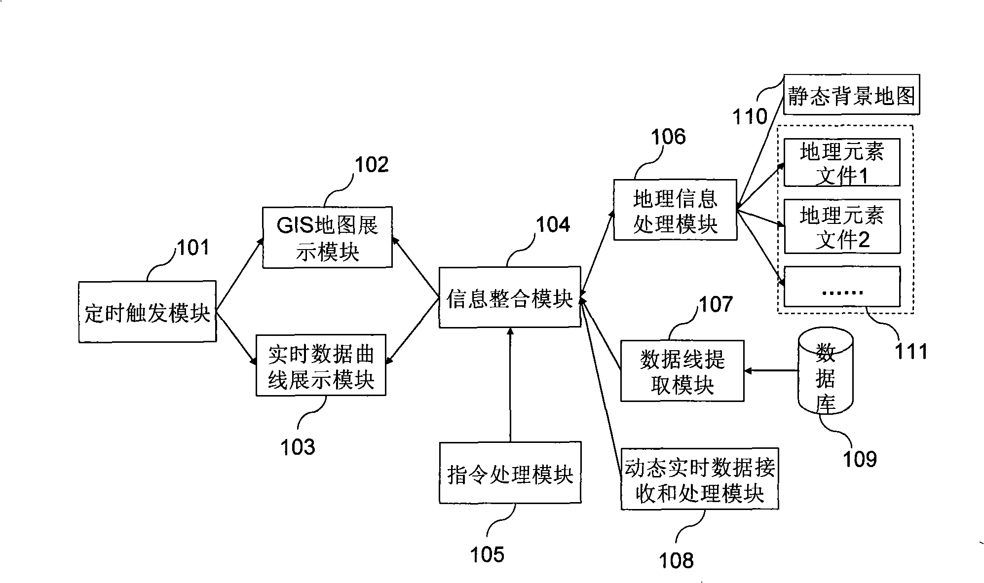
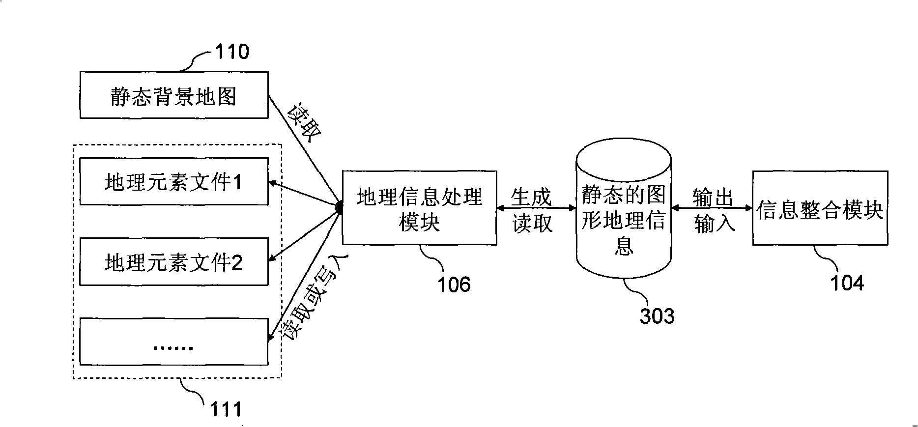
[0026] see figure 1 , showing the structure of the real-time monitoring information software module, which mainly includes: a timing trigger module 101, a GIS map display module 102, a real-time data curve display module 103, an information integration module 104, an instruction processing module 105, a geographic information processing module 106, Database processing module 107 and dynamic real-time data receiving and processing module 108, wherein, described timing trigger module 101 uses timer timing to generate trigger signal, and trigger signal is delivered in GIS map display module 102 an...
PUM
 Abstract
Description
Claims
Application Information
 - R&D
- Intellectual Property
- Life Sciences
- Materials
- Tech Scout
- Unparalleled Data Quality
- Higher Quality Content
- 60% Fewer Hallucinations
Browse by: Latest US Patents, China's latest patents, Technical Efficacy Thesaurus, Application Domain, Technology Topic, Popular Technical Reports.
© 2025 PatSnap. All rights reserved.Legal|Privacy policy|Modern Slavery Act Transparency Statement|Sitemap|About US| Contact US: help@patsnap.com


