Method for programming pedestrian navigation path

A pedestrian navigation and path technology, applied in directions such as road network navigators

Inactive Publication Date: 2009-09-09
MITAC COMP (SHUN DE) LTD
View PDF0 Cites 16 Cited by
  • Summary
  • Abstract
  • Description
  • Claims
  • Application Information

AI Technical Summary

Problems solved by technology

[0008] The invention solves the problem that the traditional navigation device only plans the pedestrian navigation path based on the hiking road, and achieves the purpose of allowing pedestrians to choose to walk on the hiking road or take public transportation to reach the destination.

Method used


Image

  • Method for programming pedestrian navigation path
  • Method for programming pedestrian navigation path
  • Method for programming pedestrian navigation path

Examples


Embodiment Construction

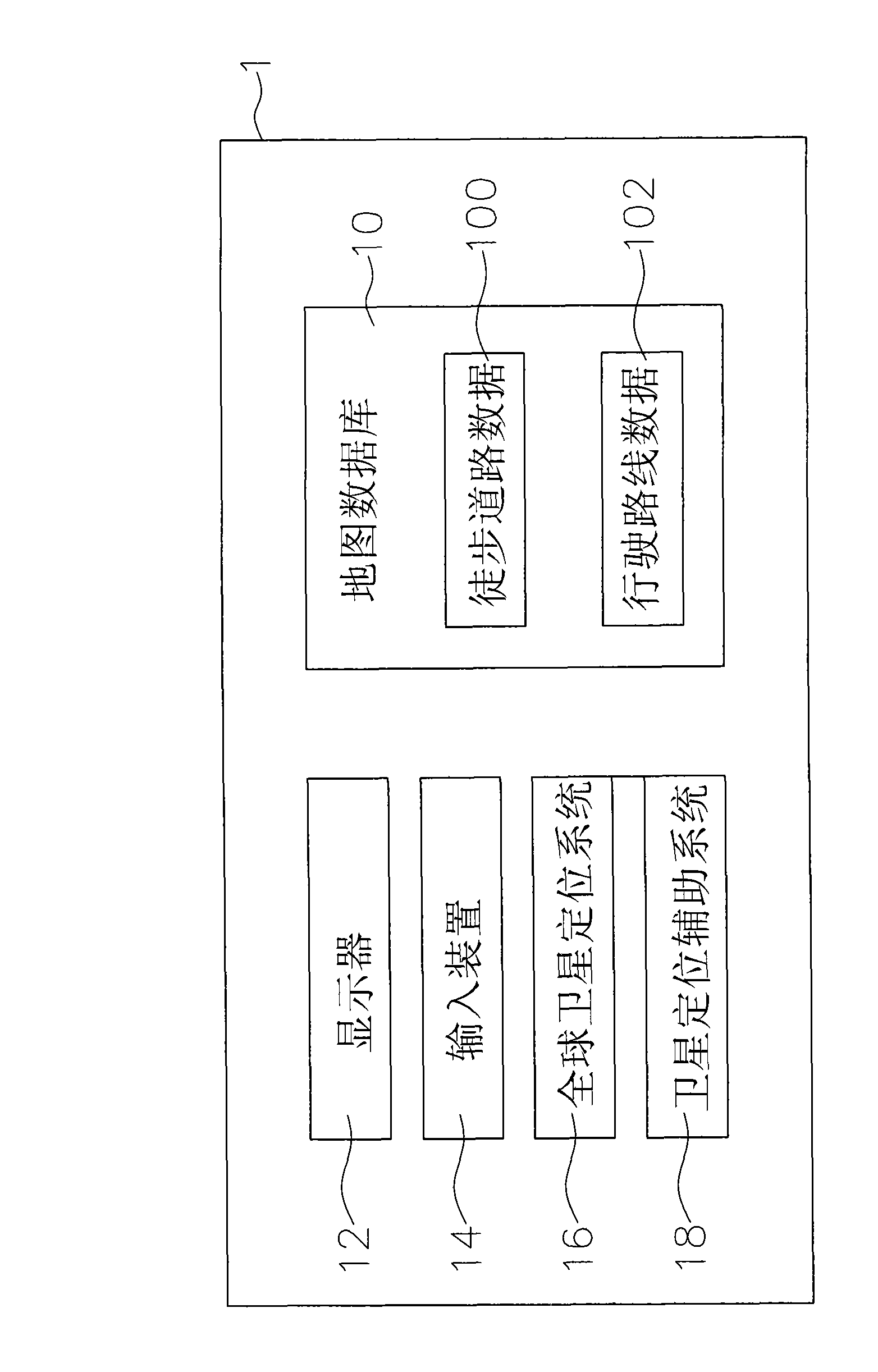
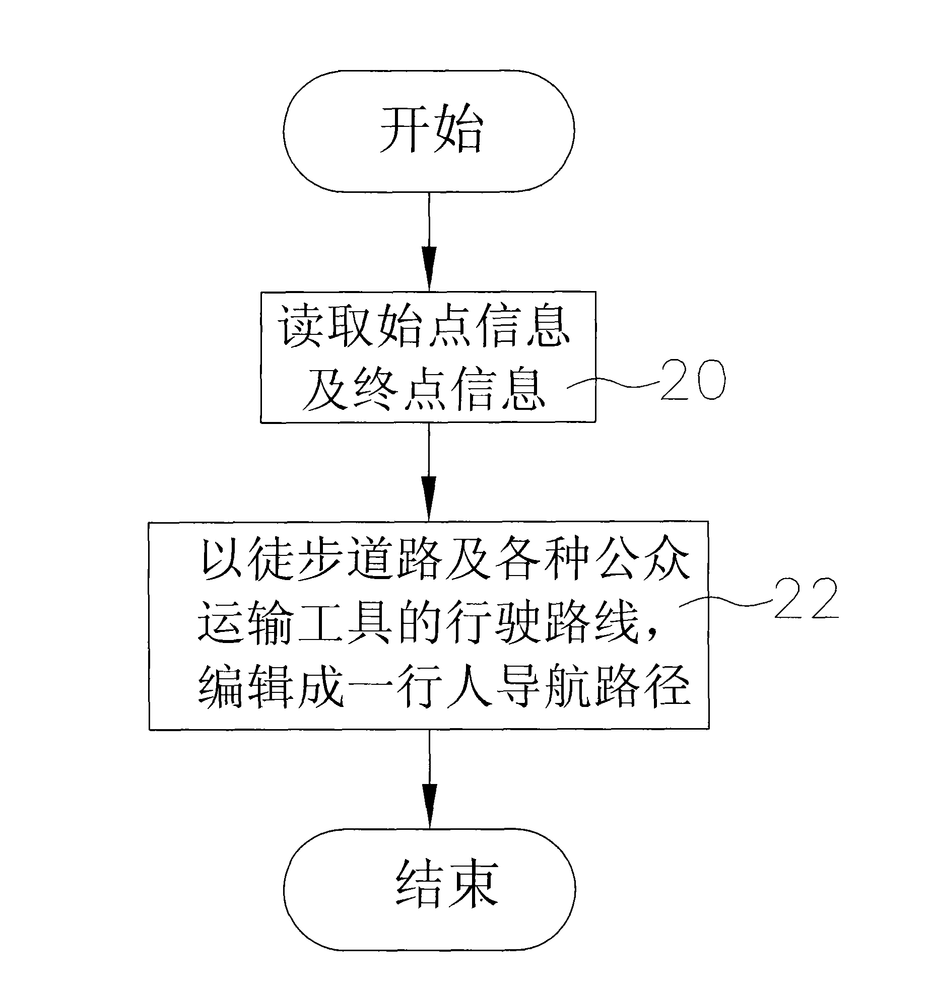
[0015] The present invention provides a method for planning pedestrian navigation paths, please refer to figure 1 As shown, it is applied to a pedestrian navigation device, the pedestrian navigation device 1 includes a map database 10, the map database 10 at least includes a footpath data 100 and at least one public transport (such as: bus, MRT, railway , air and sea, etc.), please refer to the driving route information 102 figure 2 As shown, in this method, when the pedestrian navigation device 1 is planning a pedestrian navigation route, the processing steps of the pedestrian navigation device 1 include:

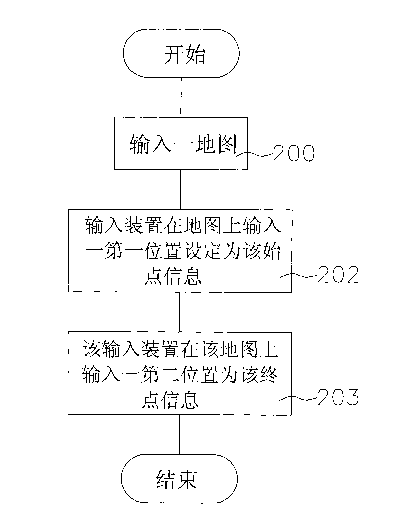
[0016] (20) read a start point information and an end point information; in the present invention, please refer to image 3 As shown, the steps for the pedestrian navigation device 1 to read the starting point information and the ending point information include:

[0017] (200) The pedestrian navigation device 1 outputs a map on a display 12 (such as an LCD screen) prov...


PUM


Abstract

The invention relates to a method for programming a pedestrian navigation path, which is applied to a pedestrian navigation device. A map database of the pedestrian navigation device at least comprises walking road data and running route data of at least one public transportation tool. The method comprises that when the pedestrian navigation device is used for programming the pedestrian navigation path, the pedestrian navigation device reads the information of an initial point and an end point, and the method programs running routes of walking roads and various public transportation tools between the initial point and the end point according to the walking road data and the running route data to edit the pedestrian navigation path. The method solves the problem that the prior navigation device programs the pedestrian navigation path only by the walking roads, and achieves the aim that a pedestrian reaches the end point by selectively walking on the walking roads or taking the public transportation tools.

Description

technical field [0001] The invention relates to a method for planning a pedestrian navigation path, especially a method for a pedestrian navigation device to choose to walk on a footpath or take a public transport to reach a destination. Background technique [0002] The early Global Positioning System (Global Positioning System) in the application field of positioning and navigation (Navigation) is limited to aircraft, automobiles, locomotives and other means of transportation. Take the car navigation device used in the car as an example, the car navigation device It includes a global satellite positioning system and a map database, so that the car navigation device can output a map on a display provided on it according to the map database, and use the dead-reckoning principle to calculate the last The speed and direction between the position and the current position, and a mark is marked on the map to indicate the current position of the vehicle. [0003] A navigation sof...

Claims


Application Information

Patent Timeline
Patent Type & Authority Applications(China)
IPC IPC(8): G01C21/26G01C21/34G01C21/36
Inventor 刘能
Owner MITAC COMP (SHUN DE) LTD
Why Eureka
Try Eureka