Method for preparing encoded geoimage data
A technology of image data and geography, applied in the field of providing encoded geographic image data, can solve the problem of insufficient transmission capacity of wireless communication interface, and achieve the effect of saving the number of transmissions, saving transmission time, and reducing the amount of data
- Summary
- Abstract
- Description
- Claims
- Application Information
AI Technical Summary
Problems solved by technology
Method used
Image
Examples
Embodiment Construction
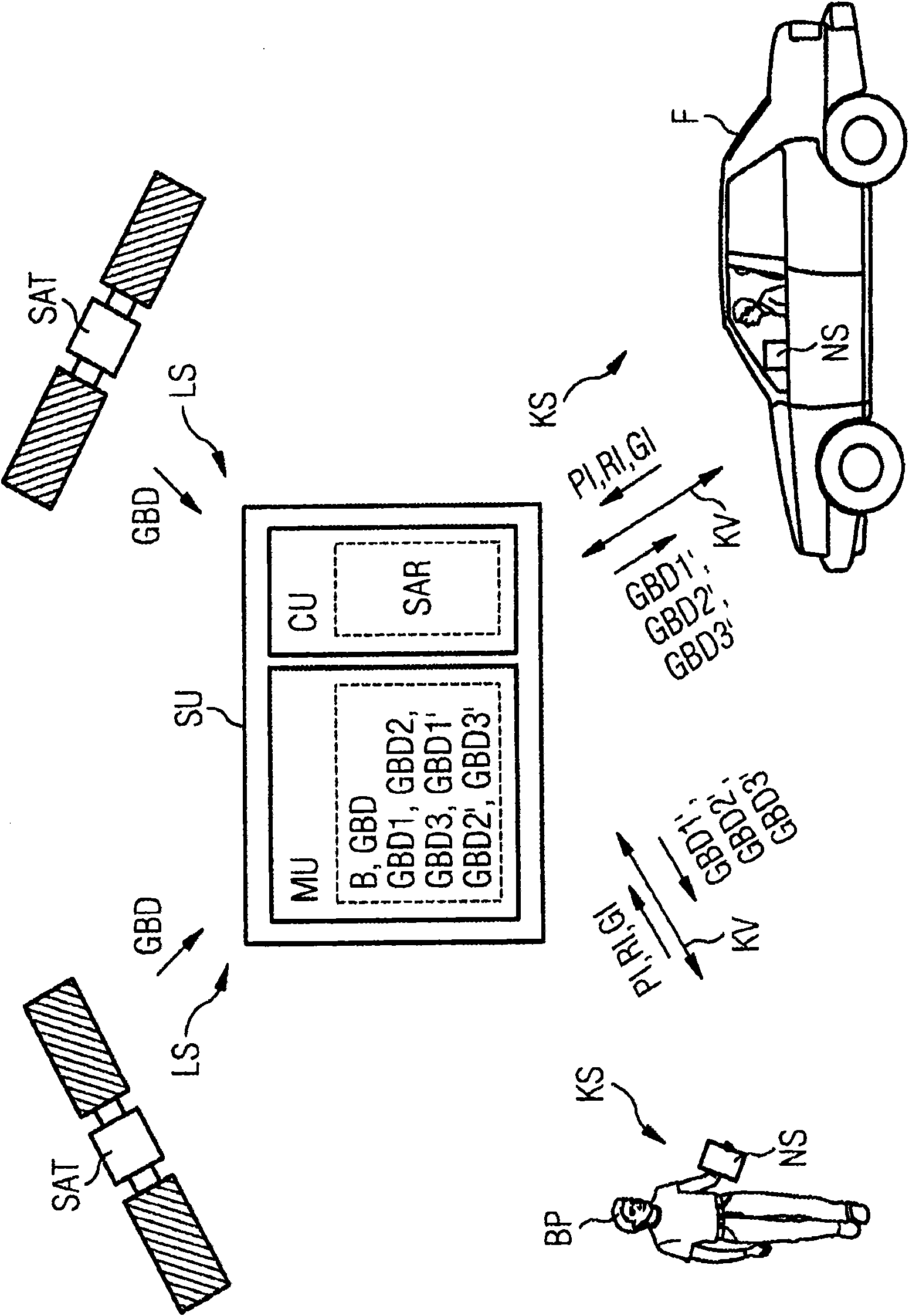
[0017] exist figure 1 A system S for recording geographic image data GBD is shown by way of example in a schematic block diagram. The system S has at least one preferably centrally arranged server unit SU, which is connected via at least one air interface LS (Luftschnittstelle) to the satellite unit SAT and via at least one wireless communication interface KS to the navigation system NS.
[0018] exist figure 1 Two satellite units SAT are exemplarily shown in , by means of which unencoded geographic image data GBD of a predetermined geographic area B of a country or region are generated, and the geographic image data GBD is transmitted to the server unit SU via the air interface LS. The geographical area B includes for example a size from 0.1 to 1000km 2 part of the area
[0019] Said server unit SU comprises a processor unit PU and at least one memory unit MU in which preferably uncoded geographic image data GBD of a geographic area B are stored. Said processor unit PU...
PUM
 Abstract
Description
Claims
Application Information
 - R&D
- Intellectual Property
- Life Sciences
- Materials
- Tech Scout
- Unparalleled Data Quality
- Higher Quality Content
- 60% Fewer Hallucinations
Browse by: Latest US Patents, China's latest patents, Technical Efficacy Thesaurus, Application Domain, Technology Topic, Popular Technical Reports.
© 2025 PatSnap. All rights reserved.Legal|Privacy policy|Modern Slavery Act Transparency Statement|Sitemap|About US| Contact US: help@patsnap.com


