
Method for preparing encoded geoimage data

A technology of image data and geography, applied in the field of providing coded geographic image data, can solve the problem of insufficient transmission capacity of wireless communication interface, and achieve the effect of saving the number of transmissions, saving transmission time, and reducing the amount of data

Inactive Publication Date: 2011-11-16
SIEMENS AG
View PDF0 Cites 0 Cited by
  • Summary
  • Abstract
  • Description
  • Claims
  • Application Information

AI Technical Summary

Problems solved by technology

For this, the transmission capacity of the currently available wireless communication interfaces is insufficient

Method used

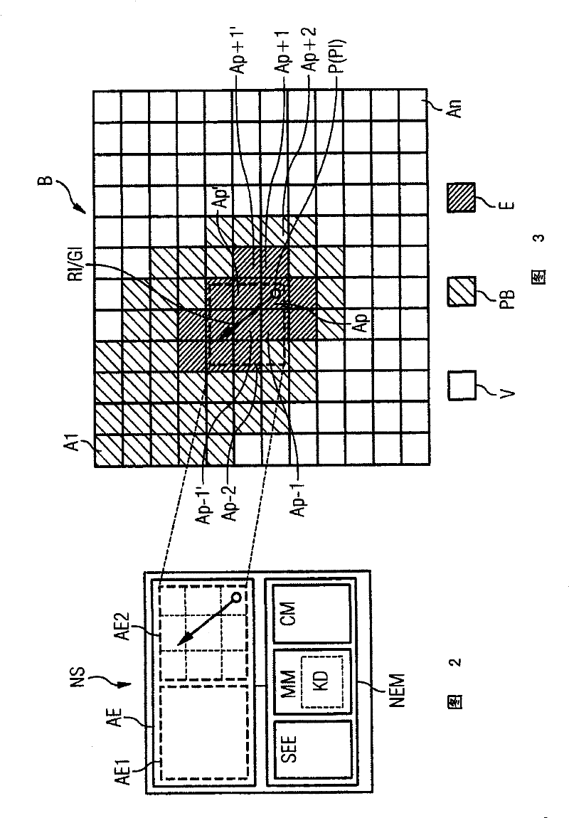

Image

  • Method for preparing encoded geoimage data
  • Method for preparing encoded geoimage data
  • Method for preparing encoded geoimage data

Examples


Embodiment Construction

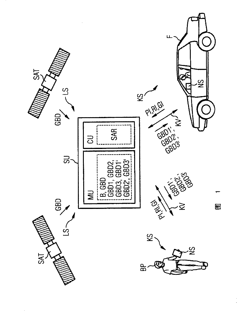
[0017] exist figure 1 A system S for recording geographic image data GBD is shown by way of example in a schematic block diagram. The system S has at least one preferably centrally arranged server unit SU, which is connected via at least one air interface LS (Luftschnittstelle) to the satellite unit SAT and via at least one wireless communication interface KS to the navigation system NS.

[0018] exist figure 1 Two satellite units SAT are exemplarily shown in , by means of which unencoded geographic image data GBD of a predetermined geographic area B of a country or region are generated, and the geographic image data GBD is transmitted to the server unit SU via the air interface LS. The geographical area B includes for example a size from 0.1 to 1000km 2 part of the area ( ).

[0019] Said server unit SU comprises a processor unit PU and at least one memory unit MU in which preferably uncoded geographic image data GBD of a geographic area B are stored. Said processor un...


PUM


Abstract

The invention relates to a method for preparing encoded geoimage data from a server unit, transferring said data to at least one navigation receiver module. A geographical region is pre-defined by means of uncoded geographical image data stored in the server unit and at least one wireless communication interface is provided between the server unit and the at least one navigation receiver module. At least one position information message is transmitted from the navigation receiver module to the server unit and an expectancy range is selected in the server unit according to the transmitted position information from the pre-defined geographical region. Furthermore, first uncoded geoimage data reproducing the expectancy range is determined and the first uncoded geoimage data is encoded in theserver unit. The first encoded geoimage data is then transferred to the navigation receiver module from the server unit via the wireless communication interface.

Description

technical field [0001] The invention relates to a method for providing coded geographic image data (Geobilddate) from a server unit to at least one navigation receiver module, wherein a geographic location is predetermined by the uncoded geographic image data stored in the server unit. area, and there is at least one wireless communication interface between the server unit and the at least one navigation receiving module. Background technique [0002] In recent years, navigation systems have been promoted more and more. Said navigation systems are usually installed permanently in the vehicle or retrofitted as mobile navigation systems. Such a navigation system has at least one display unit (Anzeigeneinheit) in addition to a navigation receiver module for receiving position signals and / or speed signals from the "Global Positioning System" (GPS), on which the Vector map fragments such as topographic or city maps. For this purpose, the map segment in which the objects connec...

Claims


Application Information

Patent Timeline
Patent Type & Authority Patents(China)
IPC IPC(8): G01C21/36G01C21/32
CPCG01C21/3647
Inventor K・卢卡斯
Owner SIEMENS AG
Learn More