Method, device and system for editing navigation track

A trajectory and editing technology, applied in the field of navigation, can solve problems such as related information deviation, and achieve the effect of sharing

Inactive Publication Date: 2009-10-21
BEIJING LINGTU SOFTWARE TECH CO LTD
View PDF0 Cites 20 Cited by
  • Summary
  • Abstract
  • Description
  • Claims
  • Application Information

AI Technical Summary

Problems solved by technology

[0005] In view of this, the object of the present invention is to provide a method, device and system for editing navigation tracks, so as to solve t

Method used


Image

  • Method, device and system for editing navigation track
  • Method, device and system for editing navigation track
  • Method, device and system for editing navigation track

Examples


Embodiment 1

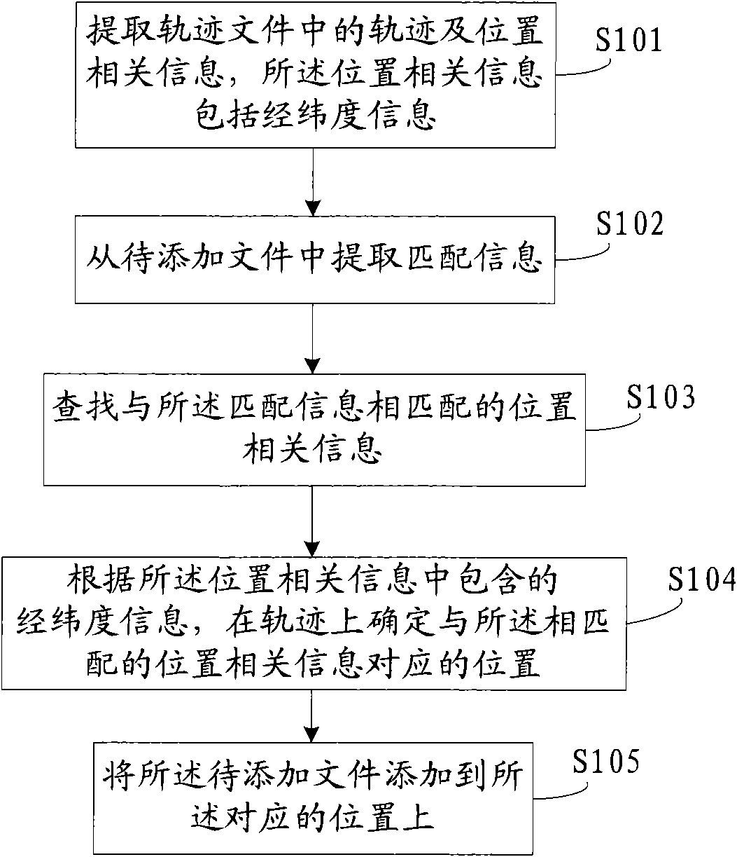
[0061] Embodiment one: see figure 1 , the method provided by the embodiment of the present invention includes the following steps:

[0062] S101: extracting track and location-related information in the track file, where the location-related information includes latitude and longitude information;

[0063]The latitude and longitude information in the trajectory file is matched with the latitude and longitude on the electronic map, and the extracted trajectory can be displayed on the electronic map. At this time, the display form of the trajectory on the map is a curve;

[0064] The embodiment of the present invention seeks a method to automatically add the photos taken by the user along the way or other related information of interest to the corresponding positions on the track. These positions are determined by the latitude and longitude information, so when extracting the track file For location-related information, latitude and longitude information needs to be included. I...

Embodiment 2

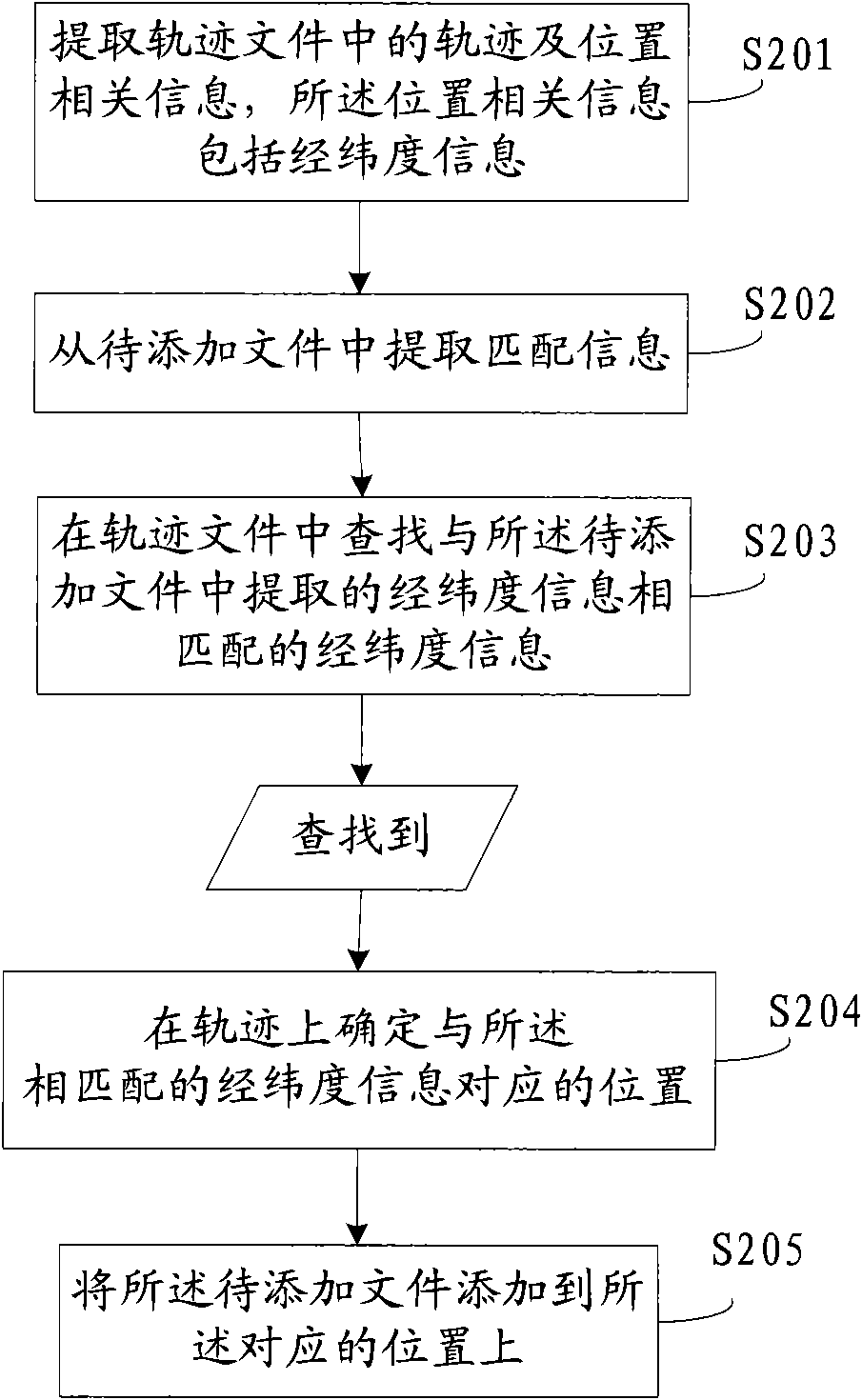
[0072] Embodiment two, see figure 2 , when the matching information extracted from the file to be added is latitude and longitude information, the method provided by the embodiment of the present invention includes the following steps:

[0073] S201: extracting track and location-related information in the track file, where the location-related information includes latitude and longitude information;

[0074] S202: Extract matching information from the file to be added;

[0075] Wherein, the matching information is longitude and latitude information;

[0076] S203: Search the trajectory file for latitude and longitude information that matches the latitude and longitude information extracted from the file to be added;

[0077] S204: If found, determine the track position according to the matched longitude and latitude information;

[0078] S205: Add the to-be-added file to the corresponding location.

Embodiment 3

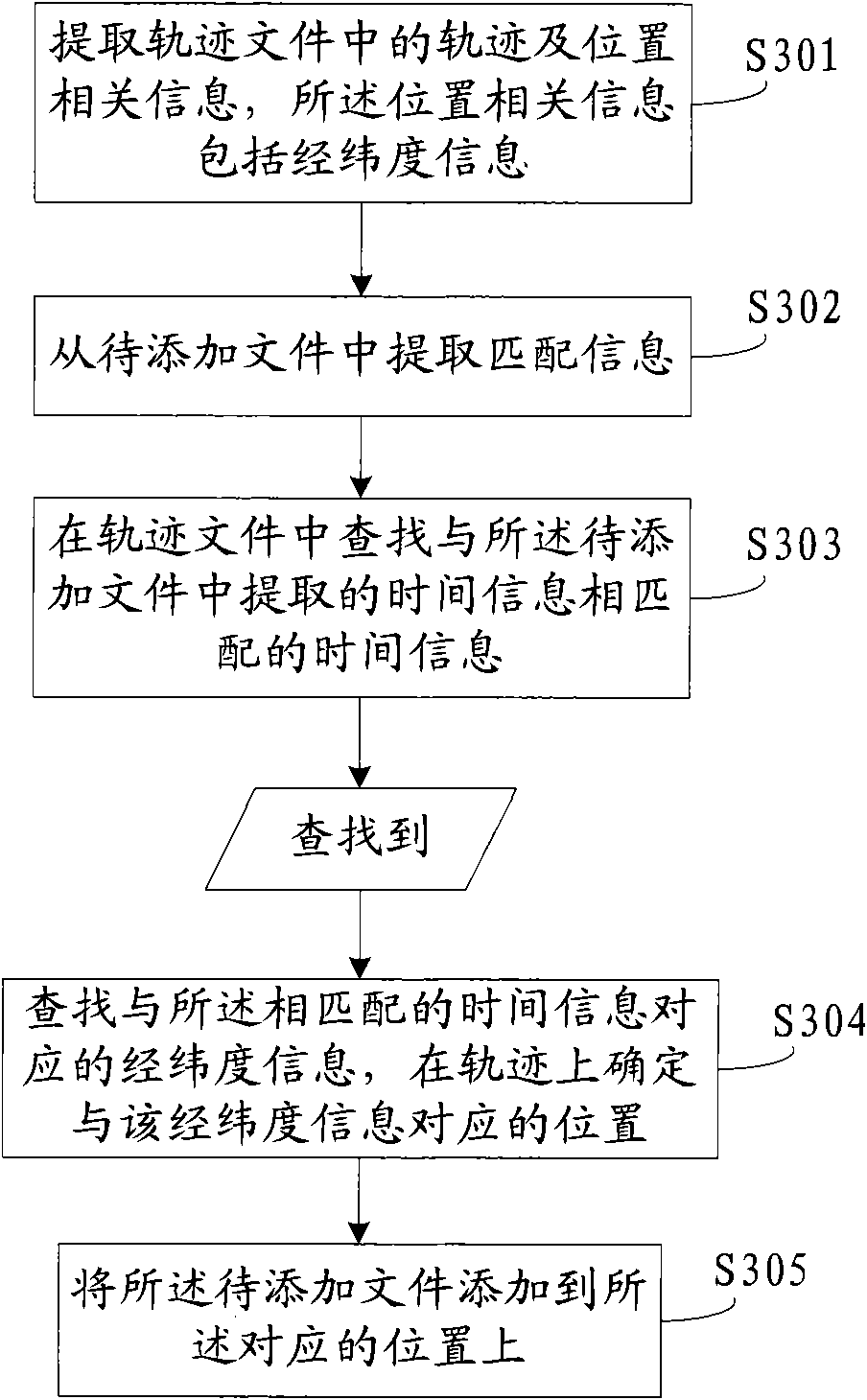
[0079] Embodiment three, refer to image 3 , the matching information extracted from the file to be added may be time information. At this time, the method provided by the embodiment of the present invention includes the following steps:

[0080] S301: extracting track and location-related information in the track file, where the location-related information includes latitude and longitude information;

[0081] Wherein, the location information also includes time information;

[0082] S302: Extract matching information from the file to be added;

[0083] Wherein, the matching information is time information;

[0084] S303: Search the track file for time information that matches the time information extracted from the file to be added;

[0085] S304: If found, continue to search for latitude and longitude information corresponding to the matched time information in the track file, and determine the track position according to the matched latitude and longitude information; ...


PUM


Abstract

The invention discloses a method for editing a navigation track, comprising the steps: relevant track and position information in a track file are extracted, and the relevant position information comprises latitude and longitude information; match information is extracted from a file to be added; the relevant position information matched with the match information is searched; if the relevant position information is found out, a position corresponding to the matched relevant position information is confirmed on the track according to the latitude and longitude information contained in the relevant position information; and the file to be added is added to the corresponding position. The invention also provides a device and a system for editing the navigation track. By the embodiment of the invention, the automatic match between the file to be added and a track file is realized, and the positioning precision is improved when the labor is saved; and moreover, the file to be added can be a photo or interesting localization information, and the like extracted from the track file, and the track file share is really realized by uploading or downloading the track file to a server.

Description

technical field [0001] The invention relates to the technical field of navigation, in particular to a method, device and system for editing navigation tracks. Background technique [0002] Navigation terminals are usually able to save trajectory files, and record text information and geographical locations of interest (Point Of Interest, POI), etc., but with the rapid development of wireless communication technology, the functions of navigation terminals are also moving towards intelligent and humanized direction development. Users are no longer satisfied that the navigation system only has a single route search function, but hope to have better information query functions, such as retrieval functions for various facilities and tourist attractions, etc., to provide convenience for travel. Therefore, it is necessary to add other relevant information to the trajectory saved by the navigation terminal. The relevant information here refers to the photos, recordings and other fi...

Claims


Application Information

Patent Timeline
IPC IPC(8): G01C21/26G06F17/30
Inventor 孙亚夫孙茳赵彩霞阎大勇张高峰
Owner BEIJING LINGTU SOFTWARE TECH CO LTD
Why Eureka
Try Eureka