Method for detecting cloud height by utilizing cloud shadow information in satellite remote sensing data

A technology for satellite remote sensing data and information detection, applied in the field of atmospheric detection, can solve the problems of low automation, poor reliability, and low precision, and achieve the effects of improved spatial resolution, strong real-time monitoring capabilities, and improved spectral resolution

Inactive Publication Date: 2009-10-28
JILIN UNIV
View PDF0 Cites 41 Cited by
  • Summary
  • Abstract
  • Description
  • Claims
  • Application Information

AI Technical Summary

Problems solved by technology

[0029] The purpose of the present invention is to provide a method for detecting cloud height using cloud shadow information in satellite remote sensing data, so as to sol

Method used


Image

  • Method for detecting cloud height by utilizing cloud shadow information in satellite remote sensing data
  • Method for detecting cloud height by utilizing cloud shadow information in satellite remote sensing data
  • Method for detecting cloud height by utilizing cloud shadow information in satellite remote sensing data

Examples


Embodiment 1

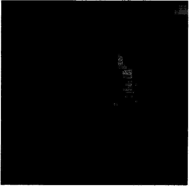
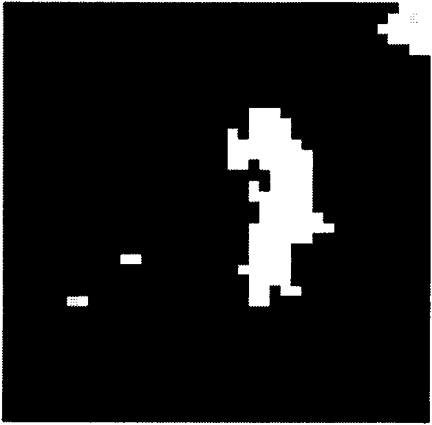
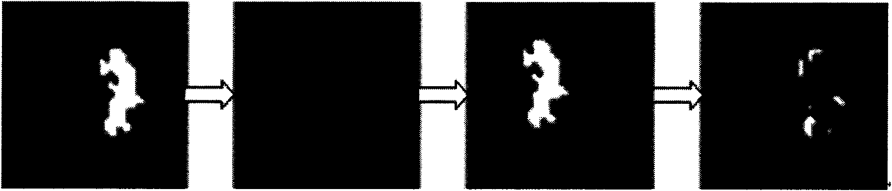
[0141] The invention uses the cloud shadow information in the satellite remote sensing data to detect the cloud height, and the application condition of the method is the data of the plain area in the MODIS satellite remote sensing data with a resolution of 250m.

[0142] Based on the MODIS remote sensing image processing technology, the invention proposes a new method for cloud height measurement in plain areas. The application condition is the plain area in the MODIS data satellite remote sensing data with a resolution of 250m, and the MODIS data used is the data after conventional correction processing. For example, select 250m MODIS data satellite remote sensing data MOD02QKM.A2002179.1820.005.2007148021815.hdf.

[0143] Technical scheme of the present invention comprises the following steps:

[0144] 1. Interpolation calculation: Since specific geographical information data of clouds and cloud shadow points are required, including longitude, latitude, solar zenith angle,...

Embodiment 2

[0242] The invention uses the cloud shadow information in the satellite remote sensing data to detect the cloud height, and the application condition of the method is the data of the plain area in the MODIS satellite remote sensing data with a resolution of 250m.

[0243] Based on the MODIS remote sensing image processing technology, the invention proposes a new method for cloud height measurement in plain areas. The application condition is the plain area in the MODIS data satellite remote sensing data with a resolution of 250m, and the MODIS data used is the data after conventional correction processing. For example, select 250m MODIS data satellite remote sensing data MOD02QKM.A2002179.1820.005.2007148021815.hdf.

[0244] 1. Interpolation calculation: Since specific geographical information data of clouds and cloud shadow points are required, including longitude, latitude, solar zenith angle, solar azimuth, satellite zenith angle, and satellite azimuth data, MODIS data ephe...


PUM


Abstract

The invention relates to a method for detecting cloud height by utilizing cloud shadow information in satellite remote sensing data, which pertains to the field of atmospheric exploration and comprises the following five steps: interpolation calculation, cloud and cloud shadow detection, the matching of the cloud with the cloud shadow by MODIS data, establishment of a cloud height model for obtaining the height of cloud layer, and cloud height calculation and analysis. The method for detecting the cloud height detects the information on the cloud and the cloud shadow in the remote sensing image data, matches the cloud with the cloud shadow by combining with digital image technology and obtains the distance between the cloud and the cloud shadow; and finally the cloud height model is established to obtain the height of the cloud layer. The method for detecting the cloud height can simultaneously calculate the heights of multiple points of a piece of cloud and the height values obtained in the way can greatly improve detection accuracy of cloud heights. The cloud height can be measured in any place where the measurement conditions are met and no measurement device is needed to be set locally.

Description

technical field [0001] The invention relates to the field of atmospheric detection, in particular to a method for detecting cloud height by using cloud shadow information in satellite remote sensing data. Background technique [0002] Clouds play an extremely important role in physical processes such as the development of weather systems, the formation of precipitation, and atmospheric radiative transfer. How to obtain cloud information accurately and in time is very important for many fields such as weather climatology research, weather forecast, artificial weather modification, national economy and military affairs. Usually, meteorological observations on clouds mainly include three items: cloud shape, cloud amount and cloud height, among which cloud height refers to the vertical distance from the ground level of the detection station to the cloud base, usually in meters. [0003] At present, the observation of cloud amount and cloud shape mainly depends on visual observa...

Claims


Application Information

Patent Timeline
IPC IPC(8): G01S17/95
CPCY02A90/10
Inventor 顾玲嘉任瑞治郭树旭张爽王昊丰单江东
Owner JILIN UNIV
Why Eureka
Try Eureka