Method for indirectly positioning and identifying three-dimensional buildings by using riverway landmarks
A positioning recognition and building technology, applied in character and pattern recognition, integrated navigators, instruments, etc., can solve the problems of repeated patterns, poor contrast, and insignificant optical imaging features
- Summary
- Abstract
- Description
- Claims
- Application Information
AI Technical Summary
Problems solved by technology
Method used
Image

Examples
Embodiment Construction
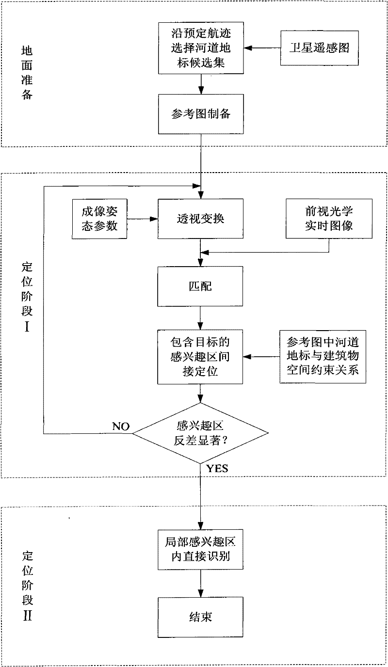
[0042] At a sufficient flying height and an appropriate flying angle, the visibility of the river course landmarks can be guaranteed. Therefore, the present invention is considered under the condition that the river course landmarks are visible.
[0043] Below to Figure 12 The present invention will be further described in detail by taking a satellite remote sensing map including a certain three-dimensional building, a river course, and land as an example. The overall flow chart is as figure 1 shown.
[0044] 1. Ground preparation
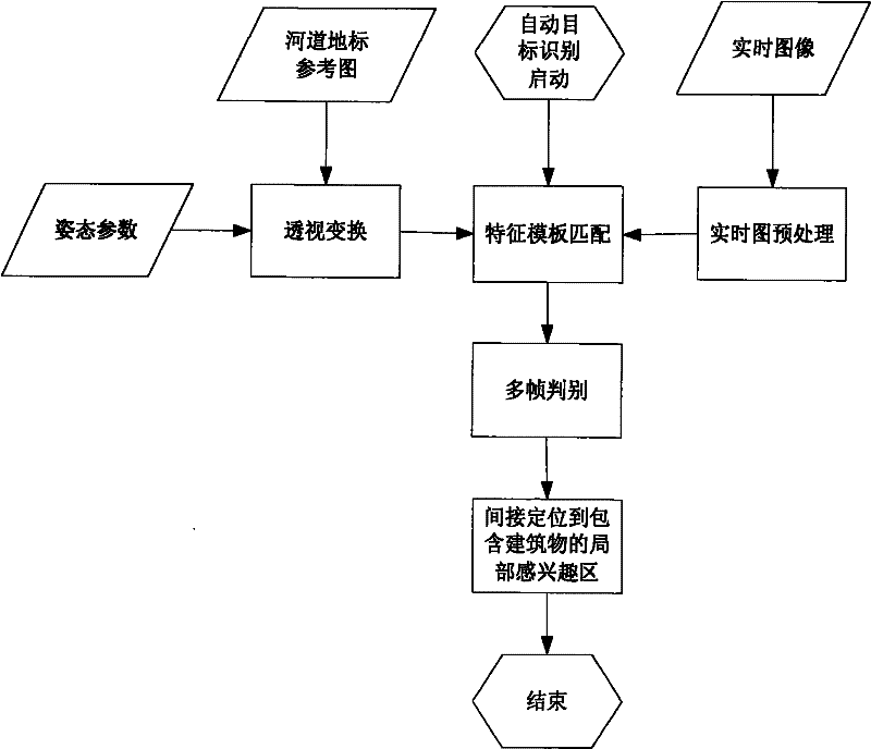
[0045] (1.1) According to the pre-planned track entry direction, select the candidate set of river landmarks visible on the route. For the sake of reliability, usually select the river landmarks in the vicinity of the building to be identified. Figure 12 and Figure 13 It is a satellite remote sensing map of the area of 2000 meters × 2000 meters near the landmarks of the river, in Figure 12 The direction of flight when acquiring the forwa...
PUM
 Abstract
Description
Claims
Application Information
 - R&D
- Intellectual Property
- Life Sciences
- Materials
- Tech Scout
- Unparalleled Data Quality
- Higher Quality Content
- 60% Fewer Hallucinations
Browse by: Latest US Patents, China's latest patents, Technical Efficacy Thesaurus, Application Domain, Technology Topic, Popular Technical Reports.
© 2025 PatSnap. All rights reserved.Legal|Privacy policy|Modern Slavery Act Transparency Statement|Sitemap|About US| Contact US: help@patsnap.com