Mixed type complex target-oriented distance map making method
A technology of complex targets and distance maps, applied in image data processing, 2D image generation, instruments, etc., can solve the problems of single spatial entity types, increased drawing time, and low efficiency, so as to improve data accuracy, speed up computing speed, The effect of improving computing efficiency
- Summary
- Abstract
- Description
- Claims
- Application Information
AI Technical Summary
Problems solved by technology
Method used
Image


Examples
Embodiment 1
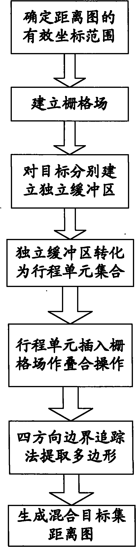
[0044] figure 1 Be the flow chart of the present invention, figure 2 An example of a distance map containing a point-line-surface mixed target set obtained under a certain influence distance is provided, and the surface elements in the figure use the outer influence area.
[0045] This embodiment is oriented to the distance map drawing method of mixed complex targets, such as figure 1 As shown, the steps include:
[0046] The first step is to determine the effective coordinate range of the spatial target distance map according to the map coordinate range of the point-line-plane target set and the maximum influence distance in the given influence distance set;
[0047] In practical applications, point, line, and area target sets are often expressed in layers, which are divided into point layers, line layers, and area layers. The coordinate range of a layer can be obtained by traversing the minimum and maximum X and Y coordinates of the coordinate points on the layer, and th...
Embodiment 2
[0065] This embodiment improves the generation of the buffer by the stacking method of primitives, and the difference from Embodiment 1 lies in the third step and the fourth step.
[0066] The distance map mapping method for mixed complex targets in this implementation, its steps include:
[0067] The first step is to determine the effective coordinate range of the spatial target distance map according to the map coordinate range of the point-line-plane target set and the maximum influence distance in the given influence distance set;
[0068] In the second step, according to the determined effective coordinate range, a grid field composed of cells with predetermined size precision is established;
[0069] The third step is to establish a group of primitive polygons corresponding to the influence distance for each target in the point, line and surface target set according to each influence distance in the given influence distance set;
[0070] The fourth step is to use the sc...
PUM
 Abstract
Description
Claims
Application Information