Method for simplifying numerical map settlement place polygon by utilizing parametric design model

A technology of applying parameters and designing models, which is applied in the field of map drawing and geographic information engineering, can solve problems such as inapplicability, difficulty in realization, and reduction of data accuracy, and achieve the effect of improving production efficiency

Inactive Publication Date: 2010-12-29
THE PLA INFORMATION ENG UNIV
View PDF0 Cites 21 Cited by
  • Summary
  • Abstract
  • Description
  • Claims
  • Application Information

AI Technical Summary

Problems solved by technology

The simplification method based on the raster data structure is generally only suitable for the outline simplification of typical rectangular buildings under large-scale conditions, and is not suitable for the simplification of residential polygons with complex shapes and structures or small and medium scale conditions.
The method of mixing vector and raster data structures combines the advantages of the two data structures, and can reasonably simplify relatively complex residential polygons, but it is difficult to implement and the stability of the method is not high
In addition, frequent conversion between vector and raster data will inevitably lead to a reduction in data accuracy
[0003] The polygon simplification method based on the vector data structure is a kind of method that is commonly used and has many research results at present, but there are the following deficiencies in the process of theoretical research and practical application: most simplification methods are the contour of the polygon of the residential area The boundary is treated as a closed line string, and the line simplification method is used to simplify the surface, ignoring the topological information and semantic information structu

Method used


Image

  • Method for simplifying numerical map settlement place polygon by utilizing parametric design model
  • Method for simplifying numerical map settlement place polygon by utilizing parametric design model
  • Method for simplifying numerical map settlement place polygon by utilizing parametric design model

Examples


Embodiment 1

[0174] Embodiment 1: Taking the planar residential area data in the 1:250,000 map data as an example to synthesize the 1:500,000 data, the attached Figure 8 (a) is a planar residential area with a scale of 1:250,000.

[0175] Implementation process:

[0176] (1) According to the digital map production specification, the values ​​or value ranges of the following parameters are given:

[0177] a.I i The value range of is shown in Table 1:

[0178] Table 1I i range of values

[0179]

[0180] b. Threshold value set D=(d 1 , d 2 ,...,d 9 ) T Partition of solution space and initial threshold According to the digital map production specification and experience, the decompression space is compressed as shown in Table 2:

[0181] The division of the solution space of Table 2-1D

[0182]

[0183] The division of the solution space of Table 2-2D

[0184]

[0185] initial threshold The value of is shown in Table 3:

[0186] Table 3 Threshold value of

[0187]...


PUM


Abstract

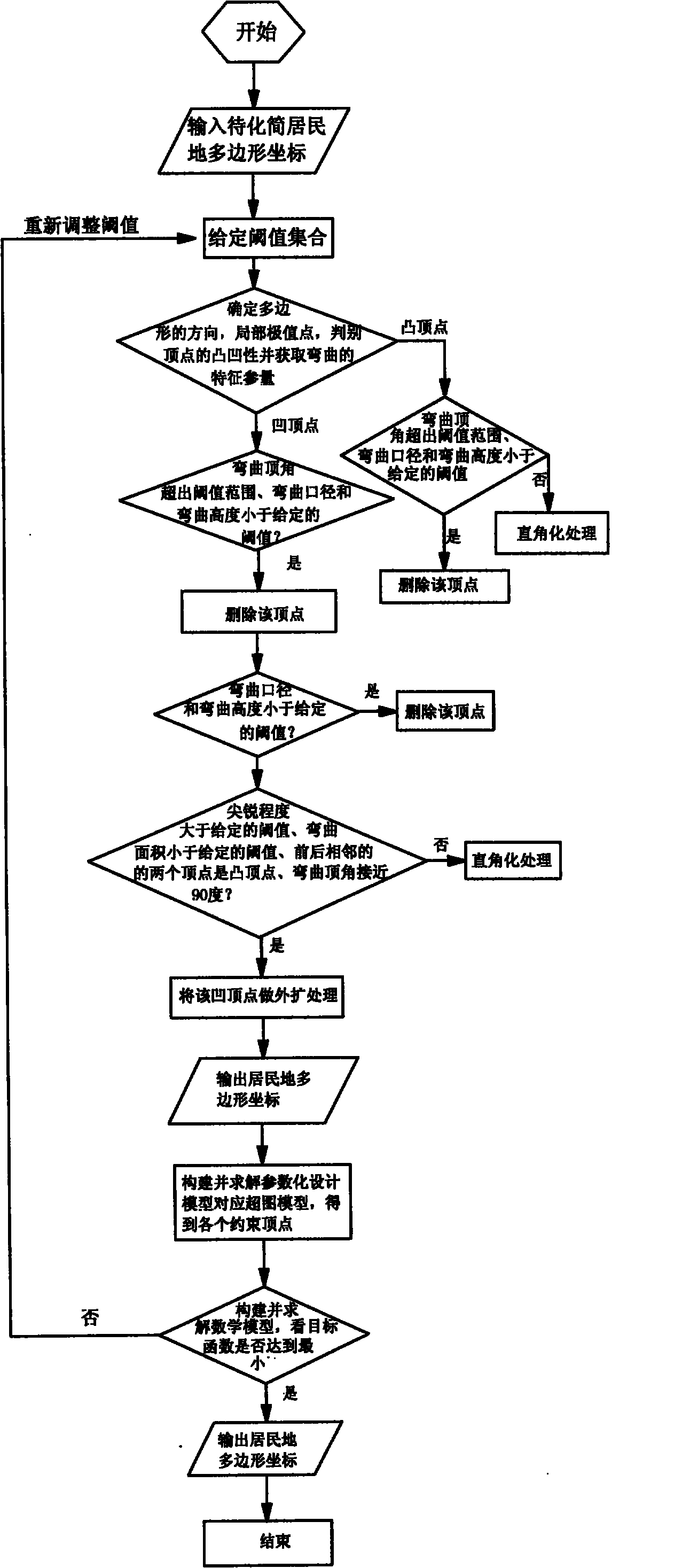
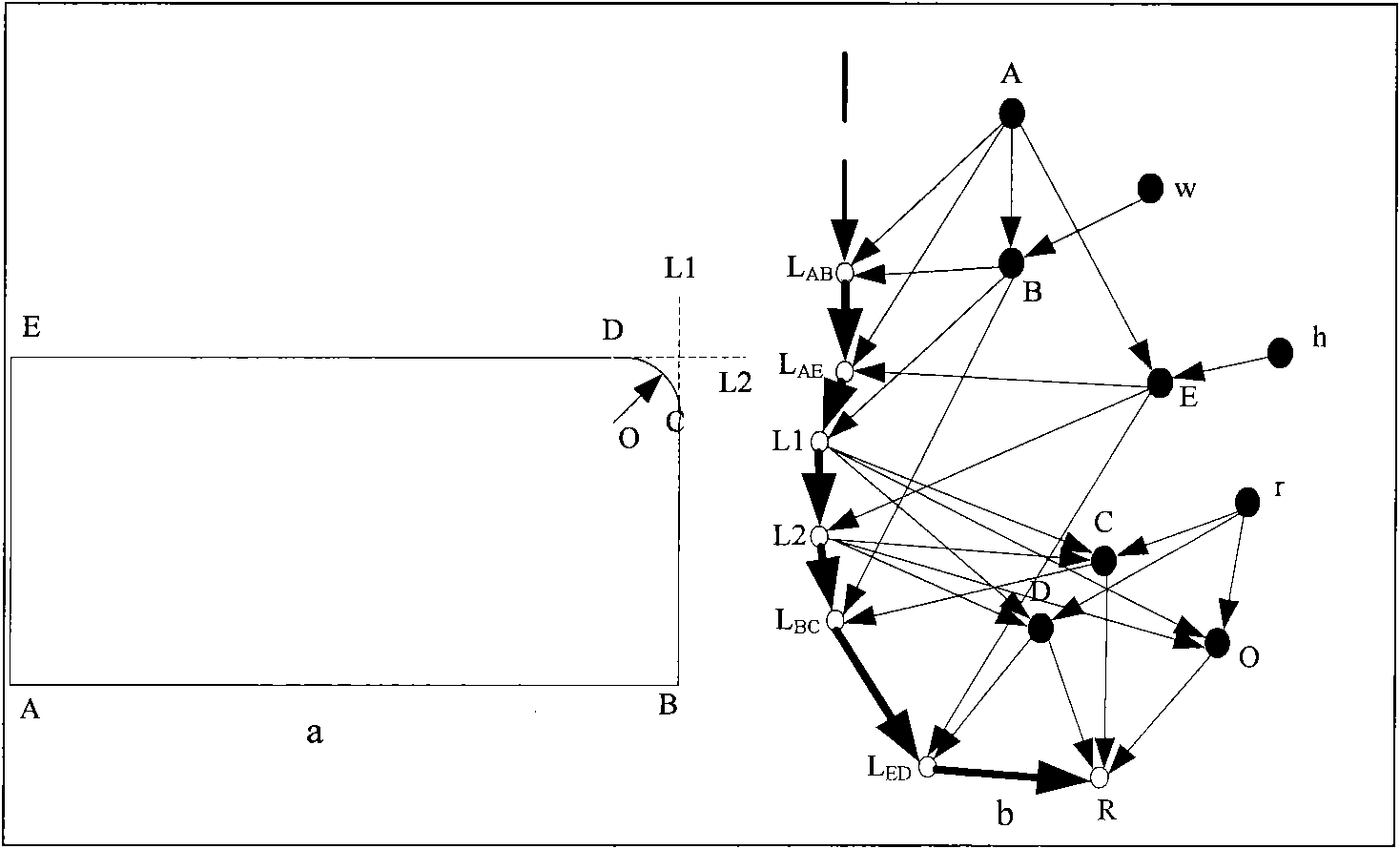
The invention relates to a method for simplifying a numerical map settlement place polygon by utilizing a parametric design model and effectively solves the problem of enabling the whole simplification process to accurate and quantitative, and ensuring good simplification effect. The method comprises the following steps: presetting the numeric area of the target function corresponding to the initial threshold value integrated digital model and simplification result quality and contribution weight; identifying the graph feature of the settlement place polygon, using coordinate monotonicity to identify local extremum point and basic bending, using adjacent edge vector multiplication cross to identify concavity of direction and culmination of the settlement place polygon; using gradual imaging simplification method to carry out primary simplification on the polygon and building the corresponding supergraph model to obtain the value of corresponding target culmination of each constrained edge in the model; using a mathematical model corresponding to the parametric design model to carry out constrained analysis on the constrained culmination, and constantly repeating iteration to obtain the final result. With coordinate data output by the computer, various settlement places can be simplified, and production efficiency and product quality of the numerical map can be improved.

Description

1. Technical field [0001] The invention relates to the fields of map drawing and geographic information engineering, in particular to a method for simplifying residential polygons of digital maps by using parametric design models in digital maps and GIS (Geographic Information System, the same below). 2. Background technology [0002] The simplification and generalization of residential polygons is the main content of map synthesis research, and it plays a very important role in the multi-scale expression of GIS. Domestic and foreign scholars have done a lot of fruitful work on the simplification of a single residential polygon. From the perspective of data structure, the more representative methods mainly include: the simplification method based on the vector data structure, the mixture of vector and raster The simplification method and the simplification method based on raster data structure. The simplification method based on the raster data structure is generally only s...

Claims


Application Information

Patent Timeline
IPC IPC(8): G06F17/50G09B29/00
Inventor 孙群刘海砚安晓亚肖强赵国成徐青李少梅肖计划阚映红季晓林车森周昭刘新贵朱蕊王海涛徐立陈换新刘晨帆孙广宇
Owner THE PLA INFORMATION ENG UNIV
Why Eureka
Try Eureka