Method and system for vehicle-mounted rapid navigation and positioning of land planning supervision implementation
A technology of navigation and positioning and land, which is applied in the field of inspection and inspection vehicles, can solve the problems of the road network map being unable to navigate and inspect the land, and achieve the effect of improving efficiency and timeliness, and improving work efficiency.
- Summary
- Abstract
- Description
- Claims
- Application Information
AI Technical Summary
Problems solved by technology
Method used
Image
Examples
Embodiment 1
[0024] A vehicle-mounted rapid navigation and positioning method for land planning implementation supervision, comprising the following steps:
[0025] (1) Analyze and process the existing land use status map or land use planning map, and quickly and automatically extract road network data from the initial data suitable for generating network data;
[0026] (2) Selection of planning path;
[0027] (3) The GPS points collected by the vehicle during driving are automatically matched with the road track on the map.
[0028] In step (1), the road network data is quickly obtained through the following steps: select the area range of the current land use map according to the needs, and perform data processing on the selected area to automatically generate the initial data of the network structure; Edit and analyze, create a local area road network, splicing and adding data to the road network library.
[0029] In step (2), the planning path is selected through the following steps:...
Embodiment 2
[0032] A vehicle-mounted rapid navigation and positioning system for land planning implementation supervision, comprising:
[0033] The data management unit uses a relational database to store spatial data and attribute data, uses a spatial data engine (SDE) as a data management middleware, and manages various basic land data and inspection data in a unified manner.
[0034] The road network data extraction unit determines the range of the road network to be extracted, performs data preprocessing on the selected range, and automatically generates the initial data of the network structure; at the same time, performs post-processing on the road network data and adds it to the road network database.
[0035] The path planning unit sets path selection conditions, selects a corresponding path planning scheme, and automatically performs path planning; at the same time, corrects the planned path.
[0036] The vehicle navigation unit displays the position and track of the driving vehi...
Embodiment 3
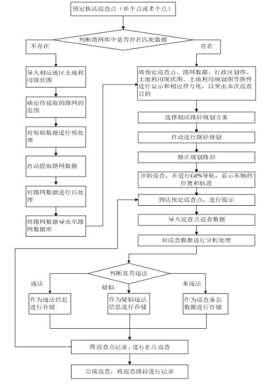
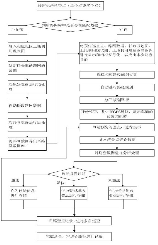
[0039] As shown in the accompanying drawing, it is a flow chart of the land planning implementation supervision vehicle-mounted fast navigation and positioning method based on land basic data of the present invention.
[0040] First, pre-book law enforcement inspection points, which can be a single point or multiple points; judge whether there is matching data in the road network database; Maps and other maps are displayed and correspondingly symbolized to highlight the purpose of this inspection, select the corresponding route planning scheme, automatically perform route planning, correct the planned route, start the inspection, and perform GPS navigation to display the position and trajectory of the vehicle, and arrive Schedule inspection points, give reminders, import inspection point inspection data, analyze and process the inspection data, judge whether it is illegal, complete the inspection, and record the inspection path; The scope of the road network, preprocessing the...
PUM
 Abstract
Description
Claims
Application Information
 - R&D
- Intellectual Property
- Life Sciences
- Materials
- Tech Scout
- Unparalleled Data Quality
- Higher Quality Content
- 60% Fewer Hallucinations
Browse by: Latest US Patents, China's latest patents, Technical Efficacy Thesaurus, Application Domain, Technology Topic, Popular Technical Reports.
© 2025 PatSnap. All rights reserved.Legal|Privacy policy|Modern Slavery Act Transparency Statement|Sitemap|About US| Contact US: help@patsnap.com


