Method for matching electronic map in urban geographic information system
A geographic information system and electronic map technology, applied in the field of geographic information systems, can solve problems such as not paying attention to the point-line relationship of the electronic map, low precision, complex matching algorithm of the electronic map, etc.
- Summary
- Abstract
- Description
- Claims
- Application Information
AI Technical Summary
Problems solved by technology
Method used
Image
Examples
Embodiment Construction
[0050] In order to make the object, technical solution and advantages of the present invention clearer, the implementation manner of the present invention will be further described in detail below in conjunction with the accompanying drawings.
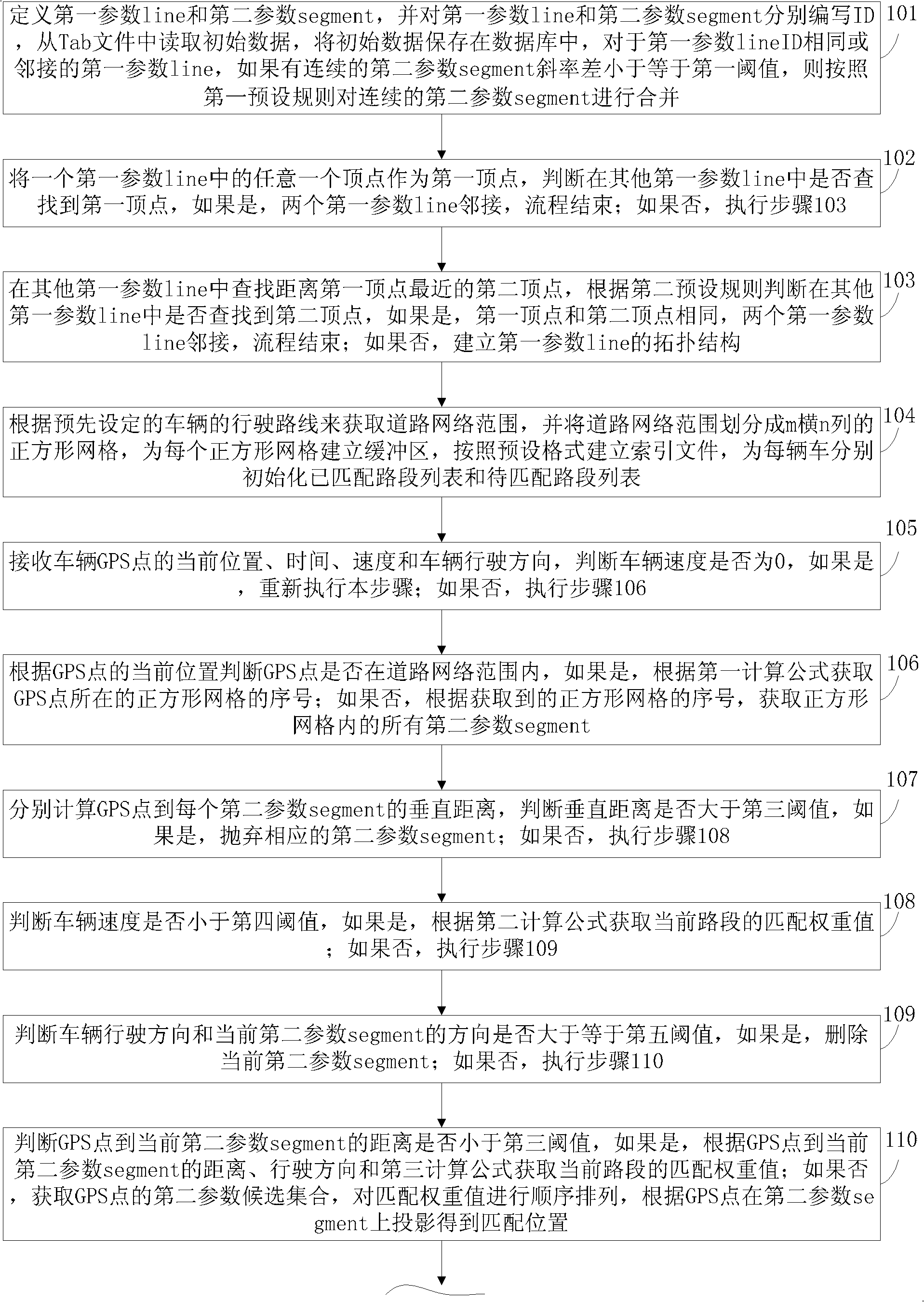
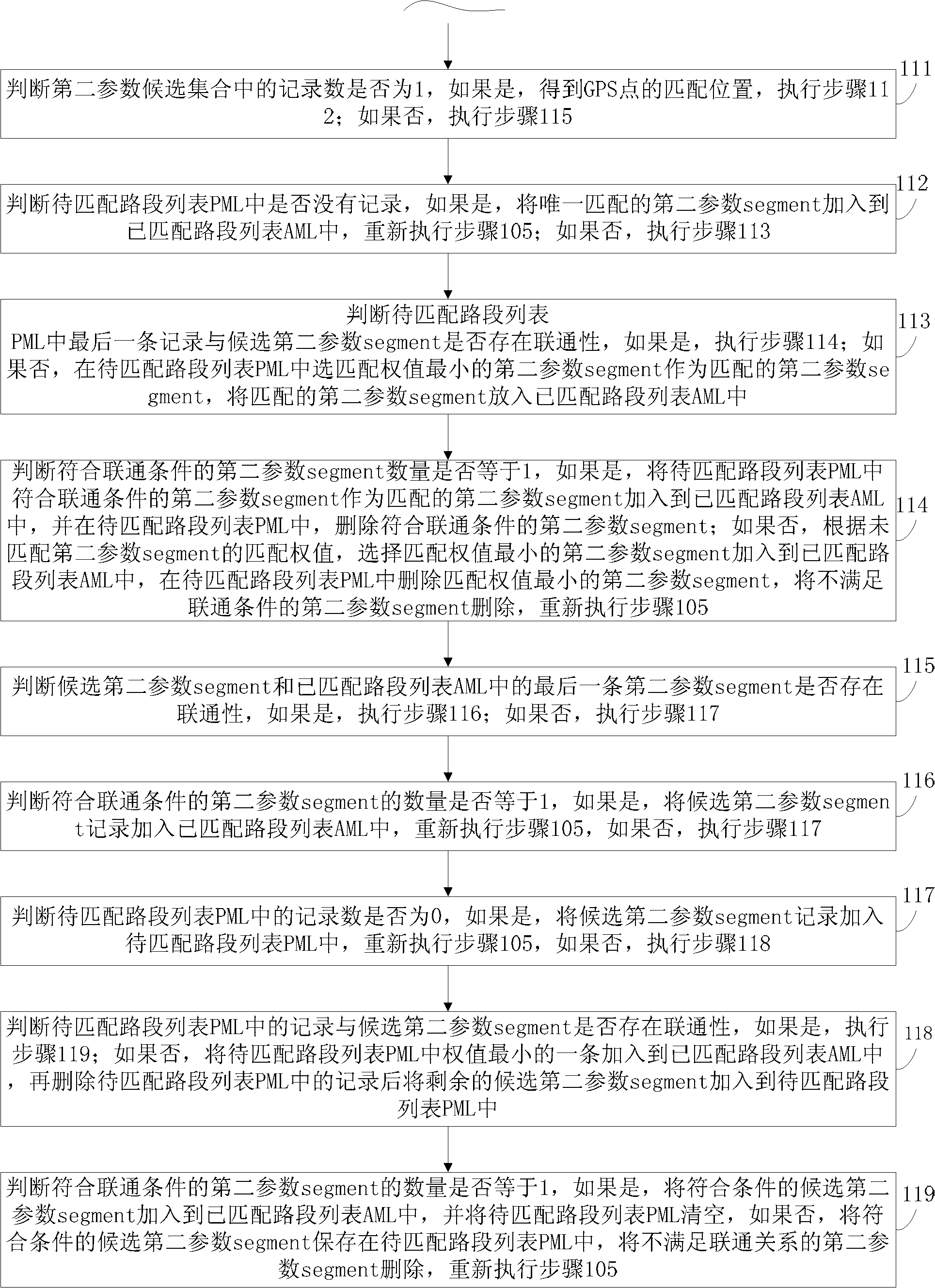
[0051] In order to solve the above problems, reduce computational complexity, improve efficiency and improve accuracy, the present invention provides a method for matching electronic maps in urban geographic information systems. During the matching process of electronic maps, points, lines and topological structures on electronic maps are required related information, such as the adjacency information of road segments. However, due to the format of the electronic map itself and the problems in the drawing process of the electronic map, it is impossible to obtain these information directly by reading the electronic map file, or because the obtained electronic map topology will make the calculation of electronic map matching too large, it...
PUM
 Abstract
Description
Claims
Application Information
 - R&D
- Intellectual Property
- Life Sciences
- Materials
- Tech Scout
- Unparalleled Data Quality
- Higher Quality Content
- 60% Fewer Hallucinations
Browse by: Latest US Patents, China's latest patents, Technical Efficacy Thesaurus, Application Domain, Technology Topic, Popular Technical Reports.
© 2025 PatSnap. All rights reserved.Legal|Privacy policy|Modern Slavery Act Transparency Statement|Sitemap|About US| Contact US: help@patsnap.com


