

Multi-scale triangulated irregular network (TIN) library coupled storage method
A multi-scale, scale technology, applied in instruments, maps/plans/charts, calculations, etc., can solve the problems of unrealistic, overall unstable subjectivity, staying in, and achieve the effect of reducing storage capacity and improving update efficiency
- Summary
- Abstract
- Description
- Claims
- Application Information
AI Technical Summary
Problems solved by technology
Method used
Image

Examples
Embodiment Construction
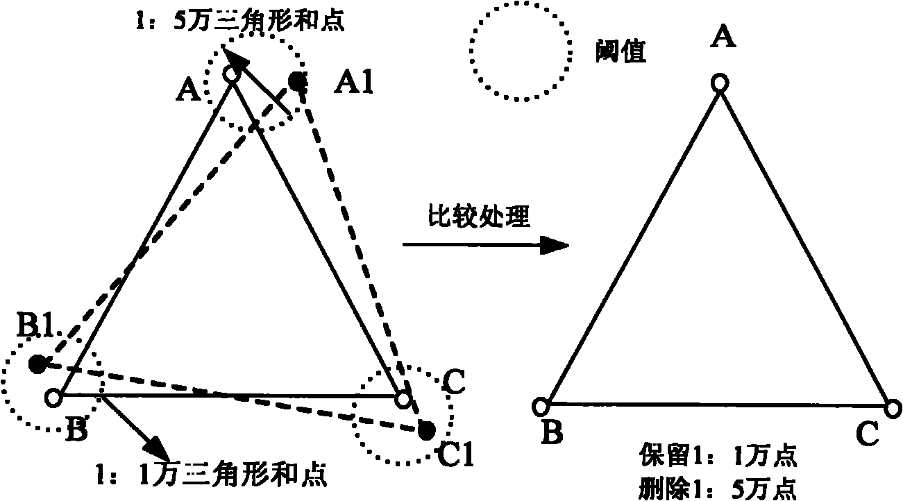
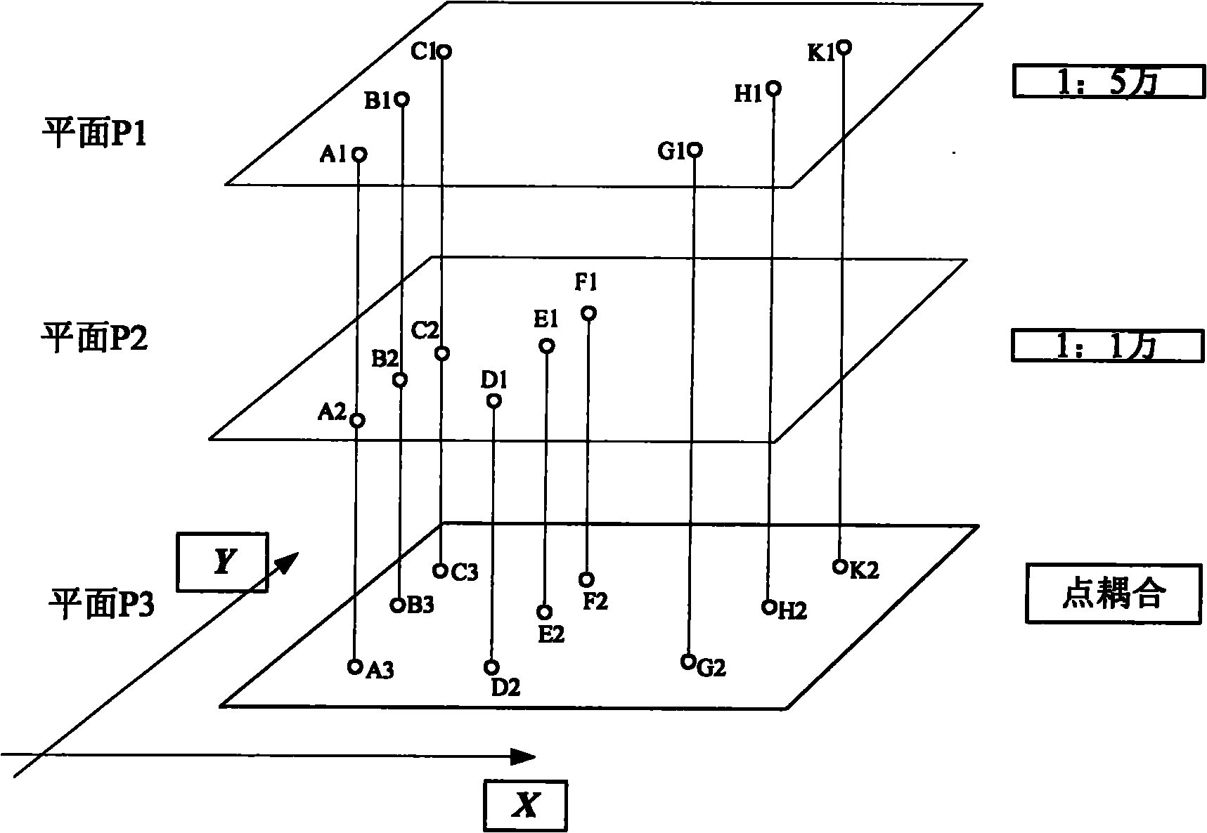
[0017] The TIN in the present invention is an irregular triangular network. In the field of geographic information, the expression of geographic continuous surface can be expressed by using triangular irregular network. The continuous surface model based on TIN can effectively describe the characteristics of terrain regions such as rivers, canyons, and terrain. The composition of TIN: a series of discrete points on the ground are connected into a non-intersecting triangular network according to certain rules and conditions. A digital elevation model (DEM) is a finite sequence of three-dimensional vectors representing terrain on an area. If the points collected according to terrain features are connected according to certain rules into many triangles covering the entire area and not overlapping each other, a DEM represented by an irregular triangular network TIN is formed, which is usually called TIN DEM.
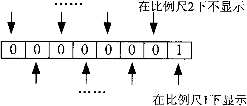
[0018] The technical scheme of the present invention is described wit...
PUM
 Abstract
Description
Claims
Application Information