System for guiding a drone during the approach phase to a platform, in particular a naval platform, with a view to landing same

A technology for offshore platforms and navigation systems, applied in the field of navigation systems, can solve problems such as the difficulty in ensuring the recovery of drones and the inability to guarantee the availability of GPS at every moment

Inactive Publication Date: 2011-10-19
DCNS SA
View PDF4 Cites 12 Cited by
  • Summary
  • Abstract
  • Description
  • Claims
  • Application Information

AI Technical Summary

Problems solved by technology

[0006] Add to these problems the difficulty of assuring recovery of drones whose position is often measured by GPS whose availability cannot be determined at every moment due to satellite constellation cycle jumps, multipath, or interference. Guaranteed

Method used


Image

  • System for guiding a drone during the approach phase to a platform, in particular a naval platform, with a view to landing same
  • System for guiding a drone during the approach phase to a platform, in particular a naval platform, with a view to landing same
  • System for guiding a drone during the approach phase to a platform, in particular a naval platform, with a view to landing same

Examples


Embodiment Construction

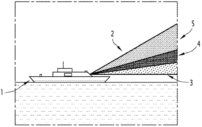
[0031] figure 1 actually shows the navigation system of the UAV at the stage close to the platform, especially the offshore platform.

[0032] The platform is indicated in this figure with the general reference number 1 and has, for example, a drone landing zone at the rear.

[0033] In fact, the platform is equipped with a glide slope indicating device that emits an array of guiding beams over a predetermined angular field from the horizontal plane.

[0034] On the UAV side, the UAV is equipped with a beam acquisition camera, which is connected to an image analysis device and a calculation device for the control commands of the UAV autopilot device, so that the UAV follows the guiding beam.

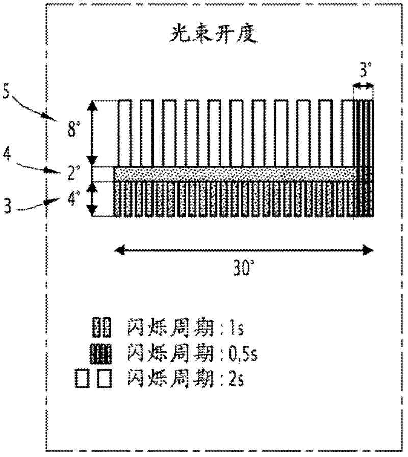
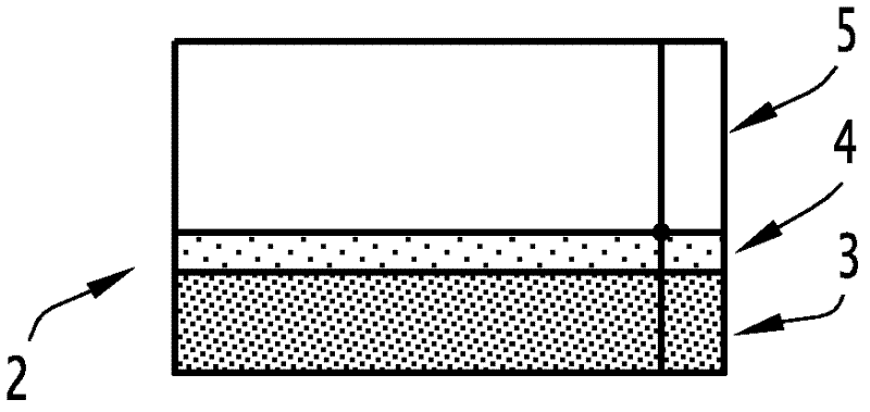
[0035] exist figure 1 In , the array of guided beams is denoted by the general reference numeral 2.

[0036] In practice, the array of directed beams may comprise three juxtaposed beams of different colors rising from the horizontal, for example in the figure 1 Beams denoted by refer...


PUM


Abstract

The invention relates to a system for guiding a drone during the approach phase to a platform, in particular a naval platform, with a view to landing same, characterised in that the platform is provided with equipment indicating the angle of descent, emitting an array of optical guide beams onto an angular sector predetermined from the horizontal, and in that the drone is provided with a camera (6) for acquiring the beam and which is connected to an image analysis means (7) and a means (8) for computing command orders sent to an automatic flight means (9) of the drone, in order to prompt the drone to follow the guide beams.

Description

technical field [0001] The invention relates to a navigation system of an unmanned aerial vehicle in the stage of approaching a platform and landing. [0002] More particularly, the present invention relates to a navigation system of such a drone during the phase of approaching a platform, such as in particular an offshore platform, for landing. Background technique [0003] This bootstrap problem is known to be a critical problem that has been developed since many years. [0004] In fact, guidance methods for such applications have been proposed based on GPS (Global Positioning System) or radar technology. [0005] However, within the special scope of application of offshore platforms, these systems need to control the platform, in particular to know its motion and its equipment. [0006] Add to these problems the difficulty of assuring recovery of drones whose position is often measured by GPS whose availability cannot be determined at every moment due to satellite const...

Claims


Application Information

Patent Timeline
Patent Type & Authority Applications(China)
IPC IPC(8): B64F1/20G01S1/70G08G5/02
CPCB64F1/20G05D1/0684G01S1/7038G01S2201/08G01S1/7034B63B35/50G08G5/02
Inventor J·P·G·莫雷斯弗
Owner DCNS SA
Why Eureka
Try Eureka