
Coordinate inversion method and system

A technology of coordinates and y coordinates, applied in special data processing applications, instruments, electrical digital data processing, etc., can solve the problems of low automation of control point selection and low processing efficiency

Inactive Publication Date: 2012-06-27
BEIJING BAIDU NETCOM SCI & TECH CO LTD
View PDF3 Cites 2 Cited by
  • Summary
  • Abstract
  • Description
  • Claims
  • Application Information

AI Technical Summary

Problems solved by technology

[0003] The existing coordinate inversion method and system need to manually select the new source of inaccurate spatial data, and set the parameters of these spatial data, such as how much to offset, how much to rotate, etc., and then perform corresponding operations according to the settings. Coordinate inversion, which has problems such as low automation of control point selection and low processing efficiency

Method used


Image

  • Coordinate inversion method and system
  • Coordinate inversion method and system
  • Coordinate inversion method and system

Examples


Embodiment Construction

[0045] In order to make the objectives, technical solutions and advantages of the present invention clearer, the present invention will be described in detail below with reference to the accompanying drawings and specific embodiments.

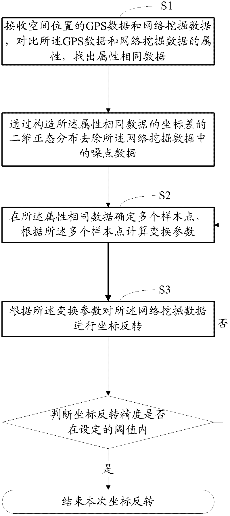
[0046] The coordinate inversion method and system of the present invention can extract sample points according to precise data (such as spatial data collected by GPS) and inaccurate data (such as spatial data captured by network mining data), determine transformation parameters through the sample points, and The error point is corrected by transforming the parameters, and finally the error evaluation is carried out.

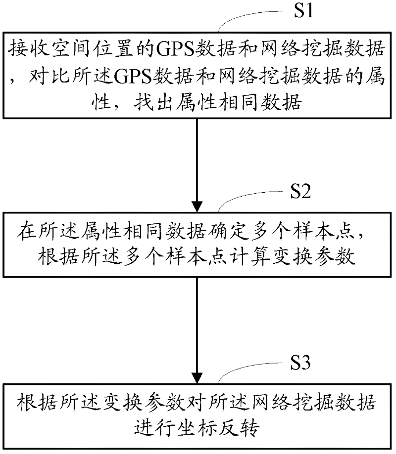
[0047] like figure 1 As shown, the coordinate transformation method in an embodiment of the present invention includes:

[0048] S1, receive GPS data and network mining data of a spatial position, compare the attributes of the GPS data and the network mining data, and find out the same data of attributes; wherein, the GPS data an...


PUM


Abstract

The invention provides a coordinate inversion method and system. The coordinate inversion method comprises the following steps: S1, receiving global positioning system (GPS) data of a spatial position and network mining data, comparing the attributes of the GPS data and the network mining data, and finding out the data with the same attribute; S2, confirming a plurality of sample points in the data with the same attribute, and calculating transformation parameters according to the plurality of sample points; and S3 carrying out coordinate inversion on the network mining data according to the transformation parameters. Compared with the prior art, the coordinate inversion method and system provided by the invention are high in degree of automation and processing efficiency.

Description

【Technical field】 [0001] The invention relates to an electronic map technology, in particular to a coordinate inversion method and system. 【Background technique】 [0002] When establishing an electronic map database, it is necessary to collect spatial data from various sources. Generally, the spatial data from some sources is relatively accurate (such as the spatial data provided by navigators), and the spatial data from some sources is not very accurate (such as At this time, it is necessary to invert the coordinates of these inaccurate spatial data when establishing an electronic map database. Coordinate inversion refers to the geometric transformation of new sources of geometric data or spatial data It can be corrected by other methods and registered to the geometric data or spatial data of existing sources. Since the data of the Internet is much more than that of GPS data, it is very valuable to invert the coordinates of the spatial data captured by the Internet. [000...

Claims


Application Information

Patent Timeline
Patent Type & Authority Applications(China)
IPC IPC(8): G06F17/30G09B29/00
Inventor 梁威
Owner BEIJING BAIDU NETCOM SCI & TECH CO LTD
Learn More