
2.5-times three-dimensional seismic exploration method of complex geological target

A three-dimensional seismic and complex geological technology, applied in the field of petroleum geological exploration, can solve the problems of multiple geological targets, increased exploration costs, and large differences in buried depth, and achieve the effects of improving signal-to-noise ratio, improving exploration effectiveness, and improving imaging accuracy

Active Publication Date: 2012-10-03
PETROCHINA CO LTD
View PDF6 Cites 18 Cited by
  • Summary
  • Abstract
  • Description
  • Claims
  • Application Information

AI Technical Summary

Problems solved by technology

[0004] Due to the relatively large deployment area of ​​the secondary 3D seismic exploration, many geological targets involved in the exploration, across different structural units, large differences in buried depth, and complex underground structures and surface conditions in some areas, the signal-to-noise ratio of the secondary 3D seismic data in local areas Problems such as inaccurate homing of low and high steep faults, failure to implement complex fault blocks, etc.
In view of the high degree of exploration in the eastern oilfields, the geological targets to be implemented tend to be deep, small, and difficult, while the geological requirements tend to be clear, precise, and accurate; the secondary 3D seismic data in some areas is difficult to meet the requirements of fine exploration and reservoir description at the present stage. geological needs
If three 3D seismic explorations are carried out for local complex geological targets, it is necessary to adopt the observation system method with higher coverage times and smaller bins, which will greatly increase the exploration cost, which is not in line with the current exploration practice in the old eastern oil regions.

Method used


Image

  • 2.5-times three-dimensional seismic exploration method of complex geological target
  • 2.5-times three-dimensional seismic exploration method of complex geological target
  • 2.5-times three-dimensional seismic exploration method of complex geological target

Examples


Embodiment 1

[0044] Embodiment 1: Taking the 2.5 times 3D seismic exploration project of the buried hill target in the NMZ area as an example, the present invention will be further described in detail.

[0045] 1) For the secondary 3D seismic full-frequency profile data in the NMZ area, the quality of the middle-shallow data above 2 seconds is high, but below 2 seconds, the buried depth of the target layer is 4000-5000 meters, and the signal-to-noise ratio of the seismic data is relatively low , the position of the controlling mountain fault is inaccurate, and the contact relationship between the inner strata and the controlling mountain fault is not clear. Using frequency-divided display data with bandpasses of 20-40 Hz, 30-60 Hz, and 40-80 Hz, the signal-to-noise ratio and poor continuity of the target layer data below Tg on the top of the buried hill are low. It has been confirmed by actual drilling that there is a certain error between the seismic data and drilling data inside the buri...


PUM


Abstract

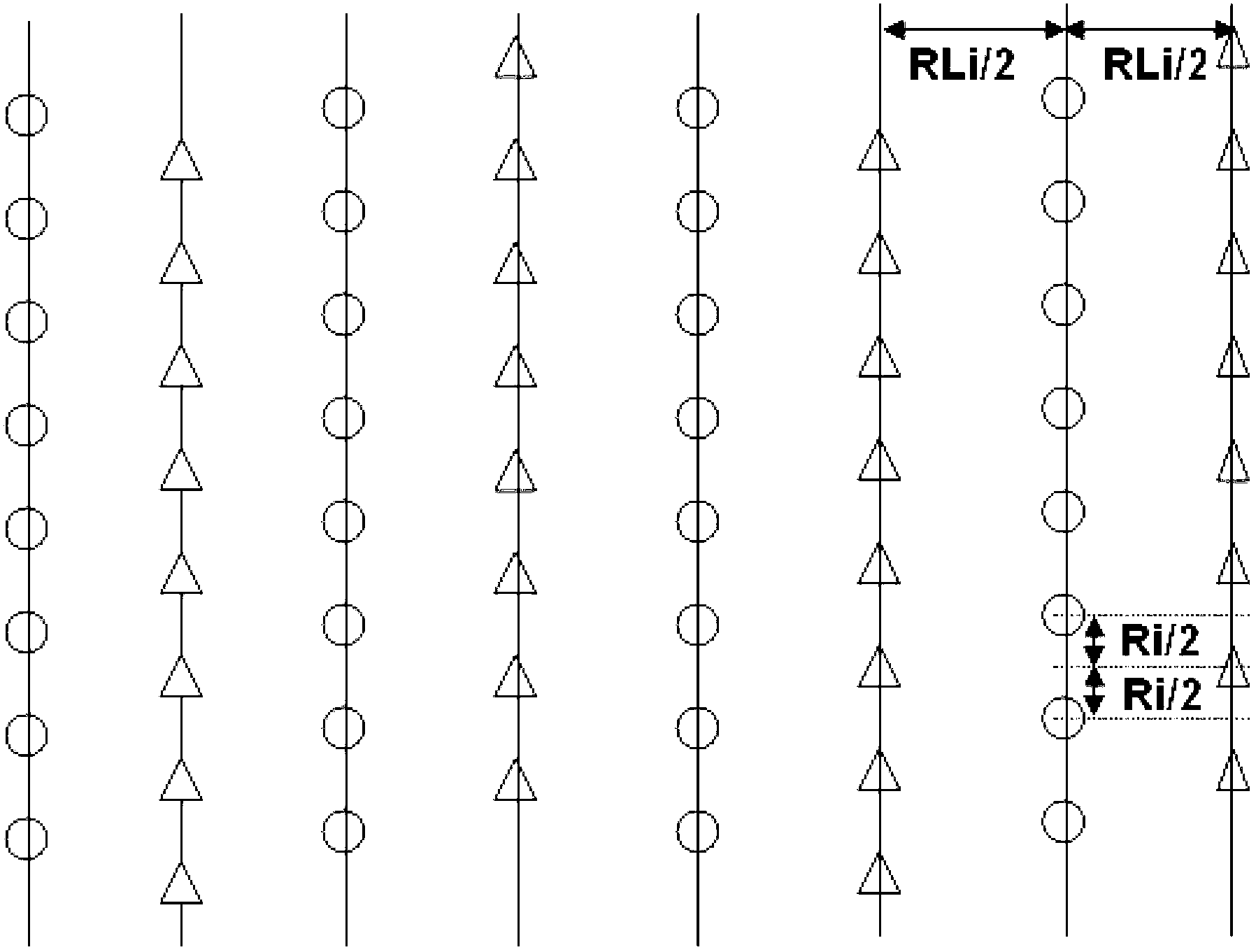
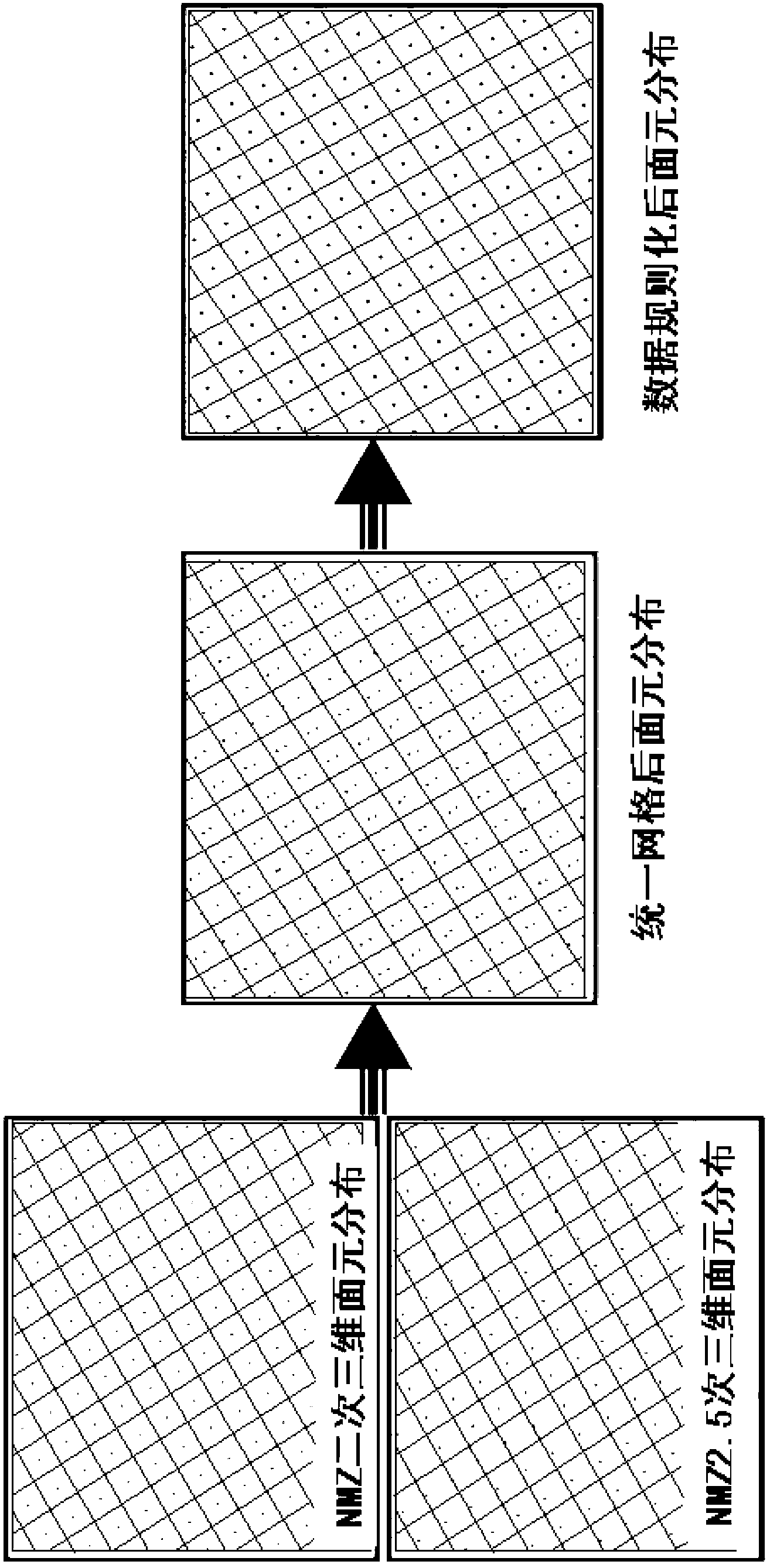
The invention discloses a 2.5-times three-dimensional seismic exploration method of a complex geological target applied to the petroleum geology exploration. The 2.5-times three-dimensional seismic exploration method comprises the following steps of: calculating coverage times needed by the 2.5-times three-dimension according to the relationship of signal-to-noise ratios and coverage times of stack section data and original single-shot data; treating and analyzing limited shot-geophone distance with utilization of two-dimensional test wire data with long shot-geophone distances and high coverage, and preferably choosing proper maximum shot-geophone distance; determining key parameters of an observation system according to the analytic conclusions; establishing an uniform coordinate grids by adopting an uniform origin of coordinates, and realizing fusion of time-domain three-dimensional seismic data; and realizing high-precision imaging of the complex target by establishment of a regular and high-precise velocity field of the three-dimensional seismic data and migration treatment of three-dimensional prestack time. The 2.5-times three-dimensional seismic exploration method of the complex geological target has the following effects: through the fusion of the three-dimensional seismic data, the coverage times is increased and the signal-to-noise ratio of the data is improved; the imaging precision of the data is improved by utilizing the prestack time migration technology, and the fine description of the complex geological target is realized.

Description

technical field [0001] The invention relates to the technical field of petroleum geological exploration, in particular to three-dimensional seismic exploration of reflected waves, and is a seismic exploration method suitable for areas with high exploration degree and complex geological targets. Background technique [0002] Most of the oil and gas-bearing basins in eastern China belong to faulted basins, and the structural units favorable for accumulation change rapidly laterally. Since the 1960s and 1970s, the eastern region has undergone geological surveys, non-seismic exploration, 2D seismic exploration and a 3D seismic exploration, and many large oil fields have been discovered one after another. [0003] After nearly half a century of exploration and development, the proven rate of oil and gas in the oil-rich sags in the Eastern Oilfield has reached over 50%, but the favorable structural belts still have great exploration potential. At the beginning of this century, th...

Claims


Application Information

Patent Timeline
IPC IPC(8): G01V1/28G01V1/30
Inventor 赵贤正张玮白旭明唐传章邓志文宴丰叶秋焱刘旺金凤鸣刘占族邱毅
Owner PETROCHINA CO LTD
Learn More