
Interpretation and evaluation method for reservoir area engineering geological survey

A technology of engineering geology and reservoirs, applied in geophysical measurement, instruments, etc., can solve the problems of high misjudgment rate, difficulty in meeting high-precision requirements in the design stage, and low accuracy rate

Inactive Publication Date: 2012-10-03
UNIV OF SCI & TECH BEIJING
View PDF0 Cites 32 Cited by
  • Summary
  • Abstract
  • Description
  • Claims
  • Application Information

AI Technical Summary

Problems solved by technology

However, most of the current interpretation results are limited to the application of small scales, which can only meet the rough judgment in the initial stage of the project, and the accuracy rate is low and the misjudgment rate is high, so it is difficult to meet the high-precision requirements of the higher design stage

Method used


Image

  • Interpretation and evaluation method for reservoir area engineering geological survey
  • Interpretation and evaluation method for reservoir area engineering geological survey
  • Interpretation and evaluation method for reservoir area engineering geological survey

Examples


Embodiment Construction

[0075] For reference and clarity, the technical terms involved in the present invention and some interpretation and evaluation methods are introduced as follows:

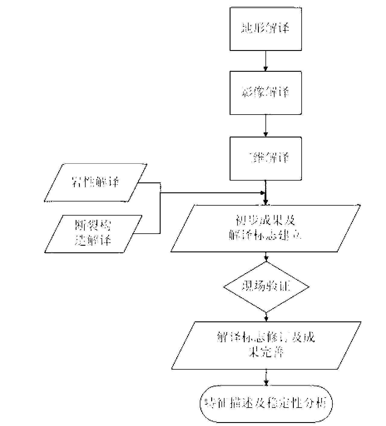
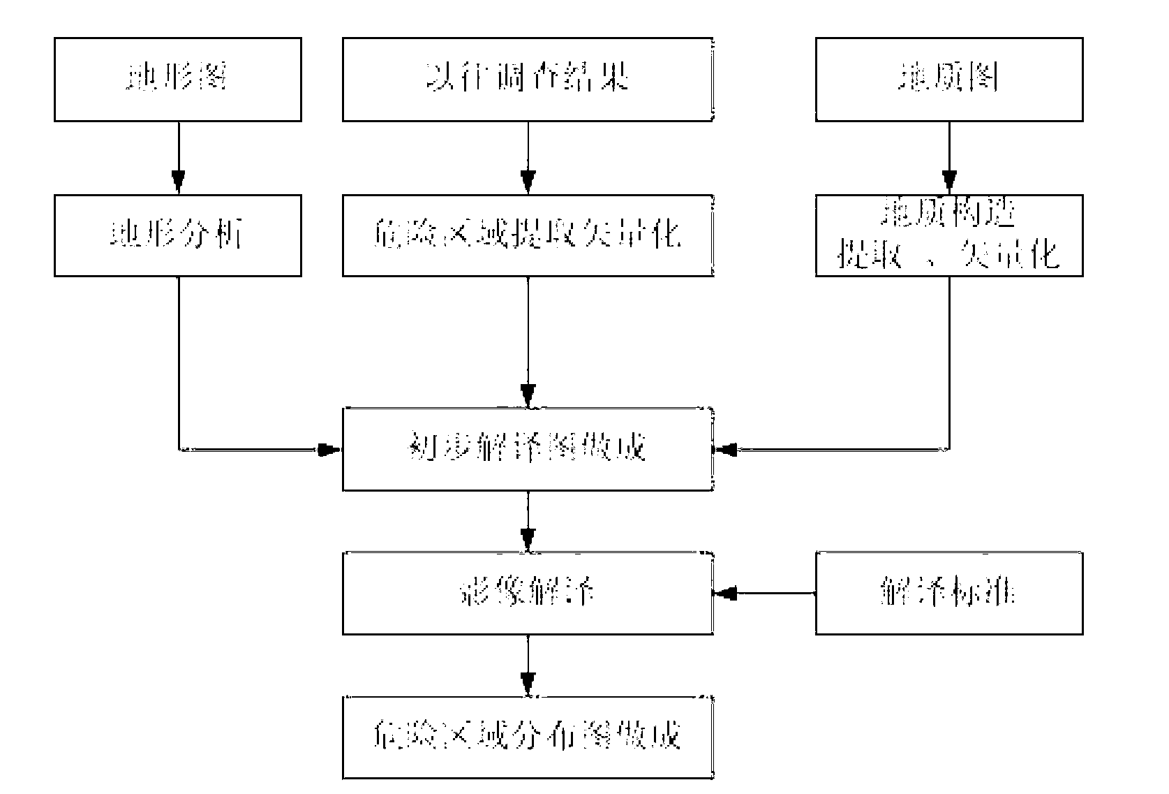
[0076] 1. Hierarchical Interpretation Method of Unfavorable Geological Phenomena in Reservoir Area: For example figure 1 As shown, the interpretation method proposed by the example implementation of the present invention is based on the analysis of topographical interpretation, based on the four external performances of stratum lithology, geological structure and rock-soil mass structure, and hydrogeological conditions. Interpretation signs (including maps and text descriptions) of images and three-dimensional features, combined with extracted information and other materials, are sampled for on-site comparison and verification to complete the interpretation work.

[0077] The method includes four steps: establishment of interpretation flags, preliminary interpretation, field verification and detailed comprehensive ...


PUM


Abstract

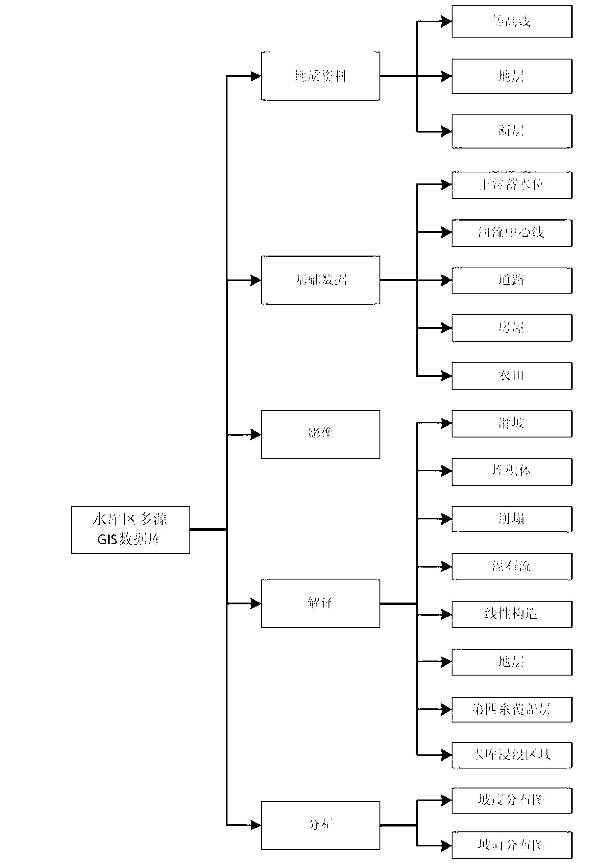
The invention discloses an interpretation and evaluation method for a reservoir area engineering geological survey and particularly relates to a hierarchy interpretation method and a comprehensive evaluation method for reservoir area engineering geological survey and evaluation. According to the interpretation and evaluation method, the interpretation of bad geologic bodies of landslide, collapse, debris flow and the like can be achieved, the precision can meet a requirement of feasibility, and the comprehensive evaluation of engineering geological problems of reservoir leakage, reservoir bank stability, reservoir bank collapse, reservoir immersion, the debris flow and the like can be achieved. The steps of the interpretation and evaluation method includes firstly, establishing a geographic information system (GIS) data bank of a reservoir area engineering geology and a three-dimensional true color remote-sensing image visualization system; secondly, establishing remote-sensing interpretation marks of the bad geologic bodies of the landslide, the collapse, the debris flow and the like; thirdly, performing preliminary interpretation with geography interpretation as a priority; fourthly, performing outdoor verification by matching of image interpretation; fifthly, performing detailed comprehensive interpretation with three-dimensional interpretation as a priority; sixthly performing reservoir leakage comprehensive interpretation based on a GIS; seventhly, performing reservoir bank stability comprehensive interpretation based on the GIS; eighthly, performing reservoir bank collapse and reservoir immersion comprehensive interpretation based on the GIS; and ninthly, performing reservoir debris flow comprehensive interpretation based on the GIS.

Description

technical field [0001] The present invention relates to the engineering geological survey of reservoir area, specifically the engineering geological survey method of reservoir area based on geographic information technology (GIS) and remote sensing technology, especially the interpretation of engineering geological conditions of reservoir area based on GIS and remote sensing technology and on this basis Evaluation of engineering geological problems in the reservoir area (reservoir leakage, reservoir bank stability, reservoir bank collapse, reservoir immersion, and debris flow). Background technique [0002] For the investigation and evaluation of geological hazards, ground survey methods are traditionally used. Since the reservoirs are usually located in mountainous areas, the transportation is inconvenient and the environment is harsh, the survey work is very difficult. At the same time, the limitation of the horizon prevents geologists from grasping the appearance of geol...

Claims


Application Information

Patent Timeline
IPC IPC(8): G01V9/00
Inventor 谢谟文张连卫刘翔宇王立伟王增福贾斌何兴东马睿许波郝楠
Owner UNIV OF SCI & TECH BEIJING
Learn More