Method and system of landslide recognition of complicated geological background area based on LiDAR
A technology for complex geology and background areas, applied in the field of landslide identification in complex geological background areas based on LiDAR, can solve the problem of less data demand, and achieve the effect of less data demand, high classification accuracy and strong practicability
- Summary
- Abstract
- Description
- Claims
- Application Information
AI Technical Summary
Problems solved by technology
Method used
Image

Examples
Embodiment Construction
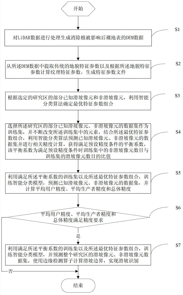
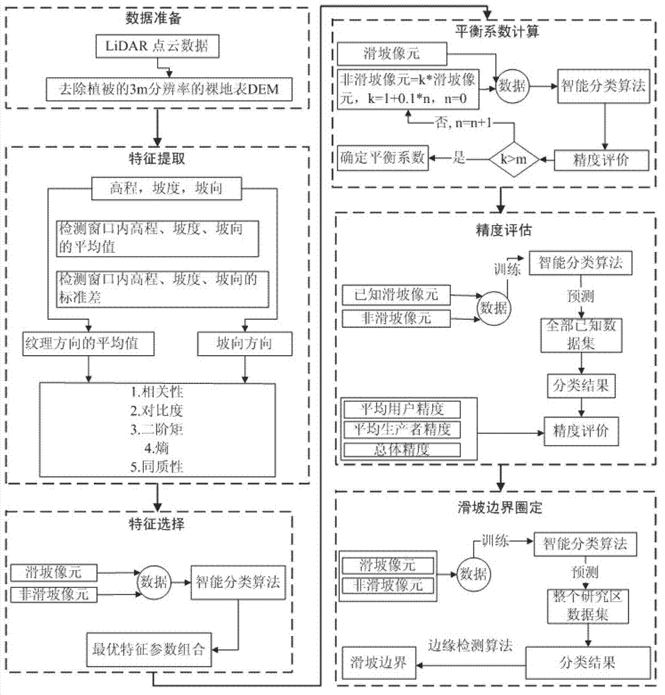
[0047] In order to make the object, technical solution and advantages of the present invention clearer, the present invention will be further described in detail below in conjunction with the accompanying drawings and embodiments. It should be understood that the specific embodiments described here are only used to explain the present invention, not to limit the present invention.
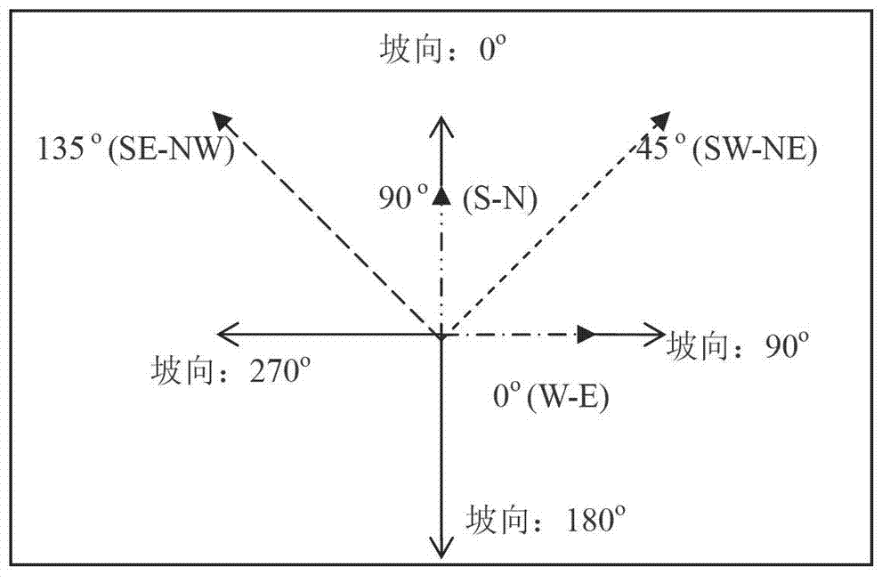
[0048] The invention utilizes the airborne lidar technology to obtain meter-level, high-density surface point cloud data and the characteristics of DEM data that eliminate the influence of vegetation, and proposes new texture feature parameters, which can realize automatic identification of landslide boundaries in complex geological background areas, and are practical Strong, can improve the quantitative level of "digital landslide".
[0049] In the embodiment of the present invention, the DEM data obtained based on LiDAR data in a certain area of the Yangtze River is used to automatically identi...
PUM
 Abstract
Description
Claims
Application Information
 - Generate Ideas
- Intellectual Property
- Life Sciences
- Materials
- Tech Scout
- Unparalleled Data Quality
- Higher Quality Content
- 60% Fewer Hallucinations
Browse by: Latest US Patents, China's latest patents, Technical Efficacy Thesaurus, Application Domain, Technology Topic, Popular Technical Reports.
© 2025 PatSnap. All rights reserved.Legal|Privacy policy|Modern Slavery Act Transparency Statement|Sitemap|About US| Contact US: help@patsnap.com