

Constructing method for topographic correction vegetation index
A vegetation index and terrain correction technology, which is applied to the reflection/re-radiation of radio waves, the use of re-radiation, measurement devices, etc. It can solve the problem of insufficient quantitative inversion of vegetation information in mountainous areas, cannot achieve terrain correction effects, and cannot cover the entire image. and other problems, to achieve the effect of eliminating differences in vegetation information, significant terrain correction effect, and low data economic cost.
- Summary
- Abstract
- Description
- Claims
- Application Information
AI Technical Summary
Problems solved by technology
Method used
Image

Examples
Embodiment Construction
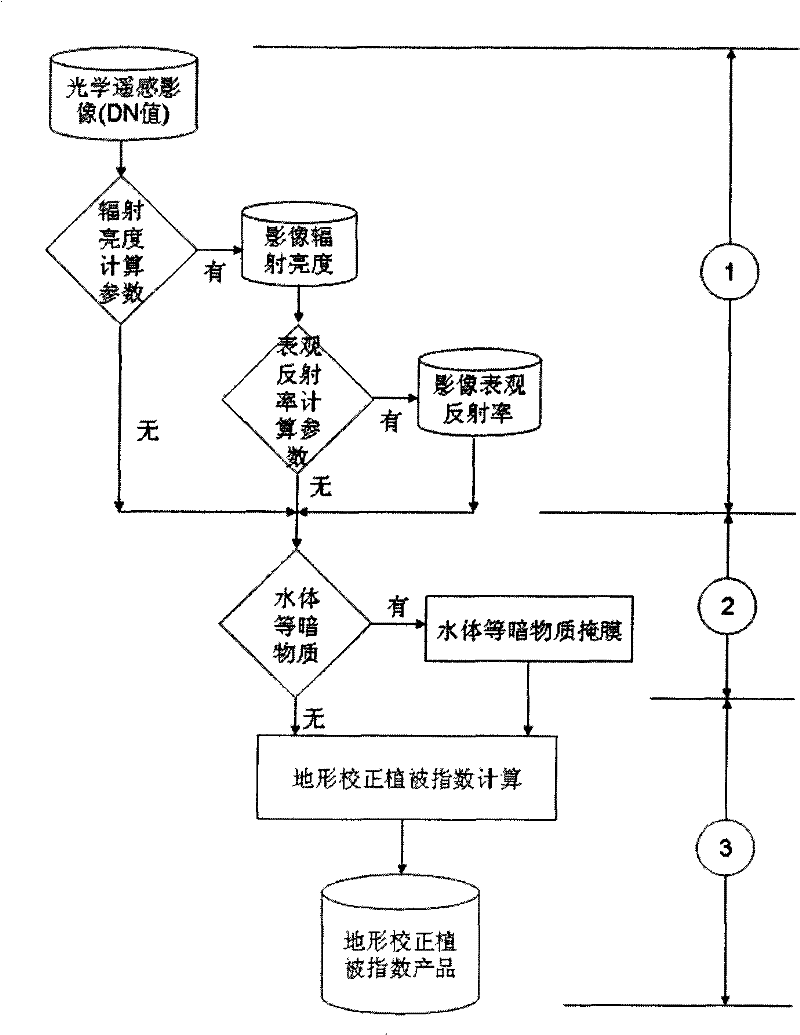
[0034] The construction method of terrain correction vegetation index of the present invention, this method comprises the following steps:
[0035] (1) Image radiation correction, corresponding to figure 1 In ①, according to the conditions of the obtained optical remote sensing image data source, different degrees of radiation correction are performed. If there are radiance calculation parameters, such as the Gain and Bias parameters of each band of the sensor, the radiance value of the relevant band data can be calculated from the DN value of each band data of the remote sensing image; if there are further calculation parameters about the apparent reflectance, For example, parameters such as the solar spectral irradiance of the corresponding wavelength at the top of the atmosphere can further calculate the apparent reflectance of the top of the atmosphere in the relevant band. Radiation correction can improve the final inversion accuracy of terrain-corrected vegetation index...
PUM
 Abstract
Description
Claims
Application Information