

Marine environment information three-dimensional visualization method
A marine environment, three-dimensional technology, applied in the field of three-dimensional visualization, can solve the problem of three-dimensional visualization without considering vector field elements
- Summary
- Abstract
- Description
- Claims
- Application Information
AI Technical Summary
Problems solved by technology
Method used
Image

Examples
Embodiment Construction
[0044] The present invention will be further described in detail below in conjunction with the accompanying drawings.
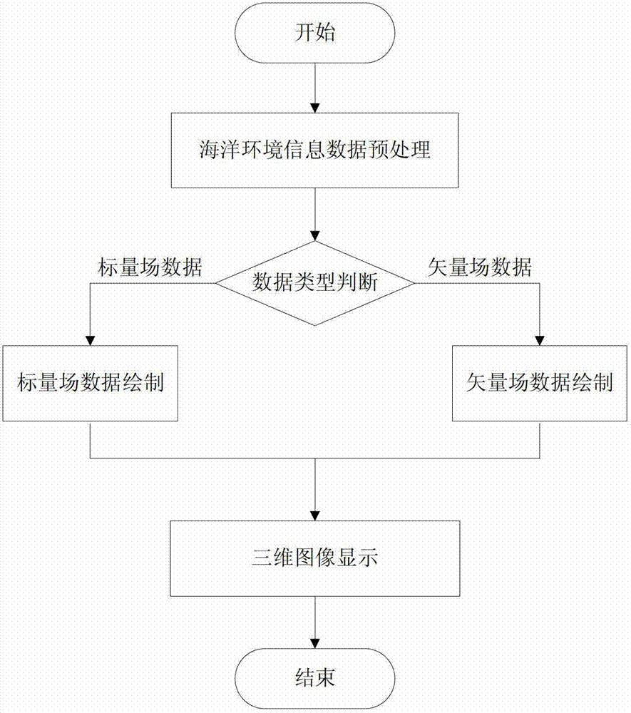
[0045] The present invention proposes a three-dimensional visualization method for marine environment information, which includes the following steps:
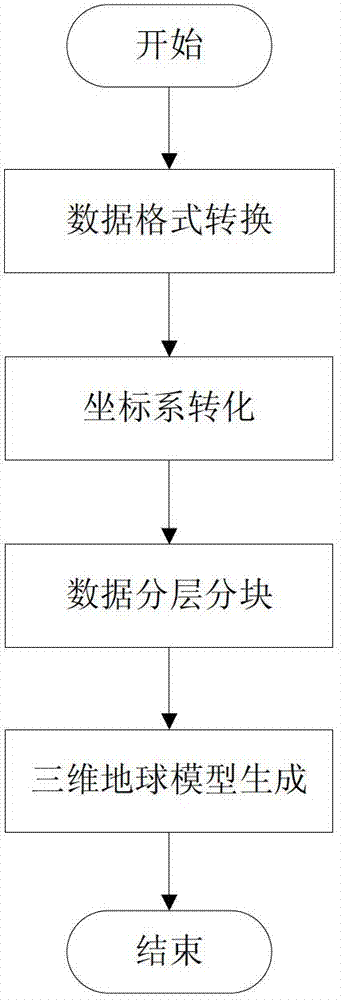
[0046] Step 1 Construction of 3D Earth Model
[0047] In order to vividly and vividly express marine environmental information in a three-dimensional manner, the present invention uses a three-dimensional earth model as a background field to realize three-dimensional visualization of marine environmental information. The three-dimensional earth model is mainly constructed by using elevation data and image data, the elevation data is used to construct the basic shape of the three-dimensional earth model, and the image data is used to increase the realism of the three-dimensional earth model. By processing the elevation data and image data, the earth model file is generated to realize the construction of the 3...
PUM
 Abstract
Description
Claims
Application Information