Map data storage method based on space exploration technology

A map data and technology technology, applied in the field of map data storage based on space exploration technology, can solve the problems of fixed internal structure, large amount of data redundancy, lack of flexibility, etc., and achieve the effect of reducing redundancy and reducing demand

Inactive Publication Date: 2013-01-02
HARBIN ENG UNIV
View PDF3 Cites 15 Cited by
  • Summary
  • Abstract
  • Description
  • Claims
  • Application Information

AI Technical Summary

Problems solved by technology

In the existing map data storage, the most popular ones are kiwi format and kiwi plus, but these two me

Method used


Image

  • Map data storage method based on space exploration technology
  • Map data storage method based on space exploration technology
  • Map data storage method based on space exploration technology

Examples


Embodiment Construction

[0020] The present invention is further described below in conjunction with accompanying drawing:

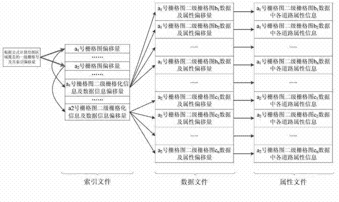
[0021] In the navigation map data, the map information that people are most concerned about is the road information, and the road information is also the most representative map data. For the convenience of subsequent explanations, the map data proposed in this patent is explained on the basis of the road information map layer. storage method. The specific implementation process is as follows:

[0022] 1. Determine the scope of the map to be stored

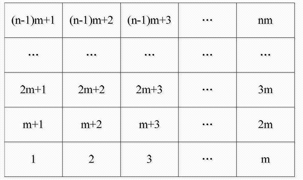
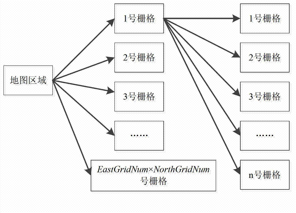
[0023] Before processing the map data, set the map area to be processed, which can be expressed as: MapMinEast, MapMinNorth, MapMaxEast, MapMaxNorth. Each variable represents the minimum east coordinate value, the minimum north coordinate value, the maximum east coordinate value, and the maximum north coordinate value of the selected map area respectively.

[0024] 2. Determine the map layer and related attribute information to b...


PUM


Abstract

The invention relates to a map data storage method based on geographic regional second-stage rasterizing and space information indexing. The method comprises the steps as follows: (1) determining the map coverage, the map layer and the attribute information of the map to be stored; (2) carrying out second-level rasterizing to the map data; (3) amplifying the coordinate data of the map; and (4) storing the map data into an index file, a data file and an attribute file. According to the map data storage method based on the space exploration technology provided by the invention, a mode of storing the map coordinate information through integrated data is adopted, therefore, the demand on a physical space can be greatly reduced; and the map data is stored in the second-level rasterizing mode, so that the redundancy rate of the data storage can be greatly reduced.

Description

technical field [0001] The invention relates to a method for storing map data based on geographic area secondary rasterization and spatial information indexing. Background technique [0002] With the development of geographic information systems, map information is becoming more and more complex, so it is of great significance to provide a map data that can not only quickly index map data, but also occupy the minimum physical storage space. A high-quality map data should contain as much map information as possible and occupy as little physical storage space as possible. Since map data usually contains a large amount of information, it is necessary to establish a convenient and fast index system, which can index the required map information in the shortest time and avoid affecting the real-time performance of system information processing. Modern transportation is developing in the direction of intelligence. One of the key factors is the storage structure and indexing method...

Claims


Application Information

Patent Timeline
IPC IPC(8): G06F17/30
Inventor 赵琳黄攀李亮刘金山
Owner HARBIN ENG UNIV
Why Eureka
Try Eureka