Land type information remote sensing automatic identification method supported by land use database

A technology of remote sensing automatic identification and land type information, which is applied in the field of remote sensing image processing, can solve the problems of large differences in classification results, achieve high reliability, overcome the influence of human factors, and improve the effect of accuracy

Inactive Publication Date: 2013-05-01
中国土地勘测规划院
View PDF3 Cites 22 Cited by
  • Summary
  • Abstract
  • Description
  • Claims
  • Application Information

AI Technical Summary

Problems solved by technology

In supervised classification, the sample area is selected by the operator according to the specific remote sensing image features and remote sensing interpretation experience, and the classification results of different operators may vary greatly

Method used


Image

  • Land type information remote sensing automatic identification method supported by land use database
  • Land type information remote sensing automatic identification method supported by land use database
  • Land type information remote sensing automatic identification method supported by land use database

Examples


Embodiment Construction

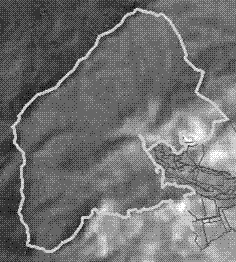
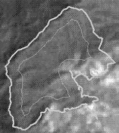
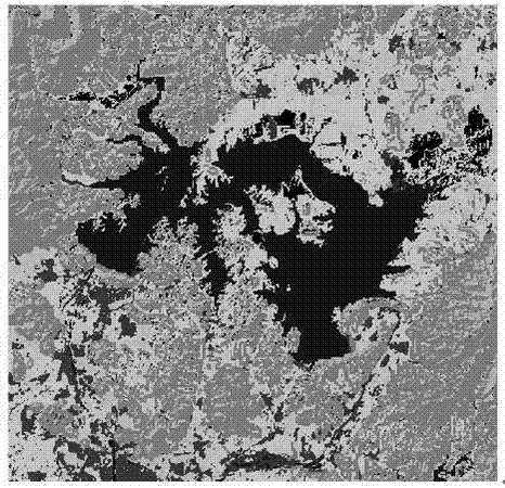
[0018] The following will combine figure 1 , detail the present invention step by step:

[0019] (1) Preliminary screening of the land use vector data obtained from the land use database based on the attribute values ​​of land types

[0020] The current land use classification divides land use categories into 12 first-level categories, and there are 57 second-level categories under the first-level categories. As far as the ability to identify land use categories from medium-resolution remote sensing data is concerned, many of them are in the land use structure. Smaller categories such as ditches and field ridges are unrecognizable and meaningless. Medium-resolution remote sensing data are mostly used to extract information on cultivated land, forest land, construction land, and water bodies. This step mainly obtains land use vector data from the land use database based on the attribute values ​​of land types, and screens large types of map spots.

[0021] The land use databa...


PUM


Abstract

The invention belongs to the field of remote sensing image processing and discloses a land type information remote sensing automatic identification method supported by a land use database. The method comprises the following steps that (1) land use vector data are obtained from the land use database in accordance with a land type attribute value, and large type pattern spots are screened out from the land use vector data; (2) a plurality of pattern spots corresponding to each land type are extracted from a large area to a small area in accordance with a screening result; (3) inward buffering processing is performed along the boundary of the pattern spots; (4) the buffered pattern spots are used as a sample area, and middle resolution remote sensing data are supervised and classified to obtain land type information; (5) gradient data are calculated through DEM (Digital Elevation Model) data, and pixels which are misclassified are filtered through the gradient data; and (6) the fine pattern spots are filtered and combined to obtain classification result data. A traditional mode that the sample area is manually selected is replaced by the method, the information extraction time is effectively saved, and the production efficiency is increased.

Description

technical field [0001] The invention belongs to the field of remote sensing image processing and relates to a remote sensing automatic recognition method for land type information supported by a land use database. Background technique [0002] Supervised classification is a common remote sensing image classification method, which requires manual selection of sample areas to provide a basis for computer automatic classification. The quality of samples is closely related to the accuracy of remote sensing image classification results. In supervised classification, the sample area is selected by the operator according to the specific remote sensing image features and remote sensing interpretation experience, and the classification results of different operators may vary greatly. Contents of the invention [0003] The purpose of the present invention is to provide a remote sensing automatic recognition method of land type information supported by a land use database, realize au...

Claims


Application Information

Patent Timeline
Patent Type & Authority Applications(China)
IPC IPC(8): G06K9/62G06F17/30
Inventor 刘顺喜尤淑撑王忠武沈均平
Owner 中国土地勘测规划院
Why Eureka
Try Eureka