Remote sensing image cutting method based on pyramid model

A pyramid model, remote sensing image technology, applied in image analysis, image data processing, instruments, etc., to achieve the effect of reliable image cutting method

Active Publication Date: 2013-06-05
ZHEJIANG UNIV
View PDF3 Cites 4 Cited by
  • Summary
  • Abstract
  • Description
  • Claims
  • Application Information

AI Technical Summary

Problems solved by technology

However, for remote sensing images that need to be published as

Method used


Image

  • Remote sensing image cutting method based on pyramid model
  • Remote sensing image cutting method based on pyramid model
  • Remote sensing image cutting method based on pyramid model

Examples


Embodiment Construction

[0020] The present invention will be described in detail below in conjunction with the accompanying drawings.

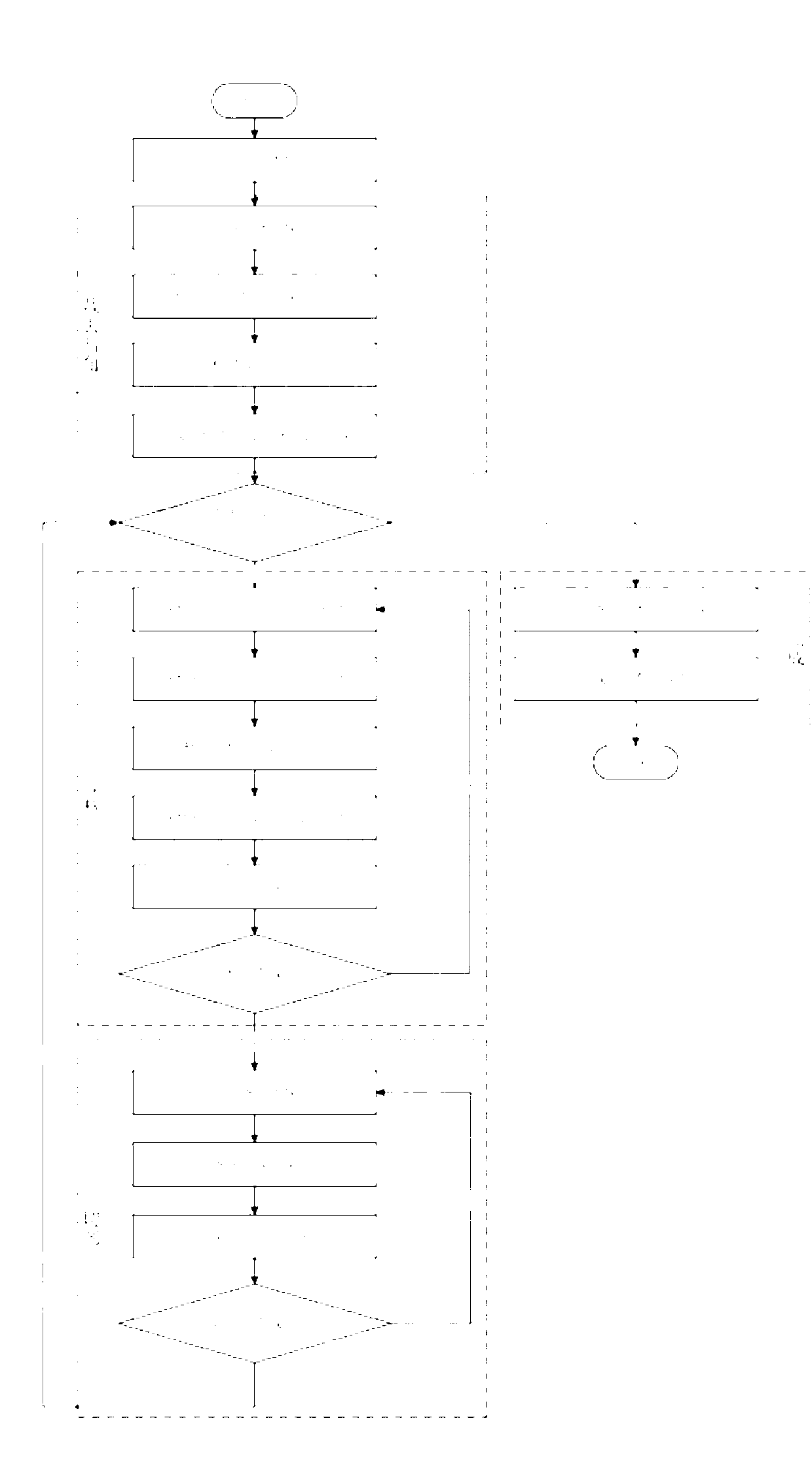
[0021] figure 1 It is a flow chart of the remote sensing image cutting method in the embodiment of the present invention. Such as figure 1 As shown, the graph cutting method specifically includes the following steps:

[0022] First, the user enters the conditions, obtains the remote sensing image, and then performs the following specific operations:

[0023] 1. Cut off dark corners

[0024] enter:

[0025] An image srcImg, the resolution of the image is srcWidth*srcHeight.

[0026] output:

[0027] An image descImg with vignetting removed, the resolution of the image is srcWidth*srcHeight. process:

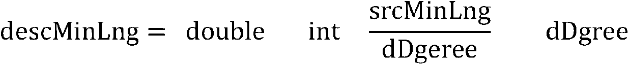
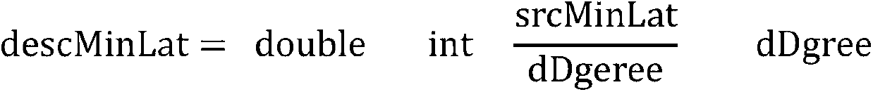
[0028] 1.1. Calculate the marginal latitude and longitude

[0029] In remote sensing images, we only know the latitude and longitude of the upper left corner (dataLeftUpLng, dataLeftUpLat), the latitude and longitude of the upper right corner (dataRightUpLng, da...


PUM


Abstract

The invention discloses a remote sensing image cutting method based on a pyramid model. The method includes the steps of computing dark corners of four corners of an image according to remote sensing image data inputted by a user, cutting off the dark corners, carrying out regulation according to the number of layers of an image to be cut outputted by the user and the longitude and latitude of a zeroth layer, then carrying out cutting on the regulated image and generating a corresponding configuration file to describe image cutting results. The remote sensing image cutting method based on the pyramid model has the advantages of being efficient, reliable, and automatic in procedures, good in data compatibility and the like due to the fact that the image cutting results can be released on the WorldwindServer and other web mapping service (WMS).

Description

technical field [0001] The invention relates to the field of image cutting techniques and methods for remote sensing applications, in particular to a method for cutting images of remote sensing images based on a pyramid model. Background technique [0002] In the field of remote sensing applications, WMS (ie Web Map Service Web Map Service) [0003] is a very important part. WMS follows the OGC's WMS1.1.1 specification, which uses data with geospatial location information to make maps. A map is defined as a visual representation of geographic data. However, the amount of remote sensing data is huge, and it also forms a certain contradiction with the high-resolution and high-quality requirements of remote sensing images. [0004] The pyramid model opens up a way of thinking to solve this contradiction. In the pyramid model, remote sensing images are compressed into several levels. The farther away from the earth, the smaller the level, the larger the compression ratio, an...

Claims


Application Information

Patent Timeline
IPC IPC(8): G06T7/00
Inventor 郑国轴陈亮江琳陶金火陈华钧吴朝晖杨建华
Owner ZHEJIANG UNIV
Why Eureka
Try Eureka