
Determining tilt angle and tilt direction using image processing

A technology of inclination direction and inclination angle, which is applied in image data processing, measuring inclination, image enhancement, etc., to achieve the effect of improving efficiency, reducing time and labor, and improving measurement efficiency

Active Publication Date: 2013-08-21
TRIMBLE NAVIGATION LTD
View PDF9 Cites 29 Cited by
  • Summary
  • Abstract
  • Description
  • Claims
  • Application Information

AI Technical Summary

Problems solved by technology

For example, a pole two meters long and inclined two degrees from the vertical can result in a measurement error of up to two centimeters

Method used


Image

  • Determining tilt angle and tilt direction using image processing
  • Determining tilt angle and tilt direction using image processing
  • Determining tilt angle and tilt direction using image processing

Examples


Embodiment Construction

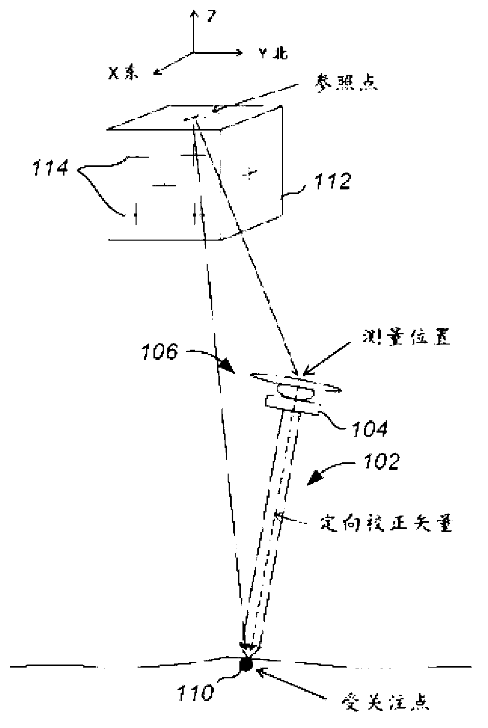
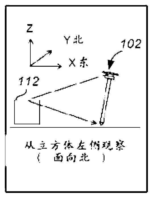
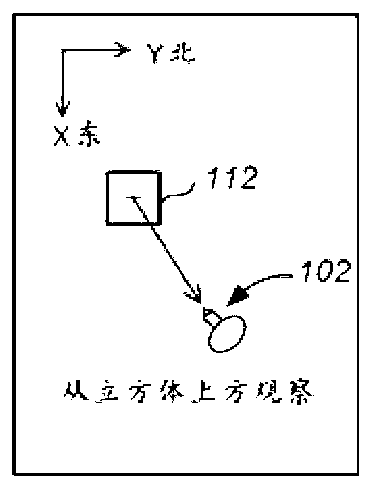
[0043] Embodiments of the present invention provide improved methods and apparatus for determining tilt angle and tilt direction using image processing techniques. As used herein, the tilt angle refers to the angle between the real vertical axis (eg, the local gravity vector) and the vertical axis of the imaging device. Tilt refers to orientation (or rotation about a vertical axis) relative to some reference, such as true north, magnetic north, or any other reference. Image processing techniques may involve determining the pose of the imaging device using one or more tracking techniques. The pose may include position and rotation of the imaging device relative to a reference. In some embodiments, the reference is provided by a feature in the image, where the feature is at a known location in a frame of reference. In other embodiments, the reference is provided by a correspondence between features in images, wherein at least one of the images is acquired with the imaging devi...


PUM


Abstract

A survey instrument includes a surveying device configured to perform survey measurements and an imaging device coupled to the surveying device and having a known spatial relationship with the surveying device. The imaging device may be configured to obtain image information. The survey instrument also includes a processor in electrical communication with the imaging device. The processor may be configured to receive the image information from the imaging device, process the image information to determine a pose of the imaging device, and determine a tilt angle of the survey instrument and a tilt direction of the survey instrument in a reference frame. Tilt angle and the tilt direction of the survey instrument may be determined using the pose of the imaging device.

Description

[0001] Cross References to Related Applications [0002] This application claims priority to US Patent Application Serial No. 13 / 397,445, filed February 15, 2012, the disclosure of which is hereby incorporated by reference in its entirety for all purposes. technical field [0003] Embodiments of the present invention generally relate to methods and apparatus for determining tilt angle and tilt direction using image processing techniques. The method and apparatus can be used in surveying applications, such as determining the location of a point. Background technique [0004] Controlling the tilt of surveying instruments is a major job of a surveyor. It takes a lot of time and labor to ensure that survey instruments are up to par. A conventional method of leveling the survey instrument involves aligning the survey instrument with the local gravity vector using a bubble level. A common survey procedure involves leveling the survey instrument before taking a survey so that th...

Claims


Application Information

Patent Timeline
IPC IPC(8): G01C9/00G01C1/00
CPCG01C15/06G01S19/51G01S19/53G01S1/725G06T2207/30204G06T2207/30244G06T7/73G01C15/00G06V20/10G01S19/485
Inventor O·P·苏博拉M·霍尔格伦J·M·扬基
Owner TRIMBLE NAVIGATION LTD
Learn More