Intelligent GPS (global position system) route planning system and method based on cloud service

A path planning and cloud service technology, applied in the field of GPS navigation, can solve problems such as single static navigation path, and achieve high reference effect

Inactive Publication Date: 2013-10-23
HARBIN INST OF TECH SHENZHEN GRADUATE SCHOOL
View PDF6 Cites 29 Cited by
  • Summary
  • Abstract
  • Description
  • Claims
  • Application Information

AI Technical Summary

Problems solved by technology

[0003] The technical problem to be solved by the present invention is to provide an intelligent GPS path planning system and method based on cloud services for the above-mentioned defects of the existing car GPS navigation system that can only provide a single static navigation path

Method used


Image

  • Intelligent GPS (global position system) route planning system and method based on cloud service
  • Intelligent GPS (global position system) route planning system and method based on cloud service
  • Intelligent GPS (global position system) route planning system and method based on cloud service

Examples


Embodiment Construction

[0037] In order to make the objectives, technical solutions and advantages of the present invention clearer, the following further describes the present invention in detail with reference to the accompanying drawings and embodiments.

[0038] The present invention conceives an intelligent GPS route planning system based on cloud services. Based on cloud computing technology, it collects and organizes GPS and OBD real-time operating information of cars and combines cloud service calculations to plan the best route for the car.

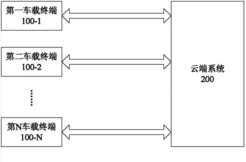
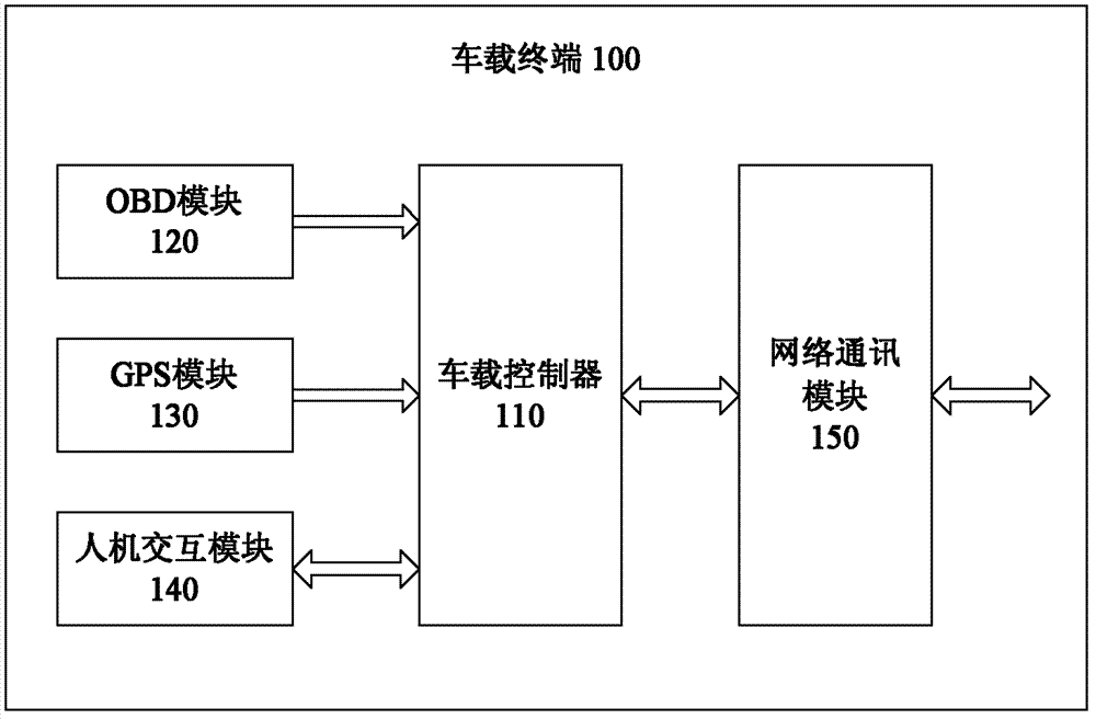
[0039] See figure 1 , Is a functional block diagram of a preferred embodiment of the intelligent GPS route planning system based on cloud services according to the present invention. Such as figure 1 As shown, the intelligent GPS route planning system based on cloud services provided by this embodiment at least includes a cloud system 200 and a plurality of vehicle-mounted terminals, such as a first vehicle-mounted terminal 100-1 to an N-th vehicle-mounted te...


PUM


Abstract

The invention provides an intelligent GPS (global position system) route planning system and method based on cloud service. The system comprises a cloud system and multiple car-mounted terminals, wherein the car-mounted terminals are used for acquiring real-time operation parameters of a car by an OBD (on board diagnostics) and acquiring real-time position information of the car by a GPS, and sending the parameters and the information to the cloud system; the car-mounted terminals also send navigation instructions inputted by a user to the cloud system; the cloud system is used for receiving and integrating the required real-time operation parameters of the car, the real-time position information of the car and regional map information, extracting integrated data according to the navigation instructions inputted by the user and sent by the car-mounted terminals so as to establish a virtual model of traffic road conditions, and calculating a driving route and issuing the driving route to a corresponding car-mounted terminal. According to the system and the method provided by the invention, by combining the existing GPS technology and the existing OBD technology, the acquired real-time operation parameters and real-time position information of the car are collected to a cloud computing platform, and an intelligent dynamic car driving route is planned through cloud computing; the reference is higher than that of the existing static route planning.

Description

Technical field [0001] The invention relates to GPS navigation technology, and more specifically, to an intelligent GPS route planning system and method based on cloud services. Background technique [0002] On the one hand, the traditional car GPS navigation system only provides a single static navigation path according to the user's requirements for distance, time, toll, driving mode, etc., and will not dynamically change with the real-time road conditions. The related calculation method does not involve collecting real-time data of the car's own operation and planning the car's driving path dynamically in real time. On the other hand, since the mid-1990s, every factory car is equipped with OBD (Automatic On-Board Diagnostic System) as standard. Through OBD, the external terminal system can obtain the relevant performance and operating parameters of the car, and then diagnose and evaluate the various performance of the car at any time. As far as the registered vehicles are co...

Claims


Application Information

Patent Timeline
Patent Type & Authority Applications(China)
IPC IPC(8): G01C21/34G01S1/02
Inventor 林文浩陈玺煌曾令英潘正祥
Owner HARBIN INST OF TECH SHENZHEN GRADUATE SCHOOL
Why Eureka
Try Eureka