Underwater wireless sensor network positioning method

A wireless sensor and network positioning technology, applied in wireless communication, network topology, electrical components, etc., can solve problems such as inability to locate, impact on network connectivity, and failure to receive common nodes, so as to reduce the impact of node failure and improve coverage rate effect

Active Publication Date: 2013-11-27
NANJING UNIV OF POSTS & TELECOMM
View PDF1 Cites 18 Cited by
  • Summary
  • Abstract
  • Description
  • Claims
  • Application Information

AI Technical Summary

Problems solved by technology

In this method, if the anchor node fails, it will affect the connectivity of the network, and some

Method used


Image

  • Underwater wireless sensor network positioning method
  • Underwater wireless sensor network positioning method
  • Underwater wireless sensor network positioning method

Examples


Embodiment Construction

[0028] An underwater wireless sensor network positioning method of the present invention will be described in detail below in conjunction with the accompanying drawings. The present invention comprises the following steps:

[0029] Step 1, positioning of common nodes:

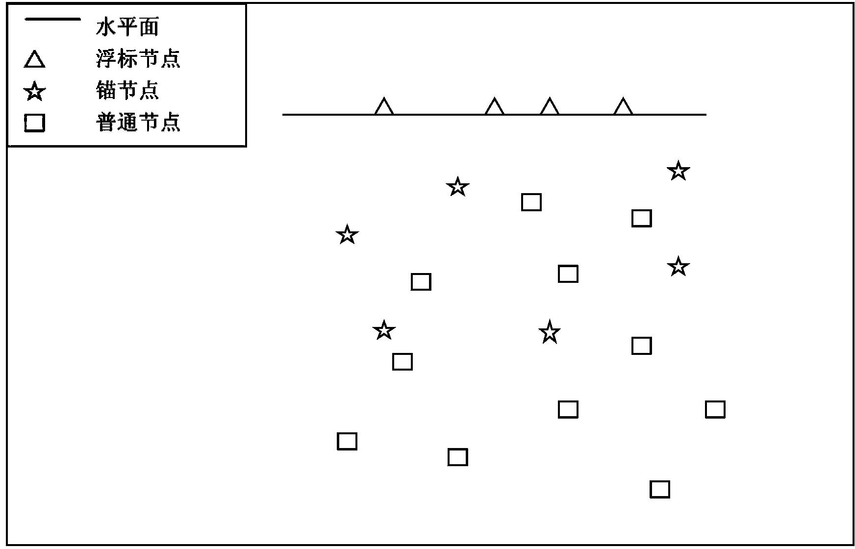
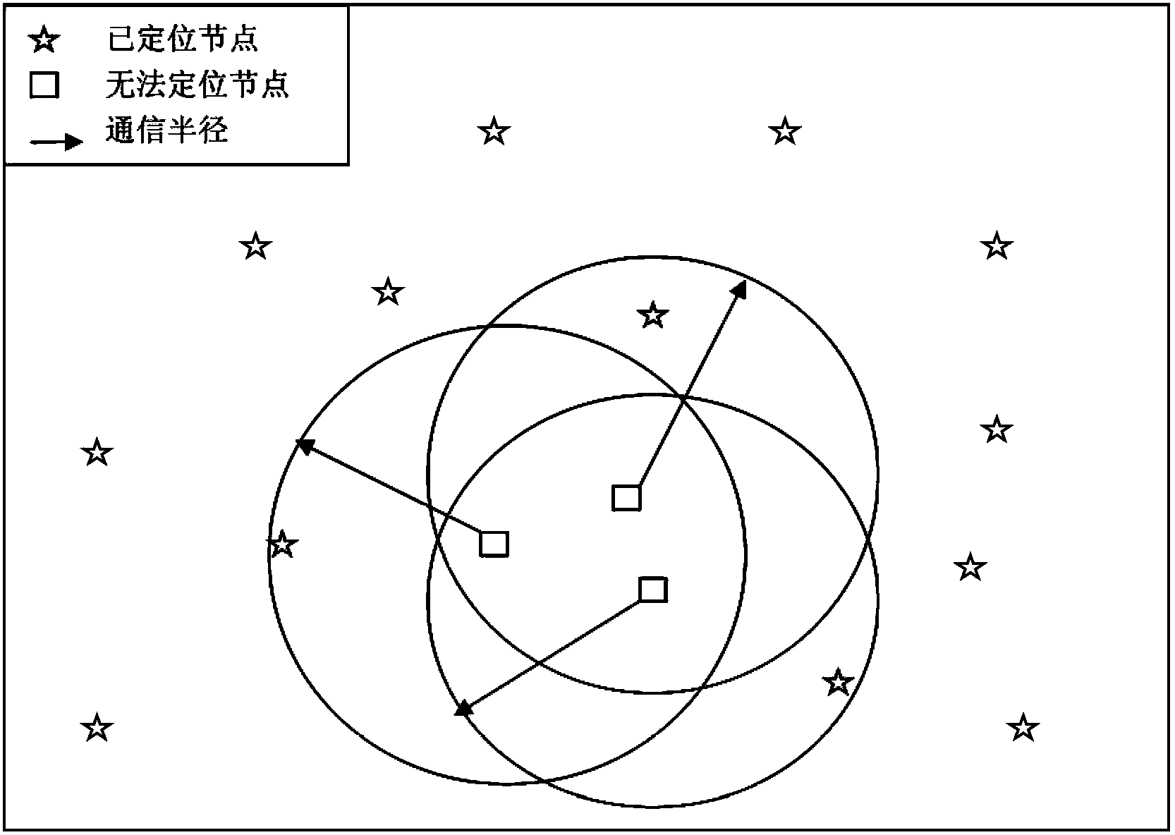
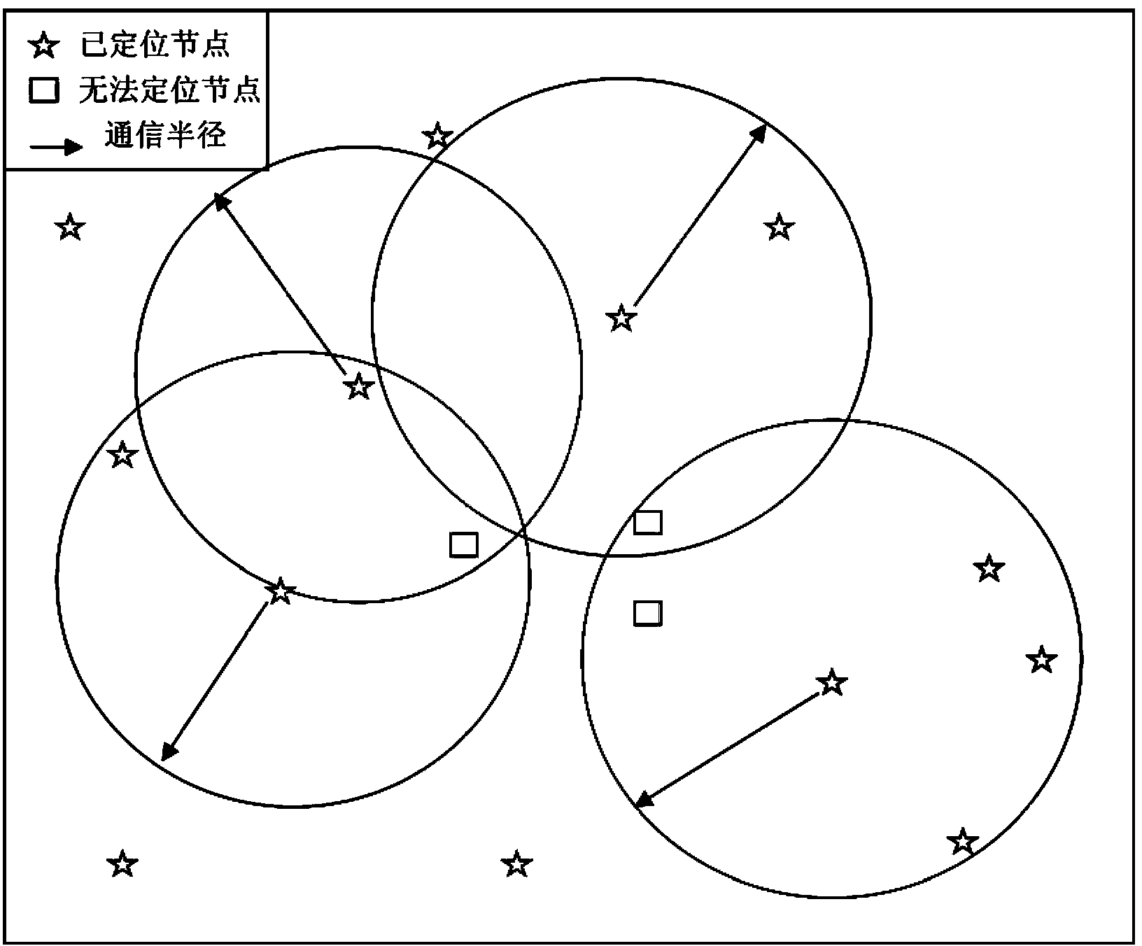
[0030] The reference node periodically broadcasts its own location information. In a positioning period, after obtaining the location information of at least three reference nodes, the unlocated common node uses the trilateration method for positioning; the common node re-initiates positioning every time T. like figure 1 As shown, the buoy node in the figure is represented by a triangle. The buoy node can directly know its position through the device, and the anchor node is represented by a five-pointed star. It can directly communicate with the buoy node, calculate its own position through the position of the buoy node, and then anchor Nodes will broadcast their own location information to help ordinary node...


PUM


Abstract

The invention provides an underwater wireless sensor network positioning method. A wireless sensor network comprises three types of nodes, namely buoy nodes, anchor nodes and ordinary nodes. The buoy nodes are satellite positioning nodes, the anchor nodes are in communication with the buoy nodes so that the anchor nodes can be positioned, and the anchor nodes and a part of positioned ordinary nodes constitute a reference node set. The ordinary nodes are in communication with the part of reference nodes in the reference node set so as to be positioned. When the anchor nodes are out of operation, the positioned ordinary nodes assist the ordinary nodes which can not be positioned to be positioned, positioning incapacity information does not need to be aggregated to a gateway, the ordinary node positioning problem is solved by itself in a region, thus, the positioning coverage rate is increased, and the node out-of-operation effect is reduced.

Description

technical field [0001] The invention belongs to the technical field of wireless communication, in particular to an underwater wireless sensor network positioning method. Background technique [0002] Different from terrestrial wireless sensor networks, the underwater environment is extremely complex, such as nodes moving with the water flow, difficult battery replenishment, high delay of underwater acoustic channels, low bandwidth and high bit error rate, which make it difficult to study positioning schemes in water. [0003] As we all know, ordinary GPS cannot work underwater. In order to enable nodes to locate themselves underwater, an underwater GPS system has been proposed, such as: GPS intelligent buoy GIB (GPS Intelligent Buoys) and PARADIGM (a GPS system that provides precise positioning) program). These underwater GPS systems rely primarily on surface buoys to provide accurate position information, and these buoys act like GPS satellites. All nodes within the buoy ...

Claims


Application Information

Patent Timeline
IPC IPC(8): H04W64/00H04W84/18
Inventor 刘林峰管文冰朱志文
Owner NANJING UNIV OF POSTS & TELECOMM
Why Eureka
Try Eureka