
Provision method of geographic information tile services and device for implementing provision method

A technology of geographic information and tiles, applied in the field of geographic information systems, can solve problems such as inconsistency of geographic information itself, lower efficiency, and service response speed that cannot reach users, so as to enhance user experience and improve request response speed Effect

Active Publication Date: 2014-01-01
CHINESE ACAD OF SURVEYING & MAPPING
View PDF5 Cites 29 Cited by
  • Summary
  • Abstract
  • Description
  • Claims
  • Application Information

AI Technical Summary

Problems solved by technology

However, if all the tiles included in the range of geographic information are to be cut in real time, the efficiency will inevitably be reduced, and the service response speed will not meet the user's requirements.
Moreover, if the real-time cropped tiles are stored for direct use in subsequent requests, the problem of inconsistency with the potentiality of the geographic information ontology is still not solved

Method used


Image

  • Provision method of geographic information tile services and device for implementing provision method
  • Provision method of geographic information tile services and device for implementing provision method
  • Provision method of geographic information tile services and device for implementing provision method

Examples


Embodiment Construction

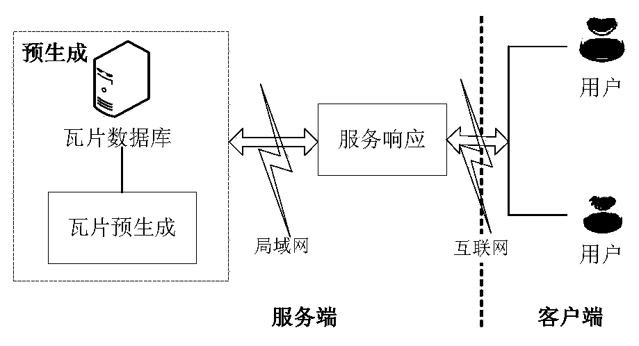
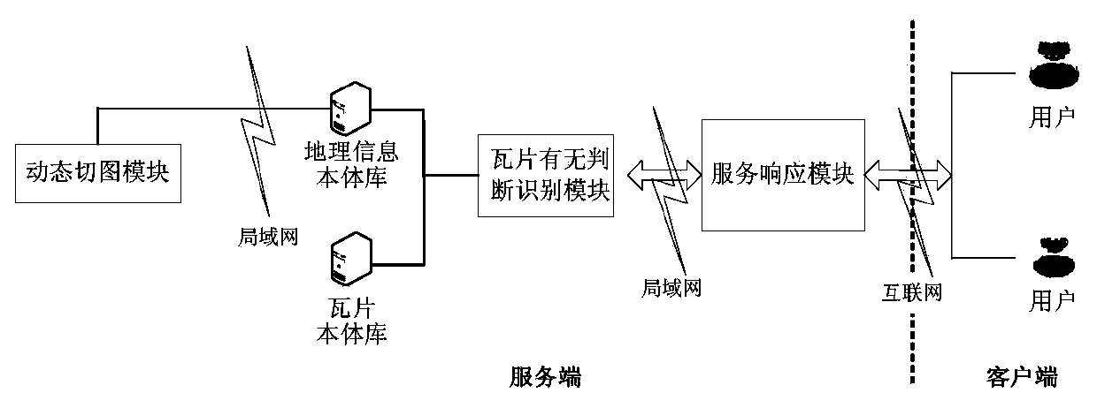
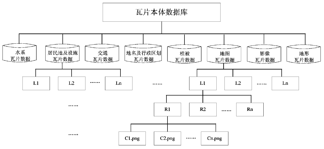
[0050] Hereinafter, the method for providing geographic information tile services related to the present invention will be described in detail with reference to the drawings.

[0051] Such as image 3 As shown, the method for providing geographic information tile services includes the following steps:

[0052] Step 100: Receive a geographic information tile service request from the client, and parse the geographic information tile related information within the request range.

[0053] In this step, the client's geographic information tile service request includes the map scale (scale), the maximum longitude of the requested geographic information range (X max ), minimum longitude (X min ), maximum latitude (Y max ), minimum latitude (Y min ) And tile data type (type) and other parameters. The parsing process of the request is to calculate the information (including the number of tiles N, the level L of the tiles, and the row and column number of each tile) of all geographic infor...


PUM


Abstract

The invention provides a provision method of geographic information tile services. The method includes the steps of receiving a geographic information tile service request of a client, and analyzing the request to obtain geographic information tile related information within the request range; searching a tile meta-database according to parameters and the related information; if the tile metadata corresponding to the related information is searched, determining whether a tile is updated lately or not; if yes, packaging and returning the tile to the client; if not, performing a processing step the same as a processing step of the tile metadata not searched; specifically, searching for geographic information data corresponding to the tile according to the related information, rasterizing and cutting the geographic information data to obtain new tiles, updating the tile meta-database and an otology database according to the new tiles, packaging and returning the new tiles to the client, thus dynamically updating and timely cutting the geographic information tiles on the premise of increasing service response speed. The invention further provides a device for implementing the provision method.

Description

Technical field [0001] The invention relates to the field of geographic information systems, in particular to a method for providing geographic information tile services and a device for implementing the method. Background technique [0002] After years of development, geographic information applications have moved from providing data to online services, and have gradually become a dominant application method. Generally speaking, geographic information online services involve three aspects: server-side, client-side and network. Among them, the server is the service provider; the client is the service applicant; and the network is the transmission channel. In order to improve the service response speed, under normal circumstances, the geographic information is rasterized and cropped on the server side in advance into multi-level pictures with uniform specifications, that is, "tiles". When the server receives the user's geographic information service application, it searches for ...

Claims


Application Information

Patent Timeline
Patent Type & Authority Applications(China)
IPC IPC(8): G06F17/30
CPCG06F16/29G06F16/9537
Inventor 李成名赵占杰孙伟刘晓丽刘勇孙隆祥方驰宇焦孟凯路文娟张成成洪志远李志庆孟永飞李朕
Owner CHINESE ACAD OF SURVEYING & MAPPING
Learn More