Method of correlating images with terrain elevation maps for navigation

A map and image technology, used in surveying and navigation, navigation, image enhancement and other directions

Active Publication Date: 2014-02-12
HONEYWELL INT INC
View PDF6 Cites 10 Cited by
  • Summary
  • Abstract
  • Description
  • Claims
  • Application Information

AI Technical Summary

Problems solved by technology

Further, both terrain and image correlation techniques have the disadvantage of being co

Method used


Image

  • Method of correlating images with terrain elevation maps for navigation
  • Method of correlating images with terrain elevation maps for navigation
  • Method of correlating images with terrain elevation maps for navigation

Examples


example 1

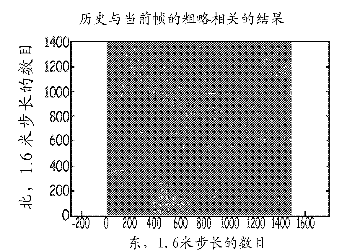
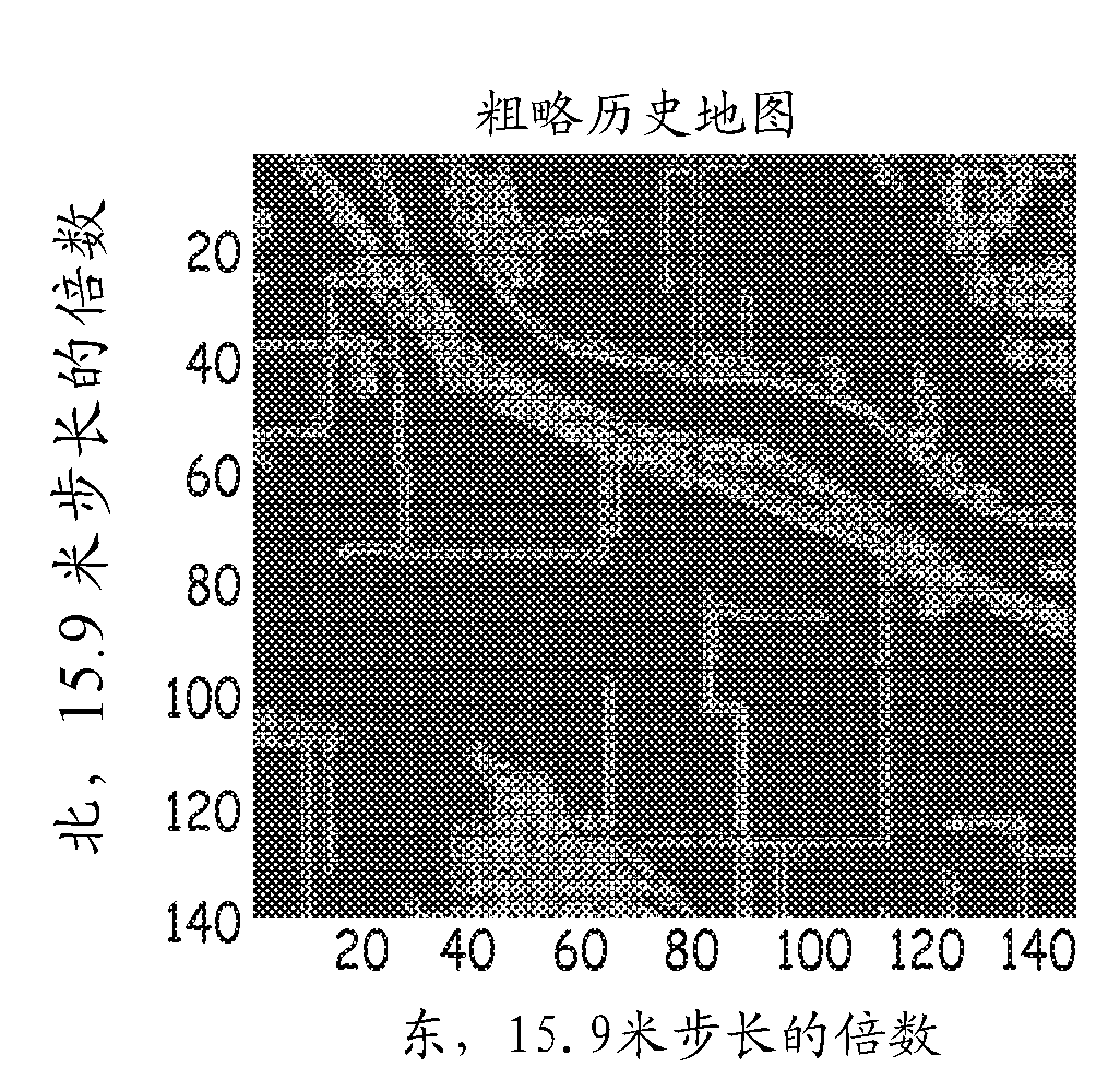
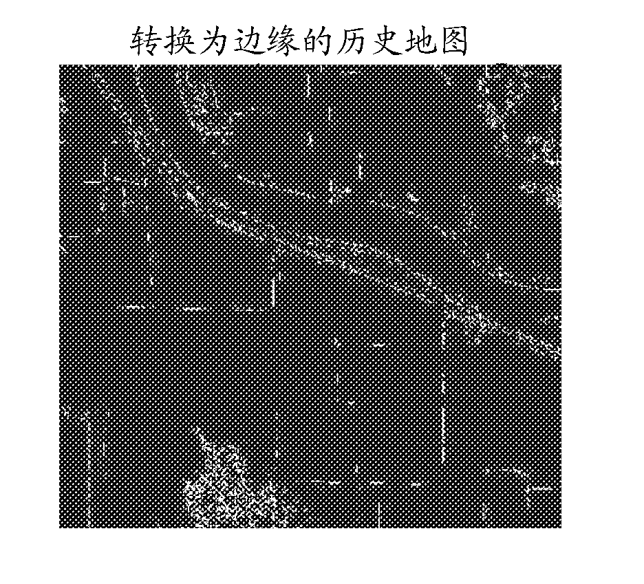
[0043] Example 1 includes a method for navigating comprising: constructing a current map comprising one or more two-dimensional or three-dimensional representations of an area; detecting one or more edge features on the current map; edge features to generate a first refined edge map; retrieve a historical map including one or more two-dimensional or three-dimensional representations of the region; detect one or more edge features on the historical map; based on the detected edges on the historical map features to generate a second fine edge map; generate a coarse version of the current map from the first fine edge map; generate a coarse version of the historical map from the second fine edge map; correlate the coarse version of the current map with the coarse version of the historical map to determine a first location and orientation; and correlating the first fine-grained edge map with the second fine-grained edge map using the first location and orientation to determine a sec...


PUM


Abstract

A method for navigation comprises constructing a current map that includes two-dimensional or three dimensional representations of an area, detecting one or more edge features on the current map, and generating a first fine-edge map based on the edge features. The method further comprises retrieving a historical map that includes two-dimensional or three dimensional representations of the area, detecting one or more edge features on the historical map, and generating a second fine-edge map based on the edge features. Thereafter, a coarse version of the current map is generated from the first fine-edge map, and a coarse version of the historical map is generated from the second fine-edge map. The coarse versions of the current and historical maps are then correlated to determine a first position and orientation. The first fine-edge map is then correlated with the second fine-edge map to determine a second, more accurate, position and orientation.

Description

technical field [0001] The present invention relates to a method of correlating images with terrain elevation maps for navigation. Background technique [0002] Terrain correlation and image correlation techniques have been used for military airborne navigation for some time. In terrain correlation, a georeferenced elevation map such as the Digital Terrain Elevation Database (DTED) is compared to a measurement of the elevation of the ground taken from an aircraft using a ranging sensor such as a radar device or a LADAR (Light Detection and Ranging) device And be related. The map surface and the sensor-generated surface are compared using a two-dimensional correlation algorithm operating in the elevation domain that produces a maximum correlation when the two surfaces overlap perfectly. This operation produces an estimate of the offset between the two, and since the elevation map is georeferenced, the error in the aircraft's position is estimated. Error estimates can be us...

Claims


Application Information

Patent Timeline
IPC IPC(8): G01C21/00
CPCG01C11/00G01C11/06G06T2207/10044G06T2207/30181G06T7/33G06T7/13
Inventor B.摩尔马云潜M.R.埃尔格斯马J.B.麦克基特里克
Owner HONEYWELL INT INC
Why Eureka
Try Eureka