Method and device for constructing three-dimensional terrain

A three-dimensional terrain and map technology, applied in 3D modeling, image data processing, instruments, etc., can solve the problems of high acquisition cost of elevation data and long update cycle of elevation data.

Active Publication Date: 2016-06-08
BAIDU ONLINE NETWORK TECH (BEIJIBG) CO LTD
View PDF2 Cites 0 Cited by
  • Summary
  • Abstract
  • Description
  • Claims
  • Application Information

AI Technical Summary

Problems solved by technology

[0002] At present, the elevation data required to construct 3D terrain in the industry is mainly obtained through field surveys by professional surveyors or space shuttle interferometric radar. This method of constructing 3D terrain is not only expensive to obtain elevation data, but also has a high update cycle for elevation data. long

Method used


Image

  • Method and device for constructing three-dimensional terrain
  • Method and device for constructing three-dimensional terrain
  • Method and device for constructing three-dimensional terrain

Examples


Embodiment Construction

[0032] Hereinafter, embodiments of the present invention will be described in detail with reference to the accompanying drawings.

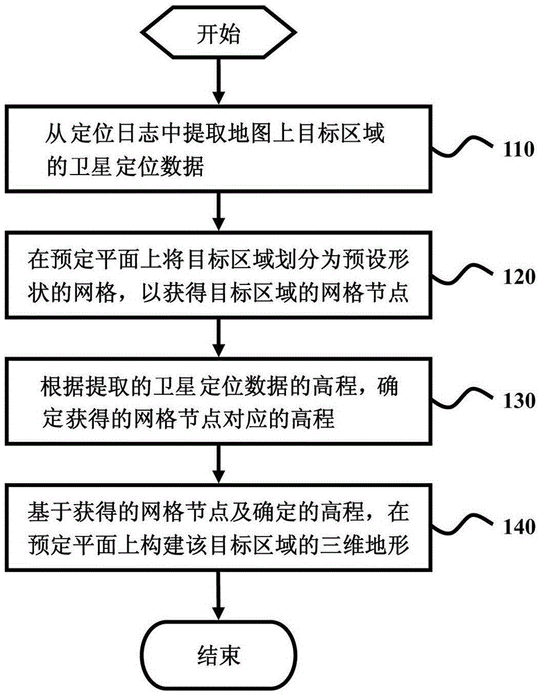
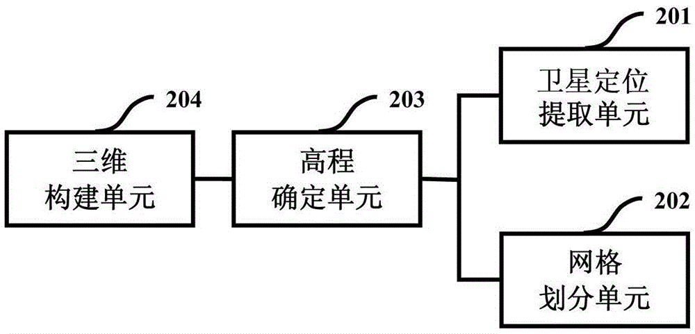
[0033] figure 1 A flow chart of a preferred embodiment of a method for constructing a three-dimensional terrain of the present invention is shown. figure 2 A device for constructing three-dimensional terrain shown can be used to realize figure 1 method described in .

[0034] refer to figure 1 , in 110, the device extracts the satellite positioning data of the target area on the map from the positioning log.

[0035] With the widespread promotion and increasing popularity of mobile positioning services on smart phones, more and more mobile phone users perform satellite positioning through the mobile client, that is, obtain satellite positioning data through the satellite navigation system, so that the positioning service system at the back end of the mobile phone Generate a large number of satellite positioning logs. Because the satellite po...


PUM


Abstract

The invention provides a method and device for constructing a three-dimensional terrain. The method includes the steps that satellite positioning data of a target zone on a map are extracted from a positioning log; the target zone is divided into grids in a preset plane so as to obtain grid nodes, in the preset plane, of the target zone; the elevation corresponding to the grid nodes is acquired according to the elevation of the extracted satellite positioning data; the three-dimensional terrain of the target zone is constructed in the preset plane based on the obtained grid nodes and the determined elevation.

Description

technical field [0001] The present application relates to a method and device for constructing a three-dimensional terrain, in particular to a technology for constructing and displaying a three-dimensional terrain according to positioning data of a target area. Background technique [0002] At present, the elevation data required to construct 3D terrain in the industry is mainly obtained through field surveys by professional surveyors or space shuttle interferometric radar. This method of constructing 3D terrain is not only expensive to obtain elevation data, but also has a high update cycle for elevation data. long. Therefore, how to conveniently obtain the elevation data of the real geographical location and adopt an effective and quick method to construct a more realistic 3D terrain has become an urgent problem to be solved in the field of 3D terrain simulation. Contents of the invention [0003] The purpose of the present invention is to provide a method and device fo...

Claims


Application Information

Patent Timeline
Patent Type & Authority Patents(China)
IPC IPC(8): G06T17/05
Inventor 梅怀博
Owner BAIDU ONLINE NETWORK TECH (BEIJIBG) CO LTD
Why Eureka
Try Eureka