

Method and system for carrying out parallel spatial analysis service based on spatial data
A technology of spatial analysis and spatial data, applied in the field of cloud services, which can solve the problem that cloud services do not have a specific field, etc.
- Summary
- Abstract
- Description
- Claims
- Application Information
AI Technical Summary
Problems solved by technology
Method used
Image

Examples
Embodiment Construction
[0021] Exemplary embodiments of the present disclosure will be described in more detail below with reference to the accompanying drawings. Although exemplary embodiments of the present disclosure are shown in the drawings, it should be understood that the present disclosure may be embodied in various forms and should not be limited by the embodiments set forth herein. Rather, these embodiments are provided for more thorough understanding of the present disclosure and to fully convey the scope of the present disclosure to those skilled in the art.
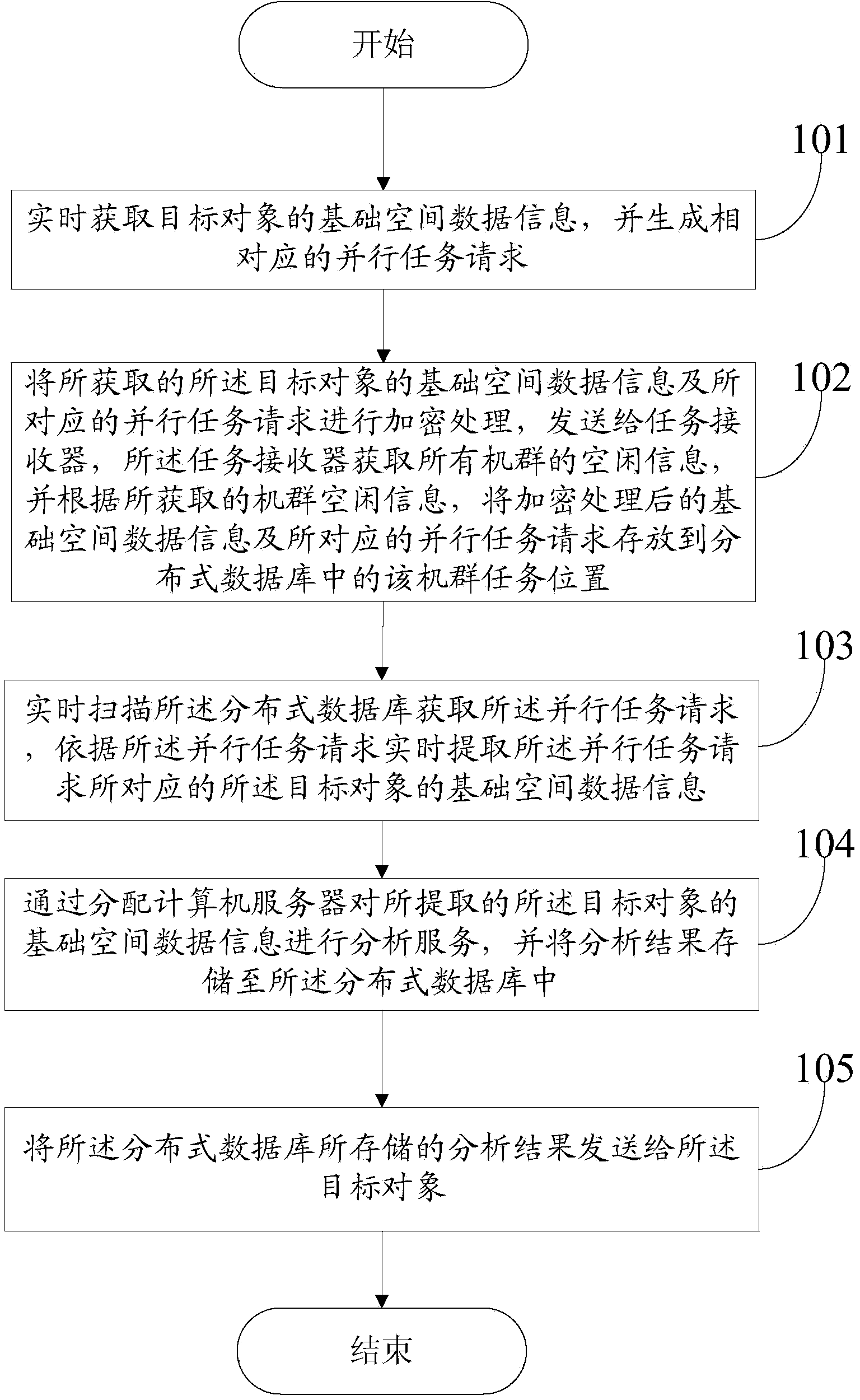
[0022] An embodiment of the present invention provides a method for performing spatial analysis services on target objects, please refer to Figure 1-2 , including the following steps:
[0023] Step S101: Obtain the basic spatial data information of the target object in real time, and generate a corresponding parallel task request;
[0024] Specifically, the executor in step S101 may be a front-end service interface that provides ...
PUM
 Abstract
Description
Claims
Application Information