Acquisition of data from image data-based map services by an assistance system
A technology of image data and auxiliary systems, applied in anti-collision systems, traffic control systems, geographic information databases, etc., to achieve accurate planning, reduce costs, and reduce burdens
- Summary
- Abstract
- Description
- Claims
- Application Information
AI Technical Summary
Problems solved by technology
Method used
Image

Examples
Embodiment Construction
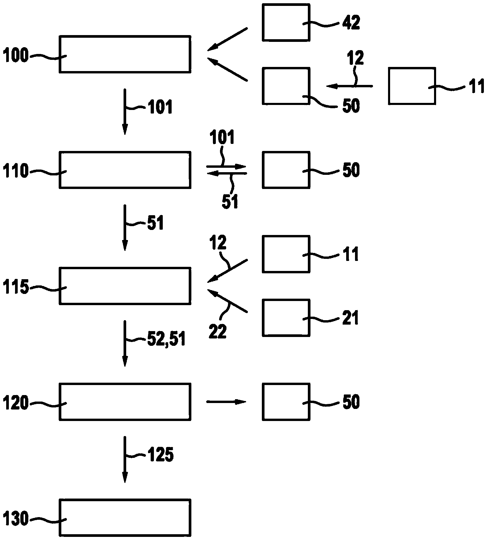
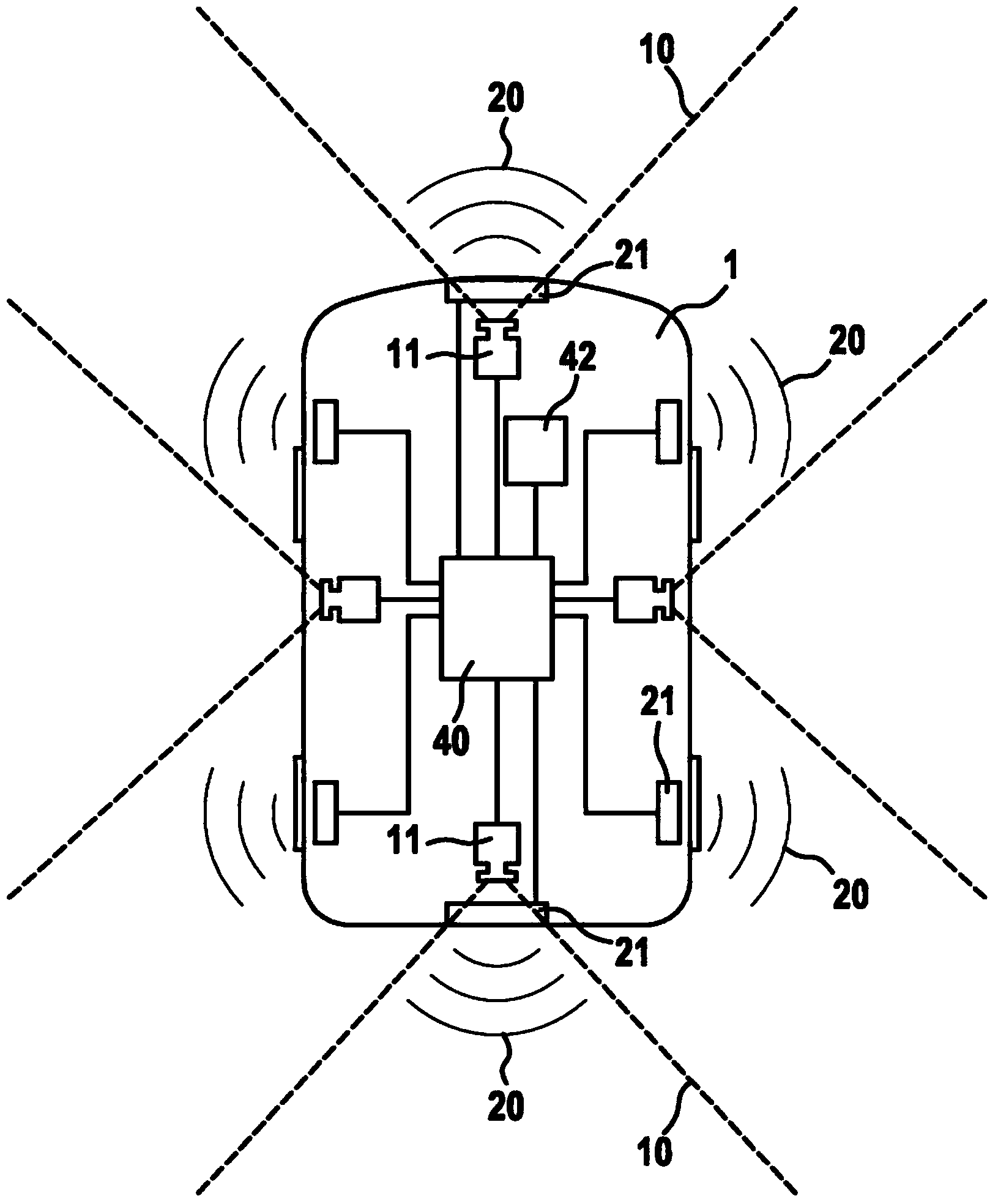
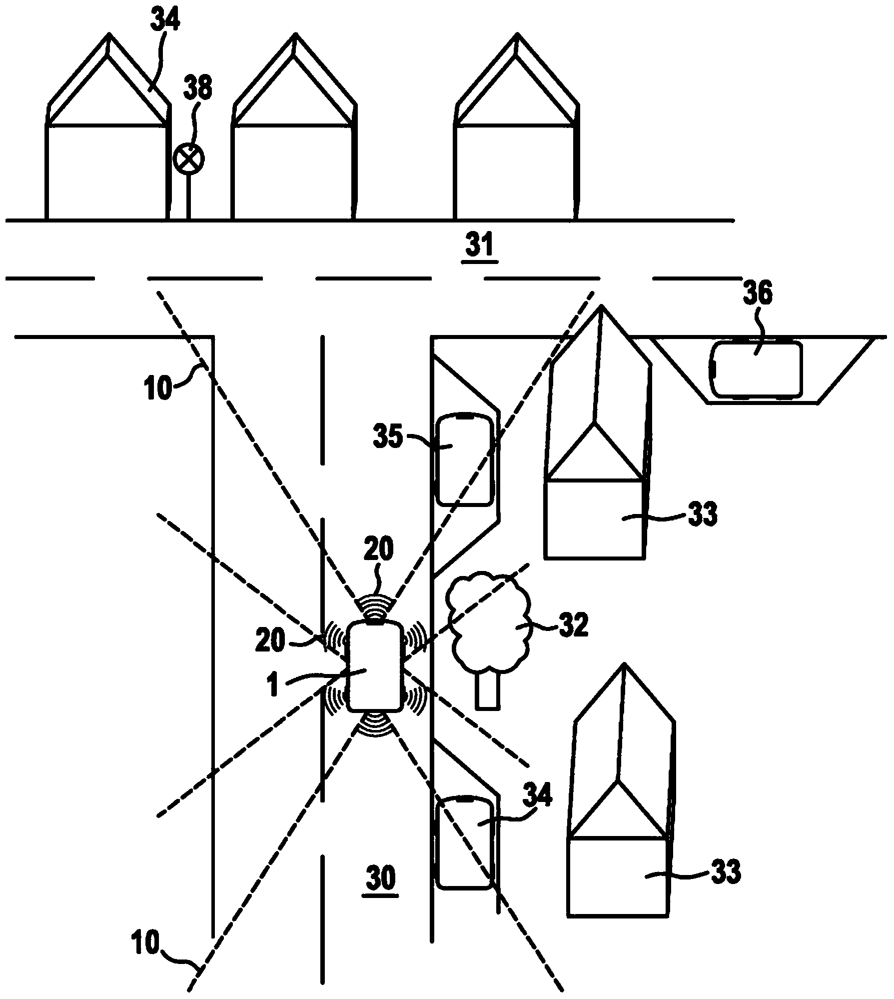
[0036] exist figure 1 The flow of the method according to the invention is schematically shown in . In a first step 100 of the method, the position of the vehicle is ascertained. For this purpose, depending on availability, the data of a radio-based or satellite-based navigation system 42 and / or the data of a map service 50 based on image data are used. For position determination by means of the image-data-based map service 50 , the camera image 12 is detected by means of one or more cameras 11 and the image-data-based map service 50 is calibrated. For position determination, the images stored in the image-data-based map service 50 are provided with data about the orientation and recording location. If during the calibration in map service 50 an image matching camera image 12 is found in map service 50 , the position and orientation of the vehicle are known. The position of the vehicle can likewise be determined via a radio-based or satellite-based navigation system. If th...
PUM
 Abstract
Description
Claims
Application Information
 - R&D
- Intellectual Property
- Life Sciences
- Materials
- Tech Scout
- Unparalleled Data Quality
- Higher Quality Content
- 60% Fewer Hallucinations
Browse by: Latest US Patents, China's latest patents, Technical Efficacy Thesaurus, Application Domain, Technology Topic, Popular Technical Reports.
© 2025 PatSnap. All rights reserved.Legal|Privacy policy|Modern Slavery Act Transparency Statement|Sitemap|About US| Contact US: help@patsnap.com