
AANET combined routing algorithm based on geographical location information

A geographic location information and routing technology, applied in location-based services, wireless communications, electrical components, etc., can solve problems such as node mobility, inefficiency, and packet loss delay, and achieve optimal routing metrics, Effect of improving communication quality, avoiding routing paths and routing loops

Inactive Publication Date: 2014-12-10
CHONGQING UNIV
View PDF2 Cites 11 Cited by
  • Summary
  • Abstract
  • Description
  • Claims
  • Application Information

AI Technical Summary

Problems solved by technology

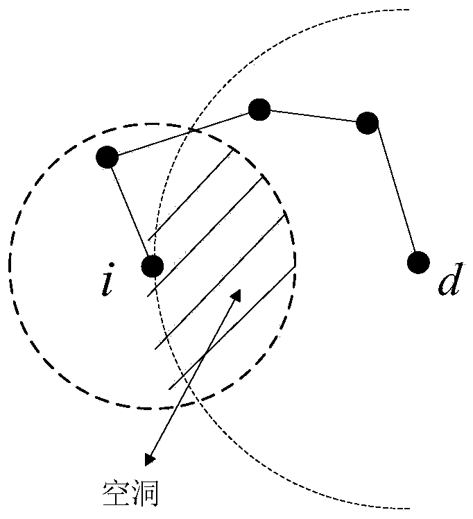
First of all, the greedy forwarding strategy of GPSR does not consider the mobility of nodes, and secondly, it is proved to be inefficient to solve the problem of routing holes by using peripheral traversal. In a highly dynamic environment, a large number of data packets are lost and the delay increases sharply.
[0005] Although a large number of routing protocols for MANETs have been proposed, few of them are researched for the specific goals of ANETs

Method used


Image

  • AANET combined routing algorithm based on geographical location information
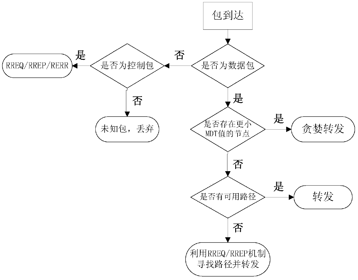
  • AANET combined routing algorithm based on geographical location information
  • AANET combined routing algorithm based on geographical location information

Examples


Embodiment Construction

[0021] In order to better understand the present invention, specific embodiments of the present invention will be described in detail below.

[0022] 1. Each node in the network maintains a routing table, and the table information includes its own location, the location of one-hop neighbor nodes, and the location of the destination node. It can be obtained through GPS global positioning system, beacon mechanism and location service respectively.

[0023] 2. When the nodes start to communicate, they first work in the greedy forwarding mode, each node maintains a periodically updated neighbor table to track the location information of a hop neighbor node, and then selects the next hop according to the new routing metric MDT forwarding node.

[0024] 3. The following determines the routing metric MDT, the geographical distance S between nodes i and j in the network i,j Can be represented by the following formula:

[0025] S i ...


PUM


Abstract

The invention discloses an AANET combined routing algorithm based on geographical location information. Greedy forwarding strategies and reactive routing in geographic routing are combined. Aiming at the high dynamic and low node density characteristics of an aviation ad-hoc network, the greedy forwarding strategies in the geographic routing is modified first, and new routing metric considers both the geographical locations of nodes and relative speed among nodes and eliminates unstable next-hop forwarding nodes. The algorithm combines good characteristics of traditional reactive routing, uses an RREQ / RREP mechanism to replace the periphery forwarding mechanism in the geographic routing, and routing void can be processed effectively. Compared with other methods, the algorithm combines the advantages of two algorithms and is more adaptive to the network environments of the aviation ad-hoc network.

Description

[0001] Technical Field: Routing Algorithms [0002] The present invention relates to a joint routing algorithm based on geographic location information in AANET (Aeronautical Ad Hoc Network), more specifically, relates to a routing algorithm combining geographic location routing and reactive routing, and by optimizing the greedy routing algorithm in geographic routing Routing metrics in forwarding mode to improve network performance. Background technique: [0003] Routing technology is one of the key technologies of aeronautical ad hoc networks, and routing algorithms determine the performance of the entire network to a large extent. Typical routing protocols can be divided into two categories: routing protocols based on topology and routing protocols based on geographic location information. The topology-based routing protocol obtains the connection relationship and link characteristics between nodes in the network through route detection, so as to determine the network rout...

Claims


Application Information

Patent Timeline
IPC IPC(8): H04W4/02H04W40/02H04W40/20H04W40/28
Inventor 谭晓衡胡小楠张颜姚超王斌陈国庆
Owner CHONGQING UNIV
Learn More