A Matching Method of SAR Remote Sensing Image

A remote sensing image and image technology, applied in the field of SAR remote sensing image matching

Active Publication Date: 2016-10-05
CHINESE ACAD OF SURVEYING & MAPPING
View PDF2 Cites 0 Cited by
  • Summary
  • Abstract
  • Description
  • Claims
  • Application Information

AI Technical Summary

Problems solved by technology

Combining these technologies together to achieve the matching of SAR images, there is no related method at home and abroad.

Method used


Image

  • A Matching Method of SAR Remote Sensing Image
  • A Matching Method of SAR Remote Sensing Image
  • A Matching Method of SAR Remote Sensing Image

Examples


Embodiment Construction

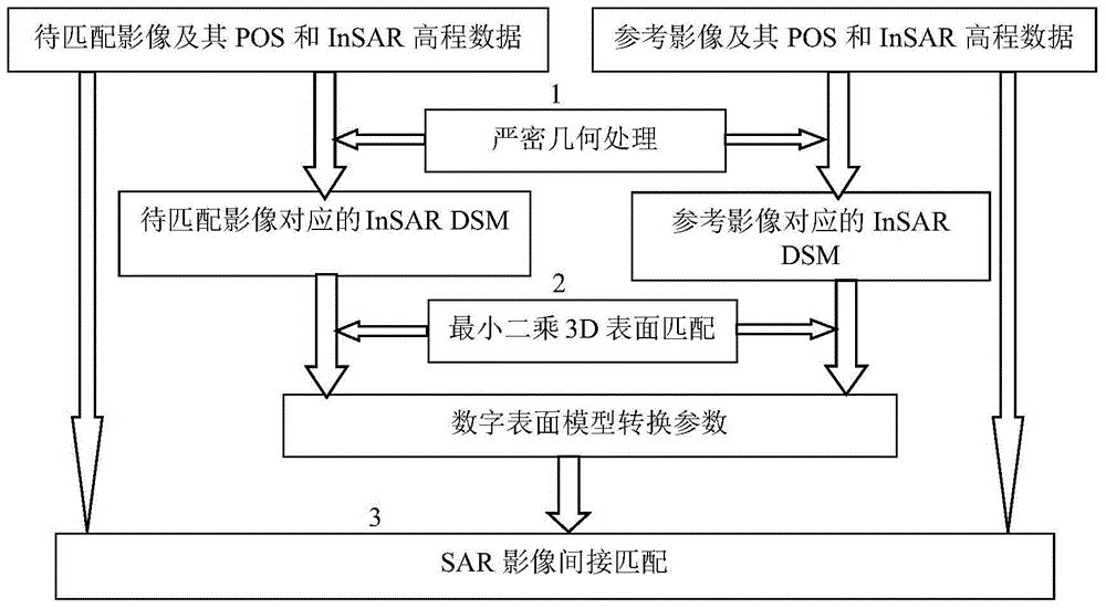
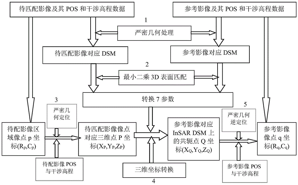
[0019] The present invention realizes the conversion between image point coordinates of different SAR images and the matching between image points with the same name through the strict geometric transformation model and the least squares 3D surface matching model. For the implementation process, please refer to the attached figure 1 , through the following steps:

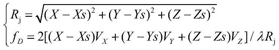
[0020] Step 1: Obtain the InSAR 3D digital surface model corresponding to the reference SAR image and the SAR image to be matched in the same way. That is, by converting the sensor position and velocity parameters in the POS data into the tangential rectangular coordinate system, using the POS data of the image, the InSAR interferometric elevation data and the rigorous geometric model to calculate the three-dimensional coordinates corresponding to the reference SAR image point by point, and obtain the image's 3D digital surface model. The calculation method of the coordinates of each object point in the Cartesian ...


PUM


Abstract

The invention provides a method for achieving SAR image indirect matching by using POS and InSAR interference altitude data. Precise geometrical models and Least-square digital surface matching are used to build to-be-matched SAR images, InSAR three-dimensional digital surface models corresponding to the to-be-matched SAR images, InSAR three-dimensional digital surface models corresponding to reference SAR images, and the coordinate conversion relations among reference images, and indirect matching the homonymy points of the to-be-matched SAR images and the reference images is achieved. The method has the advantages that the method is applicable to matching of SAR images with POS and interference data, and matching difficulty caused by geometrical deformation and gray difference of SAR images of complex terrain areas especially airborne interference SAR images is overcome.

Description

technical field [0001] The invention belongs to the fields of SAR remote sensing image information processing and SAR remote sensing surveying and mapping, and in particular relates to a SAR remote sensing image matching method. Background technique [0002] Synthetic Aperture Radar (SAR) is currently the main sensor for active microwave imaging. Compared with optical sensors, it can obtain effective data in day or night, sunny, rainy, foggy, snowy and other weather conditions, and has a wide range of applications in the military and civilian fields. The development of SAR sensor and imaging technology provides the basis for the application of SAR in different fields. The United States uses the space shuttle as a SAR sensor carrier for the Mapping Project (SRTM), which marks that radar remote sensing technology has entered a new era of three-dimensional terrain mapping. [0003] Since SAR images can provide texture information and polarization information, and InSAR (Synthe...

Claims


Application Information

Patent Timeline
Patent Type & Authority Patents(China)
IPC IPC(8): G06T17/00G01S13/90G06T7/00
CPCG01S13/9005G01S13/9023G06T7/344
Inventor 张继贤程春泉左志权黄国满
Owner CHINESE ACAD OF SURVEYING & MAPPING
Why Eureka
Try Eureka