

Holographic-image-based streetscape image fragment optimization method
A technology of panoramic image and optimization method, applied in image analysis, graphic image conversion, image data processing, etc. Effect
- Summary
- Abstract
- Description
- Claims
- Application Information
AI Technical Summary
Problems solved by technology
Method used
Image

Examples
Embodiment Construction
[0014] In order to make the object, technical solution and advantages of the present invention clearer, the present invention will be further described in detail below in conjunction with the accompanying drawings and embodiments. It should be understood that the specific embodiments described here are only used to explain the present invention, not to limit the present invention.
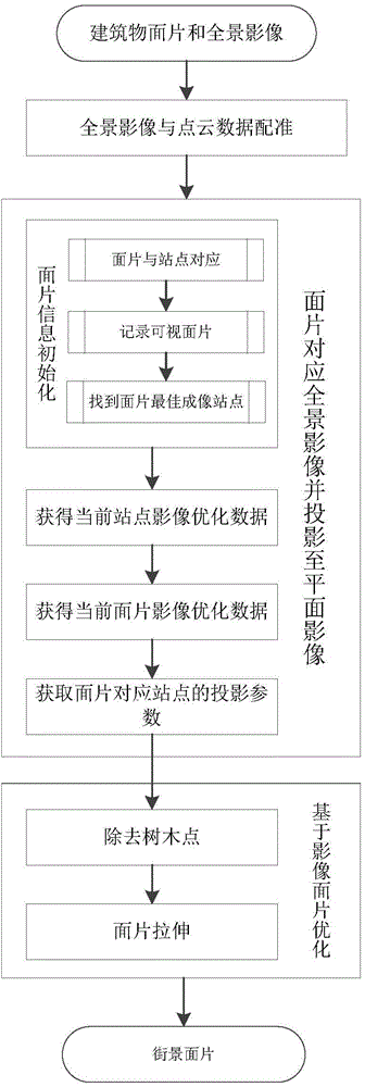
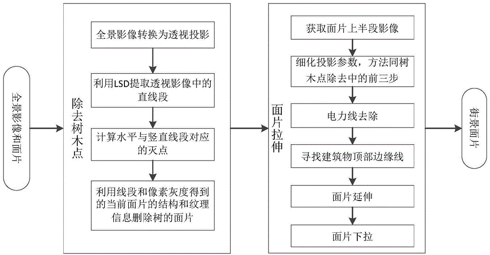
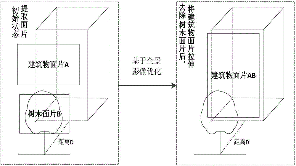
[0015] The technical solution adopted in the present invention provides a method for optimizing street view patches based on panoramic images, such as figure 1 shown, including the following steps:
[0016] Step 1, the vehicle-mounted LiDAR point cloud data and the panoramic image are registered, and the collinear equation principle is used for registration to obtain the outer orientation elements of the panoramic camera in the geodetic coordinate system. According to the position and attitude of the POS system at the moment when each photo is taken, combined with the relative positional relations...
PUM
 Abstract
Description
Claims
Application Information