

Transmission line wildfire satellite monitoring method based on background information
A transmission line and mountain fire technology, which is applied in the field of satellite monitoring of transmission line mountain fires based on background information, can solve the problems of missing low-temperature fire points, failing to meet the real-time monitoring of transmission line mountain fires, and failing to identify industrial fire points, etc. Achieve the effect of reducing false alarm rate, avoiding tripping, and strong recognition ability
- Summary
- Abstract
- Description
- Claims
- Application Information
AI Technical Summary
Problems solved by technology
Method used
Image

Examples
Embodiment Construction
[0038] In order to make the purpose, technical solutions and advantages of the embodiments of the present invention clearer, the technical solutions in the embodiments of the present invention will be clearly and completely described below in conjunction with the drawings in the embodiments of the present invention. Obviously, the described embodiments It is only some embodiments of the present invention, but not all embodiments. Based on the embodiments of the present invention, all other embodiments obtained by persons of ordinary skill in the art without creative efforts fall within the protection scope of the present invention.
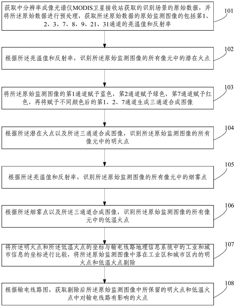
[0039] figure 1 It shows a schematic flow chart of a method for monitoring mountain fire satellites on power transmission lines based on background information provided by an embodiment of the present invention, as shown in figure 1 As shown, the background information-based satellite monitoring method for mountain fires in power transmission lin...
PUM
 Abstract
Description
Claims
Application Information