Augmented reality method based on topocentric coordinate system and perspective projection

A technology of augmented reality and perspective projection, which is applied in the directions of instruments, navigation, image data processing, etc., and can solve problems such as error-prone and slow efficiency

Inactive Publication Date: 2015-05-06
SHANDONG UNIV
View PDF0 Cites 18 Cited by
  • Summary
  • Abstract
  • Description
  • Claims
  • Application Information

AI Technical Summary

Problems solved by technology

[0002] At present, traditional maps and navigation devices can only give the location of the point of interest that people are looking for on the map. Even if the route has been

Method used


Image

  • Augmented reality method based on topocentric coordinate system and perspective projection
  • Augmented reality method based on topocentric coordinate system and perspective projection
  • Augmented reality method based on topocentric coordinate system and perspective projection

Examples


Embodiment

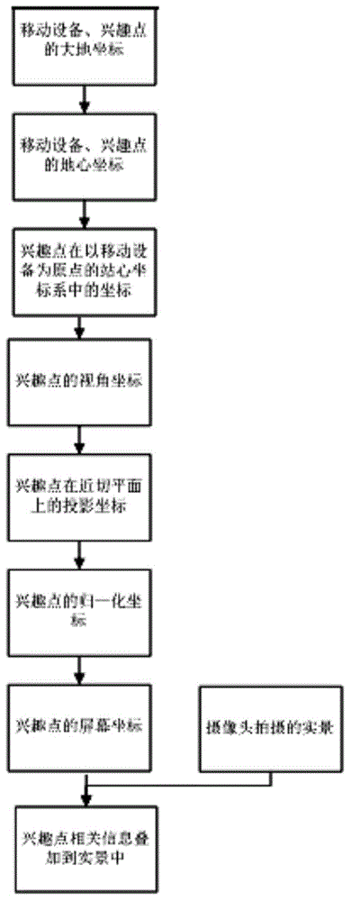
[0058] A kind of augmented reality method based on station center coordinate system and perspective projection, concrete steps comprise:

[0059] (1) Coordinate transformation, the specific steps include:

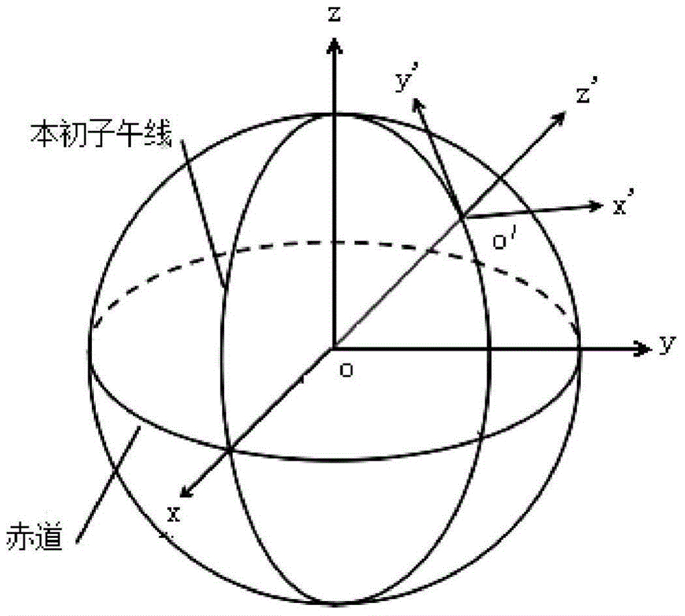
[0060] a. Obtain the user's current geodetic coordinates [lat] through GPS user the lon user alt user ] T , among them, lat user Indicates the user's current location latitude, lon user Indicates the longitude of the user's current location, alt user Indicates the height of the user's current location, and obtains the geodetic coordinates of the point of interest through the network [lat poi the lon poi alt poi ] T , among them, lat poi Indicates the latitude of the point of interest, lon poi Indicates the longitude of the point of interest, alt poi Indicates the height of the point of interest, and the current location of the user is the location of the mobile device;

[0061] b. The user's current geodetic coordinates [lat user the lon user alt user ...


PUM


Abstract

The invention relates to an augmented reality method based on topocentric coordinate system and perspective projection. The augmented reality method based on the topocentric coordinate system and perspective projection includes that (1) coordinate transformation, to be specific, converting geodetic coordinates of mobile equipment and an interest point into geocentric coordinates to obtain the coordinates of the interest point in the topocentric coordinate system to obtain the perspective coordinates of the interest point; (2) perspective projection, to be specific, perspectively projecting the topocentric coordinates of the interest point relative to the current position of a user to a display screen of the mobile equipment, using a mobile equipment camera to perform location shooting, and overlapping the relevant information of the interest point to the position of the interest point in the scenery shot by the camera of the mobile equipment according to different orientations of the mobile equipment. The augmented reality method based on the topocentric coordinate system and perspective projection overcomes the disadvantage that the traditional map and navigation application are not intuitive; the augmented reality method based on the topocentric coordinate system and perspective projection quickly finds the interest point, and the relevant information of the interest point is timely overlapped to the interest point in the shot image to present the intuitive effect; the augmented reality method based on the topocentric coordinate system and perspective projection automatically prompts the current direction of the user and quickly and precisely obtains the direction and position of the interest point relative to the current position of the user.

Description

technical field [0001] The invention relates to an augmented reality method based on a station center coordinate system and perspective projection, and belongs to the technical fields of computer image processing and sensors. Background technique [0002] At present, traditional maps and navigation devices can only give the location of the point of interest that people are looking for on the map. Even if the route has been planned, people still need to constantly observe the surrounding environment and match the information on the map when going to the destination. , not only slow, but error-prone. Contents of the invention [0003] Aiming at the deficiencies of the prior art, the present invention discloses an augmented reality method based on a station center coordinate system and perspective projection; [0004] The invention fits the points of interest to the real scene, directly and dynamically superimposes the location information that people are interested in into ...

Claims


Application Information

Patent Timeline
IPC IPC(8): G06T3/00G06F17/30G01C21/00
CPCG01C21/3476G06T3/604G06F16/29
Inventor 王洪君王增迪宋玉川马良孙超蔡楠楠刘珂罗亚慧
Owner SHANDONG UNIV
Why Eureka
Try Eureka