

Photogrammetry and remote sensing comprehensive teaching method and system
A photogrammetry and remote sensing technology, applied in the field of surveying and mapping geographic information, can solve the problems of difficult aerial photography, large amount of data, incoherent teaching methods, etc.
- Summary
- Abstract
- Description
- Claims
- Application Information
AI Technical Summary
Problems solved by technology
Method used
Image

Examples
Embodiment Construction
[0026] Embodiments of the present invention will be described in detail below in conjunction with the accompanying drawings.
[0027] It should be clear that the described embodiments are only some of the embodiments of the present invention, not all of them. Based on the embodiments of the present invention, all other embodiments obtained by persons of ordinary skill in the art without making creative efforts belong to the protection scope of the present invention.
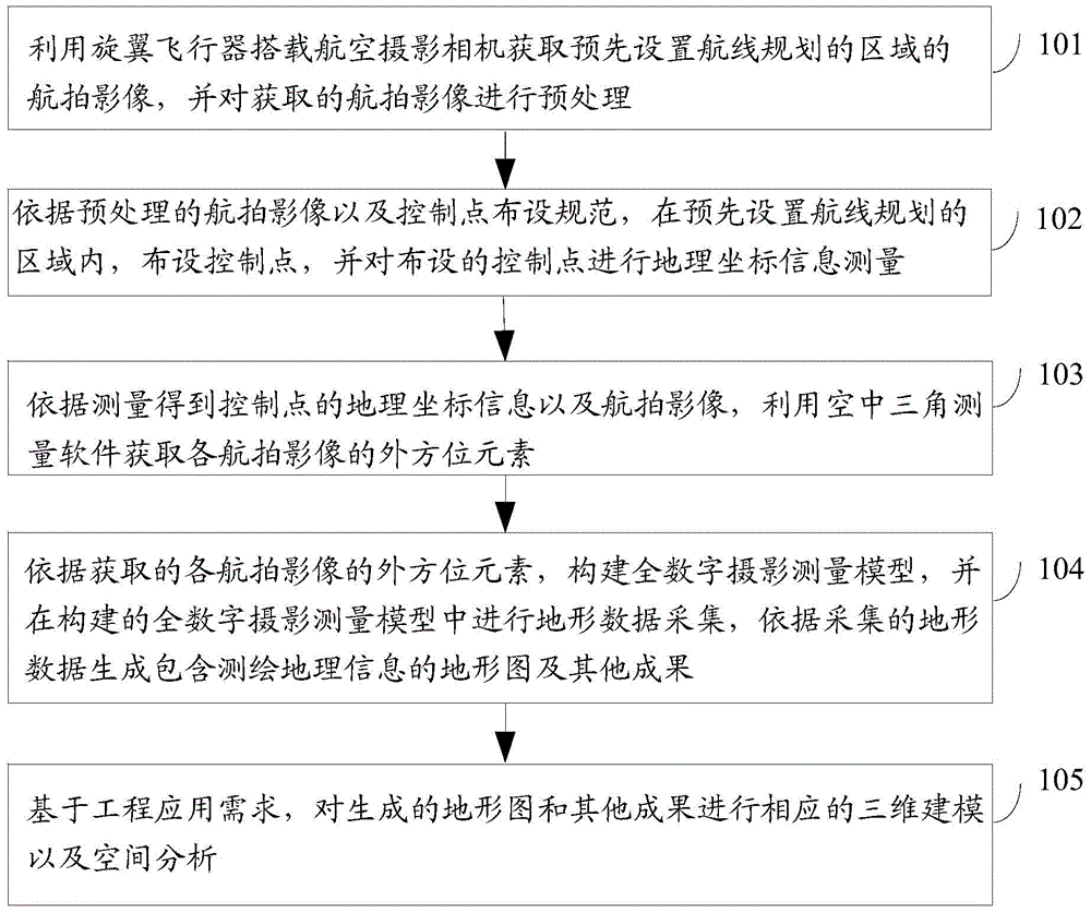
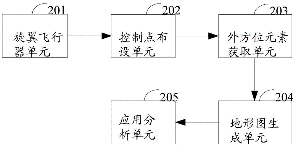
[0028] figure 1 It is a schematic flowchart of a method for integrated teaching of photogrammetry and remote sensing according to an embodiment of the present invention. see figure 1 , the method includes:
[0029] Step 101, using the multi-rotor unmanned aerial vehicle to acquire the aerial images of the pre-set route planning area, and preprocessing the acquired aerial images;
[0030] In this step, as an optional embodiment, obtaining the aerial images of the pre-set route planning area includes:
[0031]...
PUM
 Abstract
Description
Claims
Application Information