

Self-positioning orientation plotting method based on GPS RTK and panoramic image
A technology of panoramic image and mapping method, applied in the field of surveying and mapping, to achieve the effect of rapid acquisition
- Summary
- Abstract
- Description
- Claims
- Application Information
AI Technical Summary
Problems solved by technology
Method used
Image

Examples
Embodiment Construction
[0040] The technical solutions of the present invention will be further described below in conjunction with specific implementation methods and accompanying drawings.
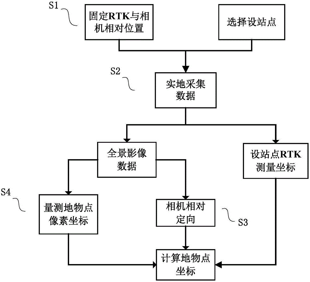
[0041] Concrete flow chart of the present invention sees figure 1 , including the following specific steps:
[0042] Step S1: Preparation for data collection.
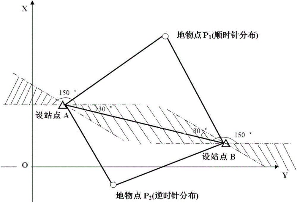
[0043] When the three-dimensional coordinates of two ground object points and the intersection angle between the two ground object points and the third unknown space point are known, the three-dimensional coordinates of the unknown space point can be obtained by using the forward intersection principle. Forward intersection refers to the process of setting up stations on known control points A and B to observe the horizontal angle and zenith distance, and calculating the coordinates of the undetermined point P according to the known control point coordinates and observed values. In the forward intersection graph, the angle between the unknown point an...
PUM
 Abstract
Description
Claims
Application Information