Precision controllable line and plane geographic element information disguising and restoring method

An information camouflage and geographic element technology, applied in the field of information camouflage and restoration of on-line geographic elements, can solve the problem that it is difficult to meet the basic requirements of vector geographic data information camouflage, the imperceptibility characteristics of vector geographic data camouflage are low, the edges of camouflage data lines are uneven, and the Problems such as spatial relationship confusion

Inactive Publication Date: 2015-05-27
NANJING NORMAL UNIVERSITY
View PDF5 Cites 3 Cited by
  • Summary
  • Abstract
  • Description
  • Claims
  • Application Information

AI Technical Summary

Problems solved by technology

[0003] At present, the related patents (such as CN 102393895 A, CN 102411695 A) of vector geographic data information camouflage method have been retrieved, because the accuracy control and the preservation of macro topological features in the process of camouflage are not paid attention to,

Method used


Image

  • Precision controllable line and plane geographic element information disguising and restoring method
  • Precision controllable line and plane geographic element information disguising and restoring method
  • Precision controllable line and plane geographic element information disguising and restoring method

Examples


Embodiment Construction

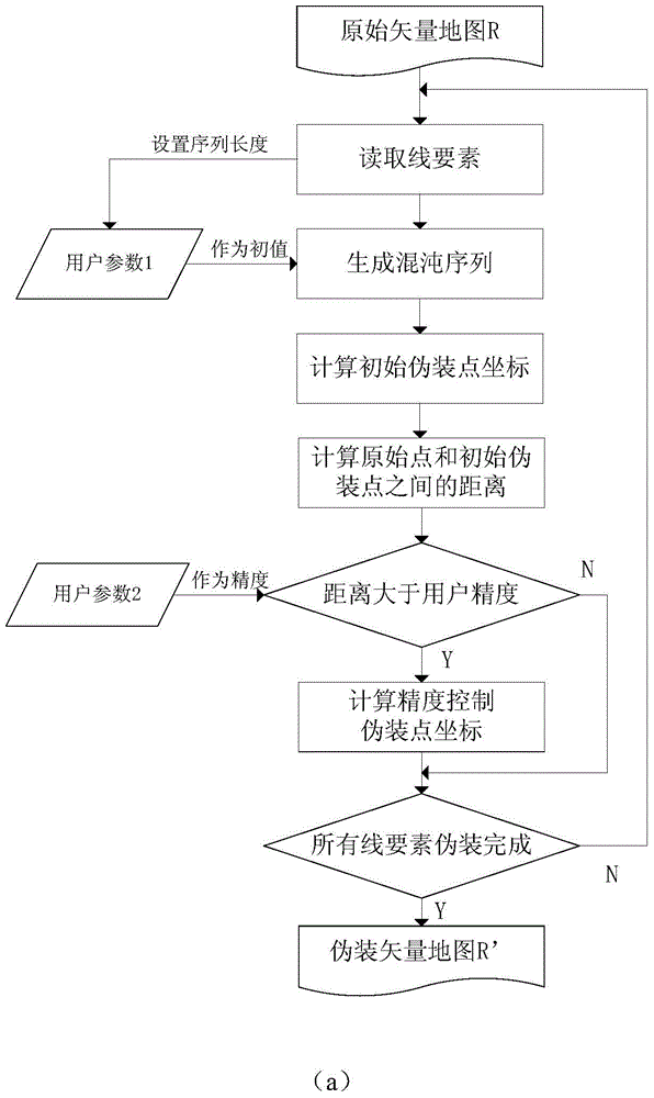
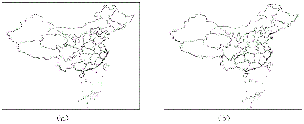
[0043] In this embodiment, vector data in shp format is selected, and the whole process of data reading, camouflage, and restoration is further described in detail. This example selects the 1:4 million provincial boundary layer data of China.

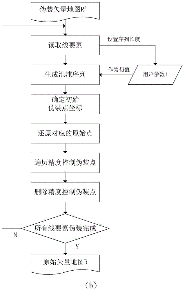
[0044] (1) Masquerading process

[0045] Step 11: Load the line layer data of the Chinese provincial boundary map, input the user parameter q=0.82 as the initial value of the chaotic system, input the precision control range a=0.05, and save it as the key file keyFile.

[0046] Step 12: Read the point set P in the current line feature in R 1 ={(121.48844146728516,53.332649230957031),(121.49738311767578,53.321044921875),...,(125.35986328125,51.609798431396484)}, n=177.

[0047] Step 13: According to formula (1), the chaotic sequence Q 1 ={0.82,0.578592,...,0.62619031571787342}, whose length is 175.

[0048] Step 14: Add the first point (121.48844146728516, 53.332649230957031) in the line feature to the point set P 1 'middle. Calcul...


PUM


Abstract

The invention discloses a precision controllable line and plane geographic element information disguising and restoring method. The method comprises the following steps: (1) calculating an initial disguising point, calculating a control disguising point and the like aiming at a line and plane type GIS (Global Information System) vector data disguising process; (2) restoring the disguising point, traversing a precision control disguising point, deleting and the like aiming at a line and plane type GIS vector data restoring process. The method has the advantages that the elusiveness is higher and the method is not limited by capacity; the safety of secret data in data transmission and elusive communication can be effectively guaranteed on the basis of hiding the existence of the secret information.

Description

technical field [0001] The invention belongs to the field of geographic information security, and in particular relates to a method for disguising and restoring information of line and plane geographic elements with controllable precision. Background technique [0002] The security protection of geographic information involves national security and social interests, and is a major national and social demand that needs to be urgently addressed. On the basis of hiding the information content of secret GIS vector data, further hiding the existence of secret information is the focus of current geographic information security research and application. [0003] At present, the related patents (such as CN 102393895 A, CN 102411695 A) of vector geographic data information camouflage method have been retrieved, because the accuracy control and the preservation of macro topological features in the process of camouflage are not paid attention to, and the edges of the camouflage data li...

Claims


Application Information

Patent Timeline
IPC IPC(8): G06F21/60
CPCG06F16/29G06F21/602G06F2221/2107
Inventor 李安波吴雪荣
Owner NANJING NORMAL UNIVERSITY
Why Eureka
Try Eureka