
Method and device for steering a seismic vessel

A seismic exploration and guidance technology, applied to seismology, seismology, and measuring devices in areas covered by water, can solve problems such as difficult to achieve, excessive, and poor global coverage, and achieve easy implementation and reduce risk effect

Inactive Publication Date: 2015-07-01
SERCEL INC
View PDF0 Cites 0 Cited by
  • Summary
  • Abstract
  • Description
  • Claims
  • Application Information

AI Technical Summary

Problems solved by technology

[0015] The main disadvantage of the first known solution is that steering the survey vessel so that the coverage of a pre-plotted line is juxtaposed with that of an adjacent pre-plotted line means that the navigator (operator) must obtain the The information continuously adjusts its guide offset from the graded offset class under consideration
Doing this manually is suboptimal and very difficult even for experienced users
[0016] Another disadvantage of the first known solution is excessive steering due to the purposeful nature of the collocated coverage
[0018] The main disadvantage of the second known solution is that setting the null offset does help with the start of the 4D measurement, but will result in poor global coverage

Method used


Image

  • Method and device for steering a seismic vessel
  • Method and device for steering a seismic vessel
  • Method and device for steering a seismic vessel

Examples


Embodiment Construction

[0072] In all the drawings of this document, the same elements and steps are denoted by the same numerical reference symbols.

[0073] see now Figure 5 , we present a steering method according to a specific embodiment of the invention. This method works through a device (more details on this device are given below image 3 description) to proceed.

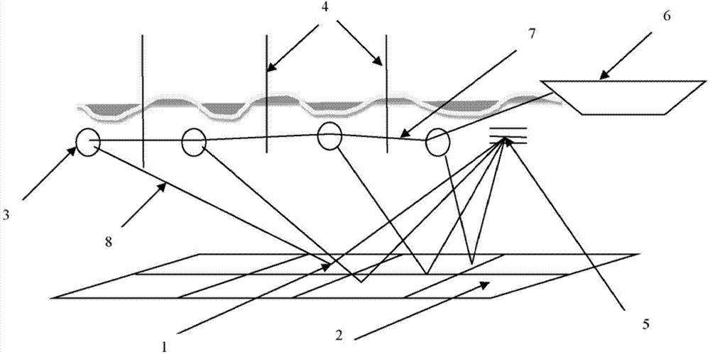
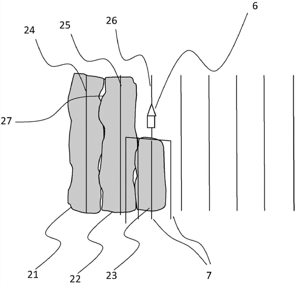
[0074] as already relative to figure 1 For the purposes of this discussion, we consider a seismic survey vessel associated with a nautical line as well as a pre-plotted line (the nautical line and the pre-plotted line are usually the same). The seismic survey vessel tows one or several streamers (acoustic linear antennas) including receivers. These receivers receive signals generated by at least one seismic source and reflected by the submerged layer at reflection points.

[0075] We assume that receivers are partitioned in multiple offset classes (eg, "near offset", "near to intermediate offset", "middle to far offset", "i...


PUM


Abstract

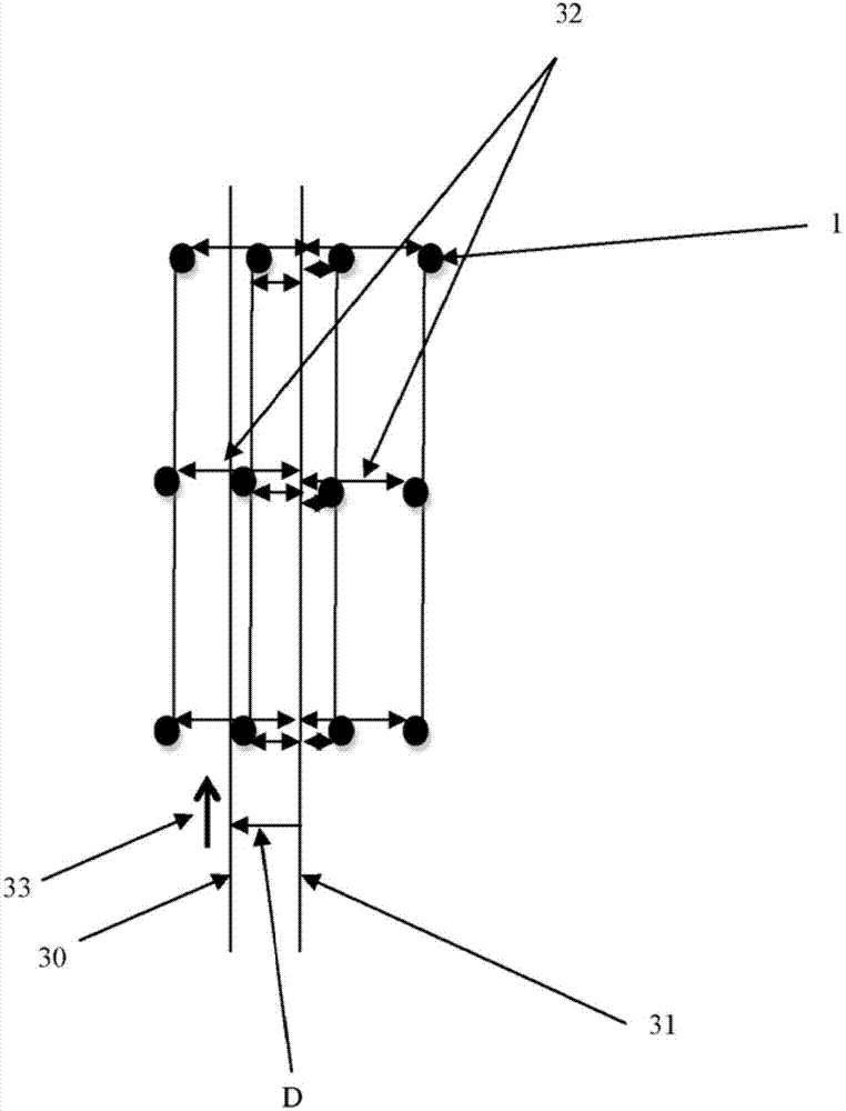
It is proposed a method for steering a seismic vessel (6) associated with a sail line (30) and a preplot line (30), said seismic vessel towing at least one acoustic linear antenna comprising receivers, said receivers receiving signals generated by at least one source and reflected by subsurface's layers at reflexion points (1). The method comprises: computing a shifted preplot line (31) which has a shape substantially identical to the shape of the preplot line and which is, according to a regression method, the best fit line associated with at least some of the reflexion points; computing a distance D between the preplot line and the shifted preplot line; and providing steering information comprising or based on the distance D to a navigation system or to an operator of a navigation system, to alter the course of the seismic vessel.

Description

technical field [0001] The field of the invention is that of geophysical data acquisition. [0002] More precisely, the present invention relates to marine seismic surveys, comprising one or several vessels for imaging the crust of the sea floor. [0003] More specifically, the present invention relates to a technique for guiding a seismic survey vessel associated with a navigation line and a pre-plotted line (also called a "track line"), which is usually the same as the navigation line (the term "Nautical Line" and "Pre-plotted Line" are defined below). The seismic survey vessel tows at least one acoustic linear antenna (hereinafter referred to as streamer) including a receiver. A receiver receives a signal generated by at least one seismic source and reflected by the underwater layer at the reflection point. [0004] In other words, the present invention relates to a steering technique suitable for use in seismic survey vessels and to perform reasonably good coverage over...

Claims


Application Information

Patent Timeline
Patent Type & Authority Applications(China)
IPC IPC(8): G01V1/38
CPCG01V1/3808G01V1/3817
Inventor 法比安·休恩
Owner SERCEL INC
Learn More