
Interpolation method for DEM (Digital Elevation Model) generated by contour lines

A technology of contour lines and vector contour lines, which is used in the interpolation of digital elevation models and the interpolation field of DEM generated by elevation lines, which can solve the problems of limited engineering applications and no self-adaptation.

Active Publication Date: 2015-07-29
SHANDONG LINYI TOBACCO
View PDF4 Cites 10 Cited by
  • Summary
  • Abstract
  • Description
  • Claims
  • Application Information

AI Technical Summary

Problems solved by technology

However, due to the manual intervention of this indicator, it is not self-adaptive, which limits the engineering application of this method to a certain extent.

Method used


Image

  • Interpolation method for DEM (Digital Elevation Model) generated by contour lines
  • Interpolation method for DEM (Digital Elevation Model) generated by contour lines
  • Interpolation method for DEM (Digital Elevation Model) generated by contour lines

Examples


Embodiment Construction

[0039] In order to clearly illustrate the technical features of this solution, the present invention will be described in detail below through specific implementation modes and in conjunction with the accompanying drawings. The following disclosure provides many different embodiments or examples for implementing different structures of the present invention. To simplify the disclosure of the present invention, components and arrangements of specific examples are described below. Furthermore, the present invention may repeat reference numerals and / or letters in different instances. This repetition is for the purpose of simplicity and clarity and does not in itself indicate a relationship between the various embodiments and / or arrangements discussed. It should be noted that components illustrated in the figures are not necessarily drawn to scale. Descriptions of well-known components and processing techniques and processes are omitted herein to avoid unnecessarily limiting the...


PUM


Abstract

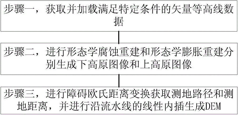
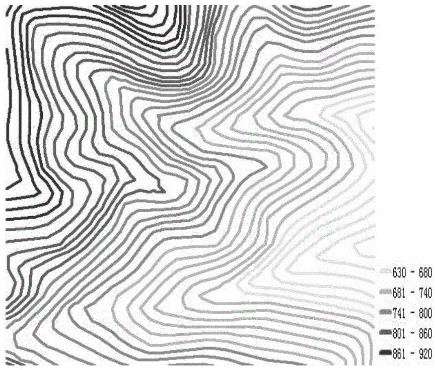
The invention discloses an interpolation method for a DEM (Digital Elevation Model) generated by contour lines. The interpolation method comprises the following steps: 1, acquiring and loading vector contour line data meeting specific conditions, wherein the specific conditions are: each contour line is spatially and continuously distributed and cannot be interrupted, and odd contour lines and even contour lines exist at intervals; 2, performing morphological corrosion reconstruction and morphological expansion reconstruction to generate a lower plateau image and an upper plateau image respectively; 3, performing obstacle Euclidean distance conversion to acquire a geodesic path and a geodesic distance, and performing pipelined linear interpolation to generate the DEM. The generated DEM has the characteristics of high accuracy and high fidelity and is generated by using the linear interpolation method, the DEM accuracy obtained under the condition that only contour line data are used is equal to or higher than the DEM accuracy obtained by using a map algebra method, manual intervention is not needed, the DEM is not limited by iterations, an adaptive algorithm is truly achieved, and the interpolation method can be applied to various industries.

Description

technical field [0001] The invention relates to an interpolation method of a digital elevation model (DEM), in particular to an interpolation method of contour line generation DEM, belonging to the technical field of cartography and geographic information. Background technique [0002] Digital Elevation Model (DEM) is a discrete digital representation of the topography of the earth's surface. Since it was proposed in the late 1950s, DEM has received great attention and has been used in the fields of surveying and mapping, civil engineering, geology, mining engineering, landscape architecture, road design, flood control, agriculture, planning, military engineering, aircraft and battlefield simulation. has been widely used. At the same time, the research on DEM is still in the ascendant, and the interpolation method for generating DEM is one of the focuses of the research. In general, different data sources require different interpolation methods to generate DEMs. At presen...

Claims


Application Information

Patent Timeline
Patent Type & Authority Applications(China)
IPC IPC(8): G06T3/40
Inventor 齐义良田雷林祥国王家民刘元德宗浩王梅勋朱先志李峰王文杰谭效磊刘文涛徐蕊王丽丽高强
Owner SHANDONG LINYI TOBACCO
Learn More