

Method for planning attitude maneuver in imaging process of agile satellite
An attitude maneuver and satellite technology, applied in the field of attitude maneuver planning algorithms, can solve the problems of increasing the workload of the ground system, the large amount of data, and the complex content of the attitude maneuver imaging instructions.
- Summary
- Abstract
- Description
- Claims
- Application Information
AI Technical Summary
Problems solved by technology
Method used
Image

Examples
Embodiment Construction
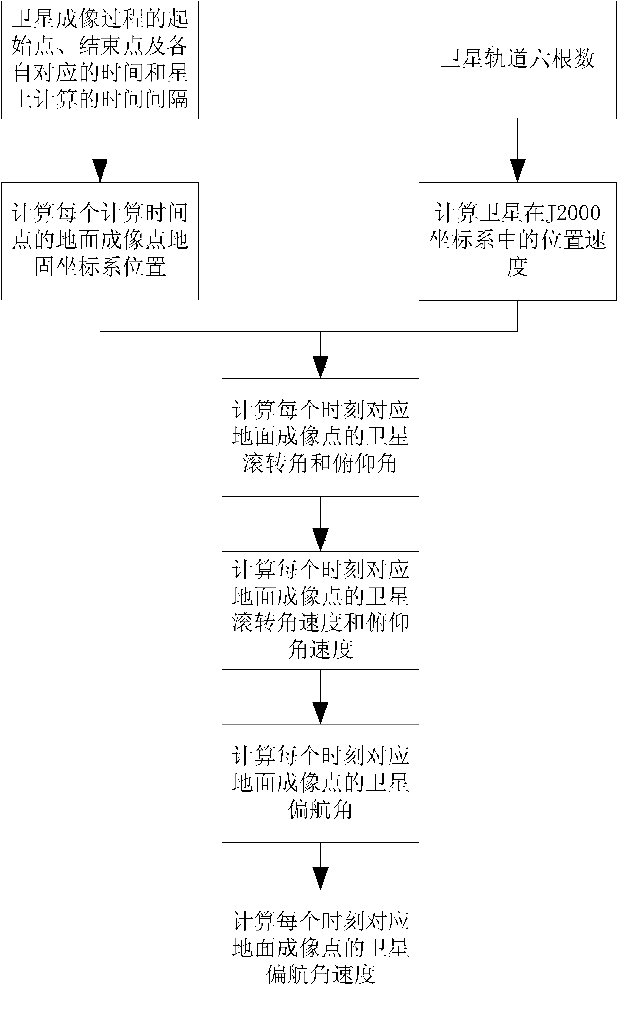
[0101] Such as figure 1 As shown, it is a flow chart of the attitude maneuver planning algorithm of the present invention, and the specific steps are as follows:
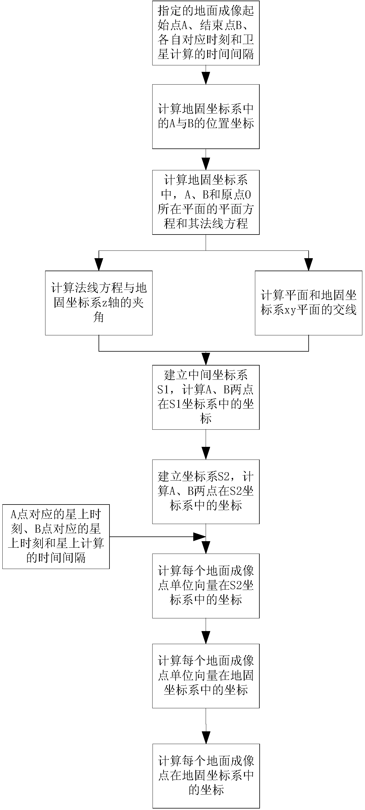
[0102] (1) According to the geographic location of the start and end points of the specified ground imaging strip, the start time and end time of imaging, and the calculation step size on the star, calculate the position of the imaging point corresponding to each time point.
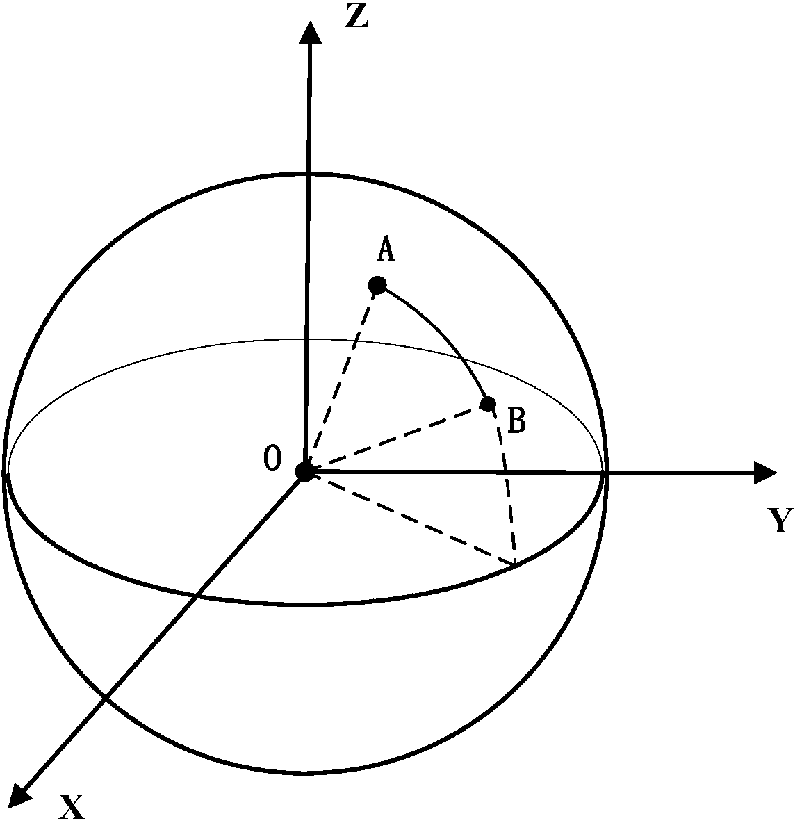
[0103] Let the starting point of the imaging observation strip be A, and its geographic latitude and longitude be Lon A,d and Lat A,d , the corresponding time is t A ; Let the end point of the imaging observation strip be B, and its geographic latitude and longitude be Lon B,d and Lat B,d , the corresponding time is t B . The step size of calculation time on the star is Δt.
[0104] The ground imaging observation band is shown as figure 2 shown. In this method, the observation strips formed between the starting point and the ending p...
PUM
 Abstract
Description
Claims
Application Information