Multi-scale forest dynamic change monitoring method
A dynamic change, multi-scale technology, applied in the application field of remote sensing technology in forestry, can solve the problems of limiting the application scope of the algorithm and unable to reflect the law of dynamic changes of forest time.
- Summary
- Abstract
- Description
- Claims
- Application Information
AI Technical Summary
Problems solved by technology
Method used
Image
Examples
Embodiment Construction
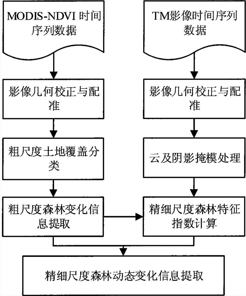
[0085] In order to make it easier for those skilled in the art to understand and implement the present invention, the present invention will be further described in detail below in conjunction with the accompanying drawings and specific embodiments.
[0086] (S1) Geometric correction and registration of remote sensing images;
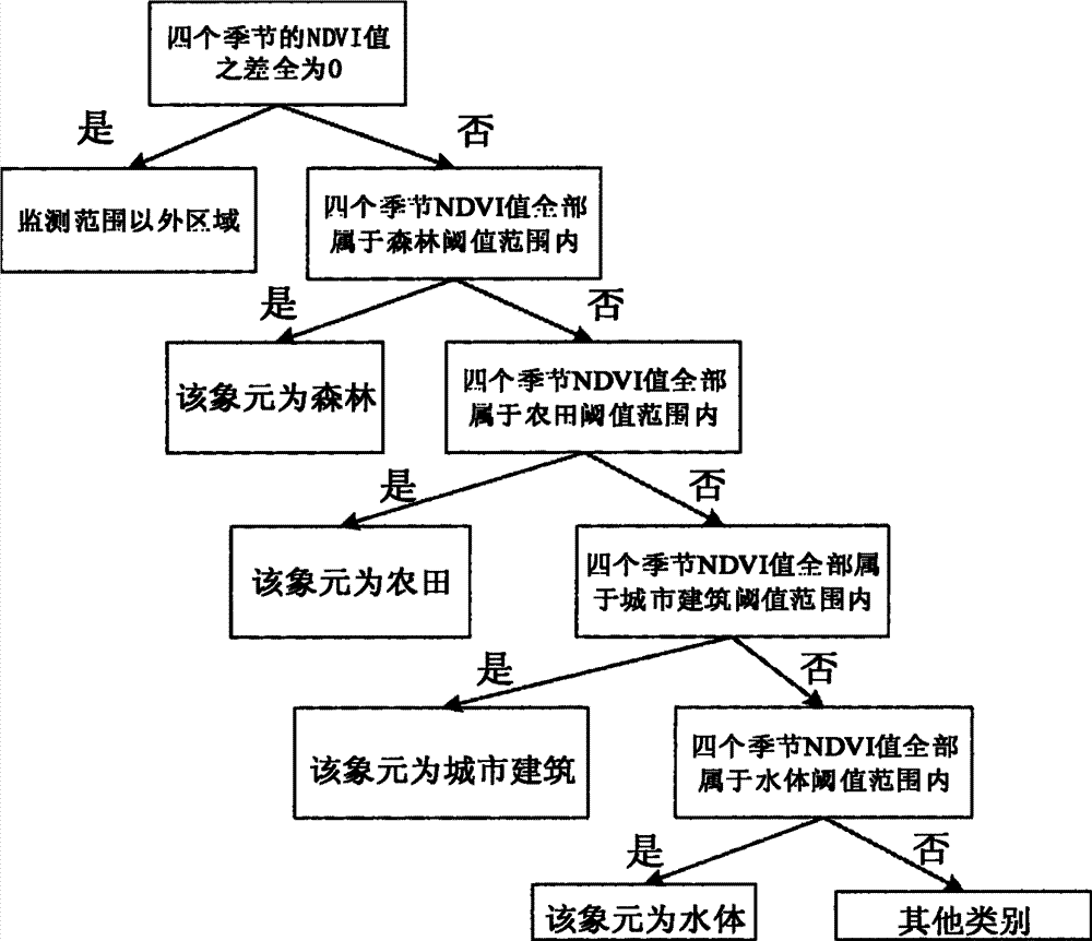
[0087] (S2) Using MODIS time series NDVI data at 1KM resolution in different seasons within a year, to obtain a land cover type map at 1KM resolution;
[0088] (S3) Using the multi-year 1KM resolution land cover map to generate coarse-scale forest vegetation change information;
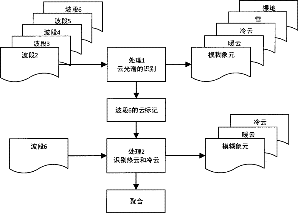
[0089] (S4) carrying out cloud and shadow mask processing to the TM data of 30M spatial resolution;
[0090] (S5) Construct a forest vegetation characteristic index on the 30m resolution TM image according to the coarse-scale forest vegetation change mask file;
[0091] (S6) Extraction of forest dynamic change information by combining the coarse-scale land cover change map wi...
PUM
 Abstract
Description
Claims
Application Information
 - R&D
- Intellectual Property
- Life Sciences
- Materials
- Tech Scout
- Unparalleled Data Quality
- Higher Quality Content
- 60% Fewer Hallucinations
Browse by: Latest US Patents, China's latest patents, Technical Efficacy Thesaurus, Application Domain, Technology Topic, Popular Technical Reports.
© 2025 PatSnap. All rights reserved.Legal|Privacy policy|Modern Slavery Act Transparency Statement|Sitemap|About US| Contact US: help@patsnap.com


