

Method for extracting phytocoenosium spatial structure
A technology of spatial structure and plant community, applied in the field of remote sensing image processing, can solve the problem of no large-scale and systematic monitoring method etc.
- Summary
- Abstract
- Description
- Claims
- Application Information
AI Technical Summary
Problems solved by technology
Method used
Image

Examples
Embodiment Construction
[0074] In order to make the purpose, technical solutions and advantages of the embodiments of the present invention clearer, the technical solutions in the embodiments of the present invention will be clearly and completely described below in conjunction with the drawings in the embodiments of the present invention. Obviously, the described embodiments It is only some embodiments of the present invention, but not all embodiments. Based on the embodiments of the present invention, all other embodiments obtained by persons of ordinary skill in the art without creative efforts fall within the protection scope of the present invention.
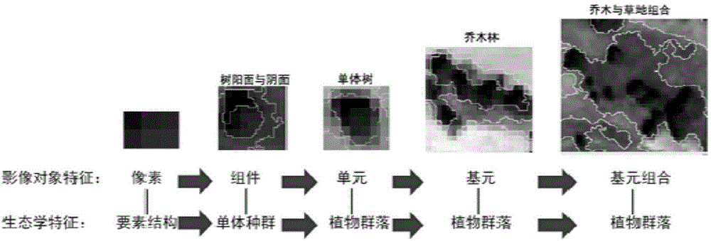
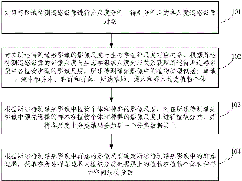
[0075] The present invention is based on multi-scale object fitting, and is a basic idea of counting the spatial parameters of plant individuals and populations within the scale of community organization. Transform image pixels into objects, and make objects generate semantic features. Objects have scale, and when the scale changes (different t...
PUM
 Abstract
Description
Claims
Application Information