

Multi-navigation system interoperable positioning method and system
A technology of navigation system and positioning method, which is applied in the field of multi-navigation system interoperable positioning method and system, can solve problems such as inability to locate, number of observed values, and inconsistent time reference, and achieve the effect of solving the problem of inability to locate
- Summary
- Abstract
- Description
- Claims
- Application Information
AI Technical Summary
Problems solved by technology
Method used
Image

Examples
Embodiment Construction
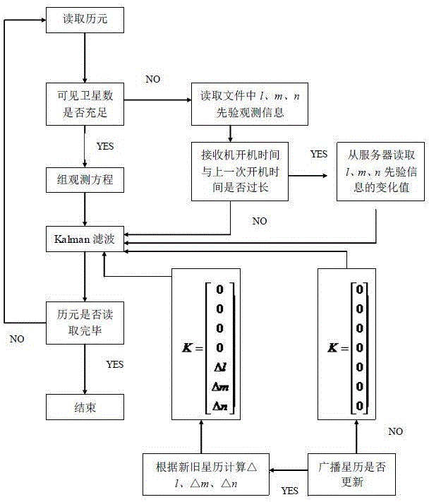
[0040] In order to make the objectives, technical solutions and beneficial effects of the present invention more clear, the present invention will be further described below in conjunction with the accompanying drawings and specific implementation methods. It should be understood that the specific embodiments described below are only used to explain the present invention, and are not intended to limit the present invention.
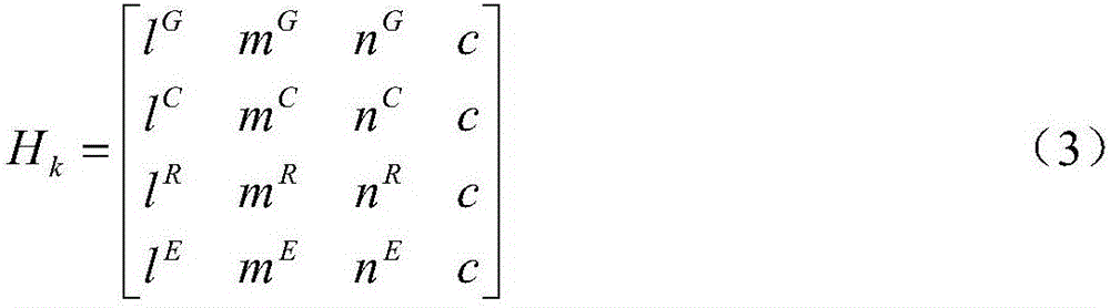
[0041] In the following formulas, G stands for GPS, C stands for BDS, R stands for GLONASS, and E stands for GALILEO.
[0042] The observation equations of each GNSS system are as follows:
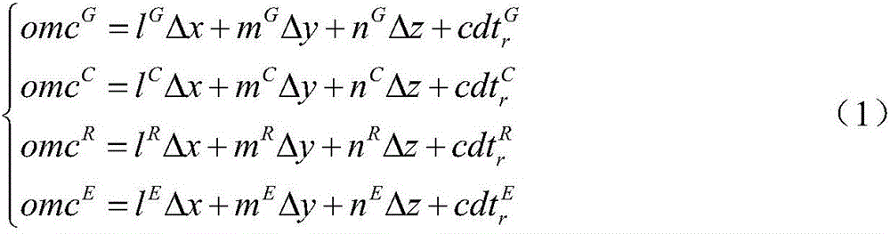
[0043]
[0044] In formula (1), omc G 、omc C 、omc R 、omc E respectively represent the observation values of GPS, BDS, GLONASS, and GALILEO systems; Δx, Δy, and Δz represent position parameters; l G 、m G , n G is the coefficient of the GPS system observation equation, l C 、mC , n C is the coefficient of the observation equation of the BDS system, l R 、m ...
PUM
 Abstract
Description
Claims
Application Information