
Sericite mineral relative abundance calculating method based on aviation hyperspectral remote sensing data

A hyperspectral remote sensing and relative abundance technology, which is applied in the field of relative abundance calculation of sericite minerals, can solve problems such as quantitative calculation of difficult-to-absorb positions, and achieve the effect of improving accuracy

Active Publication Date: 2015-10-21
BEIJING RES INST OF URANIUM GEOLOGY
View PDF2 Cites 2 Cited by
  • Summary
  • Abstract
  • Description
  • Claims
  • Application Information

AI Technical Summary

Problems solved by technology

[0003] The existing aerial hyperspectral remote sensing mineral extraction work focuses on the identification of mineral types, and visual identification methods are often used in the detailed division of different types of sericite minerals, which makes it difficult to quantitatively calculate the absorption position, and it is difficult to determine the location of minerals on the surface. content, i.e. relative abundance, for accurate calculation

Method used


Image

  • Sericite mineral relative abundance calculating method based on aviation hyperspectral remote sensing data
  • Sericite mineral relative abundance calculating method based on aviation hyperspectral remote sensing data
  • Sericite mineral relative abundance calculating method based on aviation hyperspectral remote sensing data

Examples


Embodiment Construction

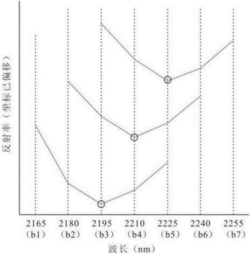
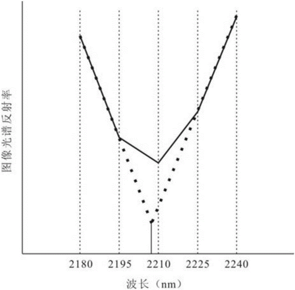
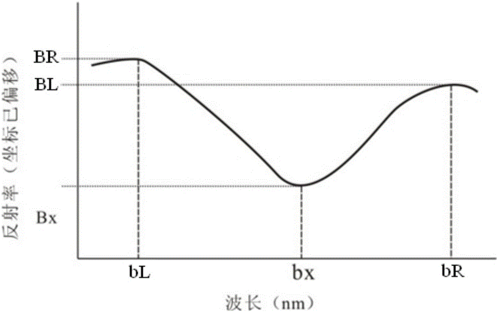
[0035] A method for calculating the relative abundance of sericite minerals based on aerial hyperspectral remote sensing data of the present invention will be described in detail below in conjunction with the accompanying drawings and embodiments.

[0036] A kind of sericite mineral relative abundance calculation method based on aerial hyperspectral remote sensing data of the present invention comprises the following steps:

[0037] Step 1 Data preprocessing of aerial hyperspectral remote sensing data

[0038] Systematic radiometric correction and geometric correction are performed on the acquired aerial hyperspectral remote sensing data to obtain spectral radiance data with geographical coordinates. The spectral radiance data are subjected to atmospheric correction and spectral reconstruction to obtain hyperspectral reflectance data with reflectance values ​​ranging from 0 to 1.

[0039] The radiation correction, geometric correction, atmospheric correction and spectral reco...


PUM


Abstract

The invention belongs to the technical field of remote sensing geology survey, and particularly relates to a sericite mineral relative abundance calculating method based on aviation hyperspectral remote sensing data. The method comprises the following steps that data preprocessing is carried out on the aviation hyperspectral remote sensing data; the spectral absorption position of a sericite mineral image is calculated; a mis-extraction area is removed; the absorption depth corresponding to the spectral absorption position of the sericite mineral image is calculated; a sericite mineral relative abundance graph is manufactured. By means of the method, the absorption position of the sericite mineral, the absorption depth and the relative abundance can be accurately calculated.

Description

technical field [0001] The invention belongs to the technical field of remote sensing geological survey, and in particular relates to a method for calculating the relative abundance of sericite minerals based on aerial hyperspectral remote sensing data. Background technique [0002] Hyperspectral remote sensing technology is a cutting-edge technology in the field of remote sensing, which can obtain continuous and complete spectra of ground objects, and directly identify ground objects according to the characteristics of spectral curves. In the application of remote sensing geology, the use of hyperspectral remote sensing technology can directly identify single minerals on the basis of distinguishing mineral categories. [0003] The existing aerial hyperspectral remote sensing mineral extraction work focuses on the identification of mineral types, and visual identification methods are often used in the detailed division of different types of sericite minerals, which makes it ...

Claims


Application Information

Patent Timeline
IPC IPC(8): G01N21/31G06F17/12G06F17/00
Inventor 孙雨赵英俊秦凯田丰周家晶刘鹏飞
Owner BEIJING RES INST OF URANIUM GEOLOGY
Learn More