

Object-orientated city entity geocoding integration method
An object-oriented, geocoding technology, applied in the field of urban geocoding, can solve problems such as rapid incorporation of unfavorable new data, high technical threshold, content ambiguity, etc., to reduce the generation of redundant data and ambiguous data, and avoid storage operations. , the effect of improving efficiency
- Summary
- Abstract
- Description
- Claims
- Application Information
AI Technical Summary
Problems solved by technology
Method used
Image

Examples
Embodiment Construction
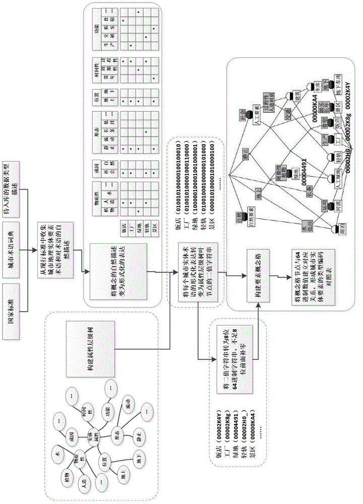
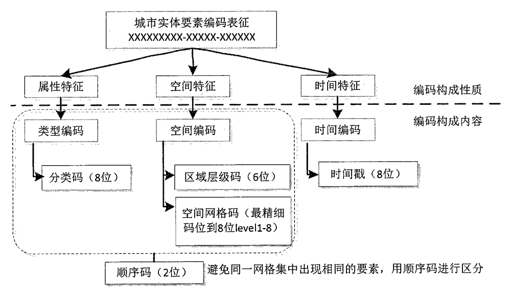
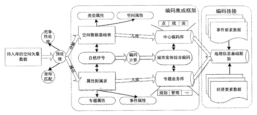
[0028]The present invention will be further described below in conjunction with the accompanying drawings and specific embodiments.
[0029] Terms related to the present invention are explained as follows:
[0030] The urban geographic information public platform relies on geographic information data to meet the basic needs of government departments, enterprises, institutions, and the general public for geographic information and spatial positioning and analysis through online methods. It has secondary development interfaces and expandable space for personalized applications. The general term for the data, software and its supporting environment that realize the application service function of the geospatial framework.
[0031] Spatial data warehouse: Spatial data warehouse is based on the data warehouse, introduces spatial dimension data, increases the storage, management and analysis capabilities of spatial data, and intercepts from different GIS application systems from tra...
PUM
 Abstract
Description
Claims
Application Information