Multi-data center based natural resource geospatial data organization method and system

A technology of geospatial data and natural resources, applied in the field of natural resource geospatial data organization, can solve the problems of lack of unity at the conceptual level and weak traceability of data sources, and achieve the effect of ensuring independence and relevance

Inactive Publication Date: 2015-11-11
国家信息中心
View PDF3 Cites 19 Cited by
  • Summary
  • Abstract
  • Description
  • Claims
  • Application Information

AI Technical Summary

Problems solved by technology

[0010] The present invention aims at the lack of traceability of data sources and whereabouts existing in the organization and management of natural resource geospatial data in the prior art, the different data types of multiple data centers are not unified at the conceptual level, and the collection of data information only records simple associations between data and other issues, a method for organizing natural resource geospatial data bas

Method used


Image

  • Multi-data center based natural resource geospatial data organization method and system
  • Multi-data center based natural resource geospatial data organization method and system
  • Multi-data center based natural resource geospatial data organization method and system

Examples


Embodiment Construction

[0042] The present invention will be described below in conjunction with the accompanying drawings.

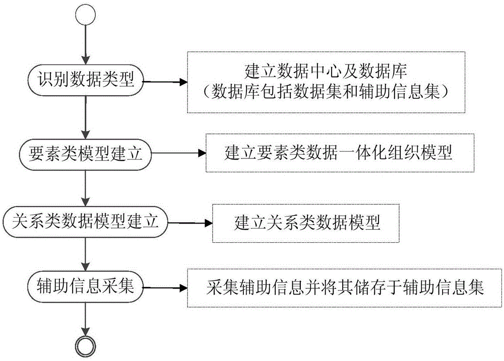
[0043] The present invention relates to a method for organizing natural resource geospatial data based on multiple data centers, such as figure 1 As shown, the organizational method includes the following steps:

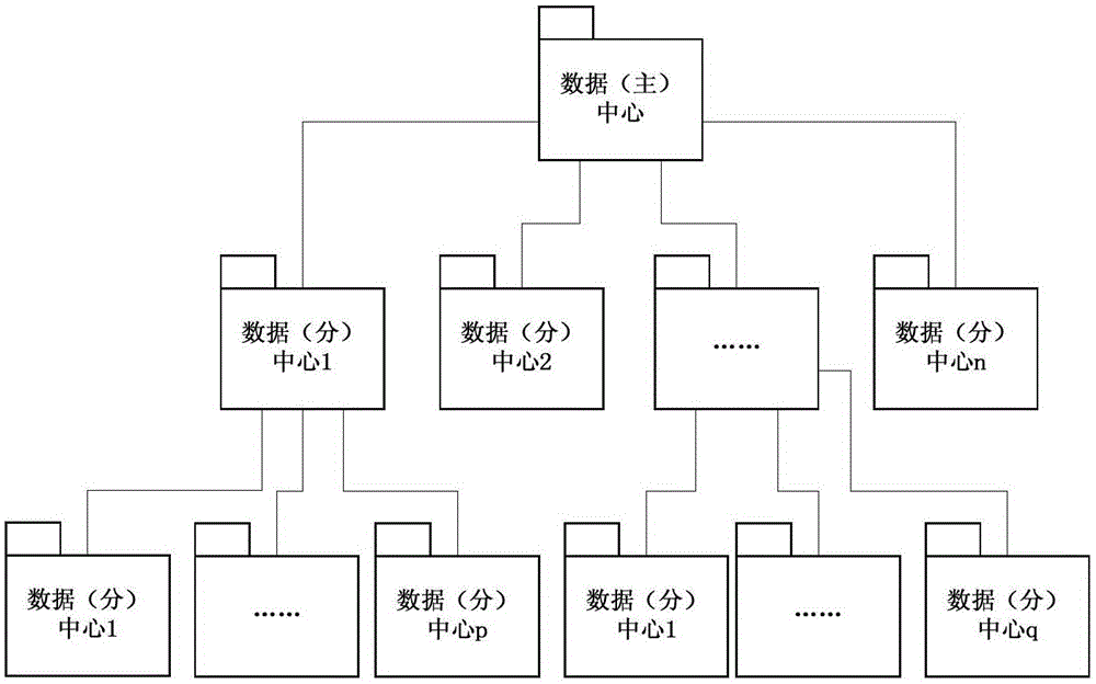
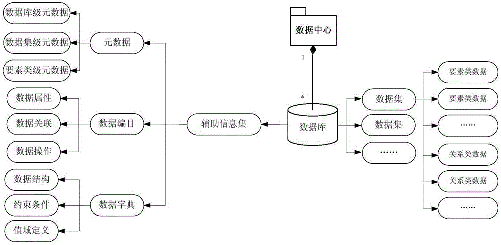
[0044] The step of identifying data type is to identify the data type of natural resource geospatial data and establish a data center. The data center respectively establishes several databases, and each database includes data sets and auxiliary information sets; the natural resource geospatial data after the data type is identified as Feature class data is placed in a dataset;

[0045] The step of establishing the feature class model is to carry out the integrated organizational modeling of the feature class data based on the vector and raster integration technology according to the identified data type, and establish the integrated organizational model of the feat...


PUM


Abstract

The invention provides a multi-data center based natural resource geospatial data organization method and system. The method comprises a data type identification step, a feature class model establishment step, a relation class data model establishment step and an auxiliary information acquisition step. Firstly, the type of natural resource geospatial data is identified and data centers, a database, a data set and an auxiliary information set are established; secondly, according to the identified data type, establishing a feature class data integration organization model and establishing a relation class data model; and finally, according to the identified data type and a relation class data calculation result, acquiring auxiliary information and storing the auxiliary information in the auxiliary information set. According to the organization method provided by the invention, unification of different data types in a conception layer based on a plurality of data centers and integration organization management of different data types are realized; orderly data management and data tracking and backtracking are realized; and the application convenience and flexibility of the natural resource geospatial data are satisfied.

Description

technical field [0001] The invention relates to the technical field of natural resource geographic space data management, in particular to a multi-data center-based natural resource geographic spatial data organization method and system. Background technique [0002] The national natural resources and spatial geographic basic information database is one of the four basic national e-government information databases clearly proposed in the "National Informatization Leading Group's Guiding Opinions on my country's E-government Construction" (Zhongbanfa [2002] No. 17). The national e-government application and the public provide long-term, stable and standardized natural resources and spatial geographic basic information products and services, which have important reference value for the construction of cross-departmental e-government application systems, and at the same time improve the inter-departmental e-government cooperation mechanism It has positive exploration significance...

Claims


Application Information

Patent Timeline
IPC IPC(8): G06F17/30
CPCG06F16/284G06F16/29
Inventor 李浩川徐枫王定国王铎施健余鹏程婧瑶黄非程立君
Owner 国家信息中心
Why Eureka
Try Eureka